
Urmeniș
Urmeniș | |
|---|---|
 Church in the village of Șopteriu | |
 Location in Bistrița-Năsăud County | |
 Urmeniș Location in Romania | |
| Coordinates: 46°46′18″N 24°21′56″E / 46.77167°N 24.36556°E | |
| Country | Romania |
| County | Bistrița-Năsăud |
| Government | |
| • Mayor (2020–2024) | Dumitru Tomșa (PNL) |
| Area | 59.28 km2 (22.89 sq mi) |
| Elevation | 390 m (1,280 ft) |
| Population (2021-12-01)[1] | 1,677 |
| • Density | 28/km2 (73/sq mi) |
| Time zone | EET/EEST (UTC+2/+3) |
| Postal code | 427370 |
| Area code | +40 x59 |
| Vehicle reg. | BN |
| Website | www |
Urmeniș (Hungarian: Mezőörményes) is a commune in Bistrița-Năsăud County, Transylvania, Romania. It is composed of ten villages: Câmp, Coșeriu, Delureni (Mezőújlak), Fânațe (Szarvadi szénafűdűlő), Podenii (Kisújlak), Scoabe, Șopteriu (Septér), Urmeniș, Valea (Fundáta), and Valea Mare (Völgytanya).
Geography[edit]
The commune is situated on the Transylvanian Plateau, at an altitude of 390 m (1,280 ft). It is located at the southern extremity of Bistrița-Năsăud County, at a distance of 55 km (34 mi) from the county seat, Bistrița, on the border with Mureș County. Urmeniș is crossed by national road DN16, which connects Cluj-Napoca, 70 km (43 mi) to the west, to Reghin, 33 km (21 mi) to the east.
Natives[edit]
- Alexandru Dobra (1794–1870), Greek Catholic hierarch
References[edit]
-
 Rákóczi-Bánffy Castle in Urmeniș
 -
 Orthodox church in Urmeniș
 -
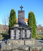 World War Memorial in Urmeniș
 -
 Delureni

.jpg)
.jpg)
.jpg)

This Bistrița-Năsăud County location article is a stub. You can help Wikipedia by expanding it. |