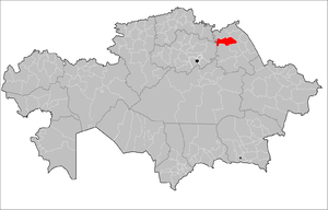
Aqtogai District, Pavlodar Region
Aktogay
Ақтоғай | |
|---|---|
District | |
| Ақтоғай ауданы | |
 Irtysh River in Aktogay District | |
 | |
| Country | |
| Region | Pavlodar Region |
| Administrative center | Aktogay |
| Founded | 1938 |
| Government | |
| • Akim | Arynov Karshyga Zalmukhanovich[1] |
| Area | |
| • Total | 3,800 sq mi (9,800 km2) |
| Population (2013)[2] | |
| • Total | 13,735 |
| Time zone | UTC+6 (East) |
Aqtogai (Kazakh: Ақтоғай ауданы, Aqtoğai audany) is a district of Pavlodar Region in northern Kazakhstan. The administrative center of the district is the selo of Aqtogay.[3] Population: 13,735 (2013 estimate);[2] 15,114 (2009 Census results);[4] 21,056 (1999 Census results).[4]
Physico-geographical characteristic[edit]
Geographic location[edit]
The area is 9.8 thousand km² (7.69% of the territory of the region). It occupies the 5th place in terms of size among the districts of the region. Aktogay District is located in the south of the West Siberian Plain, on the left bank of the Irtysh.[5] In the north it borders on Irtysh district, in the south - on the rural areas of the cities of Aksu and Ekibastuz, in the west - on Akmola and North Kazakhstan regions, in the east - with Terenkol region and Pavlodar regions along the Irtysh river.
Climate[edit]
Climate Sharply continental climate. The average temperature in January is -17°-19°C, in July - +20°+21°C. Annual amount of atmospheric precipitation - 250-300 mm.
Relief and Hydrography[edit]
The relief of the territory is flat (Irtysh plain). There are numerous salt lakes, such as Zhamantuz. Reserves of natural building materials have been explored in the bowels. Minerals: common salt, sands, clays.
Flora and fauna[edit]
The vegetation is steppe, forb-feather grass; poplar, maple, willow, meadowsweet grow in the river valleys. Live wolf, fox, hare, korsak, badger, gopher, hamster.
References[edit]
- ^ "Акимат Актогайского района". www.gov.kz.
- ^ a b "Население Республики Казахстан" (in Russian). Департамент социальной и демографической статистики. Retrieved 27 December 2013.
- ^ "www.geonames.de Subdivisions of Kazakhstan in local languages". Archived from the original on 2016-03-03. Retrieved 2008-04-25.
- ^ a b "Население Республики Казахстан" [Population of the Republic of Kazakhstan] (in Russian). Департамент социальной и демографической статистики. Retrieved 8 December 2013.
- ^ "Большие города. Актогайский район (Павлодарская область)". 24.kz.
52°42′00″N 75°28′48″E / 52.70000°N 75.48000°E

