
Alabaster, Alabama
Alabaster, Alabama | |
|---|---|
City | |
 Alabaster in 2012 | |
 Location in Shelby County and the state of Alabama | |
| Country | United States |
| State | Alabama |
| County | Shelby |
| Government | |
| • Mayor-Council government | Marty Handlon |
| Area | |
| • Total | 20.6 sq mi (53.1 km2) |
| • Land | 20.5 sq mi (53 km2) |
| • Water | 0.1 sq mi (0.1 km2) |
| Elevation | 502 ft (153 m) |
| Population | |
| • Total | 30,352 |
| • Density | 1,098/sq mi (426/km2) |
| Time zone | UTC-6 (Central (CST)) |
| • Summer (DST) | UTC-5 (CDT) |
| ZIP code | 35007, 35114 |
| Area code | 205 |
| FIPS code | 01-00820 |
| Website | http://www.cityofalabaster.com |
Alabaster is a city and southern suburb of Birmingham in Shelby County, Alabama, United States. At the 2010 census the population was 30,352. According to the 2011 U.S. Census estimates, the city had a population of 30,799. Alabaster is still a growing population.[2] Alabaster was ranked number 85 on Money Magazine's 100 Best Places To Live in 2009.[1]
Geography
Alabaster is located at 33°13′52″N 86°49′26″W / 33.23111°N 86.82389°W (33.231162, −86.823829)Template:GR.
According to the U.S. Census Bureau, the city has a total area of 20.6 square miles (53 km2), of which, 20.5 square miles (53 km2) of it is land and 0.1 square miles (0.26 km2) of it (0.24%) is water.
History
George L. Scott, Sr., an Alabaster pioneer, owned and operated Alabaster Lime Co. His shipping point, named for him, was known as “Scott Rock”. Later, housing was built to accommodate some of the employees, and the community acquired its name Alabaster from the "white calcium carbonate mineral". The First Bank of Alabaster opened in 1952, and its president was George L. Scott, Jr., who later became the first mayor of Alabaster. The first attempt in 1952 to incorporate Alabaster failed. In January 1953, the petition was again filed, and on February 23, 1953, Alabaster was officially incorporated with a favorable vote of 79 to 23, and 427 residing inhabitants. Other Alabaster pioneers were Kenton B. Nickerson and William J. Maxwell. In 1955, the Alabaster Water and Gas Board was formed.[3]
Demographics
| Census | Pop. | Note | %± |
|---|---|---|---|
| 1960 | 1,623 | — | |
| 1970 | 2,642 | 62.8% | |
| 1980 | 7,079 | 167.9% | |
| 1990 | 14,732 | 108.1% | |
| 2000 | 22,619 | 53.5% | |
| 2010 | 30,352 | 34.2% | |
| 2011 (est.) | 30,799 | 1.5% | |
2011 estimate | |||
2010 Census data
As of the census of 2010, there were 30,352 people, 11,016 households, and 6,482 families residing in the city [9].The population density was 1,104.8 people per square mile (426.6/km²). The racial makeup of the city was 81.2% White,15.0% Black or African American, 0.31% Native American, 0.64% Asian, 0.02% Pacific Islander, 2.2% from other races, and 0.69% from two or more races. 4.54% of the population were Hispanic or Latino of any race.
There were 11,016 households out of which 41.9% had children under the age of 18 living with them, 68.0% were married couples living together, 8.9% had a female householder with no husband present, and 20.6% were non-families. 17.1% of all households were made up of individuals and 3.6% had someone living alone who was 65 years of age or older. The average household size was 2.73 and the average family size was 3.09.
In the city the population was spread out with 27.7% under the age of 18, 7.0% from 18 to 24, 32.0% from 25 to 44, 25.0% from 45 to 64, and 8.0% who were 65 years of age or older. The median age was 35 years. For every 100 females there were 94.7 males. For every 100 females age 18 and over, there were 90.7 males.
The median income for a household in the city was $64,411, and the median income for a family was $78,940. The per capita income for the city was $22,466. About 4.3% of families and 5.9% of the population were below the poverty line, including 7.0% of those under age 18 and 12.3% of those age 65 or over.
Government
The government consists of mayor who is elected at large and a seven member city council. One member is elected from each of the seven wards.
The Mayor and City Council are elected every four years.
The most recent election was held August 2012, with a runoff for Mayor held in October 2012.
Schools
On July 1, 2013, the Alabaster City Schools System officially separated from the Shelby County Schools system, and will operate the public schools in the city.[4] Private school K-12 education is also available.
- Creek View Elementary School
- Meadow View Elementary School
- Thompson Intermediate School
- Thompson Sixth Grade Center
- Thompson Middle School
- Thompson High School
- Kingwood Christian School
- Evangel Christian School
Points of interest
Notable people
- In 1966, Nathan Johnson was shot by James Bonard Fowler at the Alabaster Police Department.[5]
Gallery
-
 Alabaster City Hall
 -
 Buck Creek


References
- ^ "2010 Census Redistricting Data (Public Law 94-171) Summary File". American FactFinder. United States Census Bureau. Retrieved July 7, 2012.
- ^ "Annual Estimates of the Population for All Incorporated Places in Alabama" (CSV). 2011 Population Estimates. U.S. Census Bureau, Population Division. June 29, 2012. Retrieved July 7, 2012.
- ^ Alabaster merged with the adjoining city of Siluria, Alabama April 27, 1971. "History of Shelby County". ALGenWeb: Shelby County. Retrieved on 2008-05-21.
- ^ http://blog.al.com/spotnews/2013/07/alabaster_school_district_cele.html
- ^ Associated, Press (November 24, 2009). "FBI: Ex-Alabama trooper Fowler's 1966 killing of black man in Alabaster jail still probed". WHNT News 19. Retrieved November 24, 2009. [dead link]
External links
33°13′52″N 86°49′26″W / 33.231162°N 86.823829°W
Municipalities and communities of Shelby County, Alabama, United States | ||
|---|---|---|
| Cities | 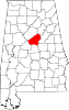 | |
| Towns | ||
| CDPs | ||
| Other unincorporated communities | ||
| Footnotes | ‡This populated place also has portions in an adjacent county or counties | |