
Arayat, Pampanga
- For the mountain of the same name, see Mount Arayat.
Arayat | |
|---|---|
 Poblacion | |
 Map of Pampanga showing the location of Arayat | |
| Country | |
| Region | Central Luzon (Region III) |
| Province | Pampanga |
| District | 3rd District |
| Barangays | 30 |
| Government | |
| • Mayor | Luis A. Espino |
| Area | |
| • Total | 134.48 km2 (51.92 sq mi) |
| Elevation | 8 m (26 ft) |
| Population (2010)[3] | |
| • Total | 121,348 |
| • Density | 900/km2 (2,300/sq mi) |
| Time zone | UTC+8 (PST) |
| ZIP code | 2012 |
| Income class | 1st class |
| Website | arayat.gov.ph |
| Year | Pop. | ±% p.a. |
|---|---|---|
| 1995 | 85,940 | — |
| 2000 | 101,792 | +3.70% |
| 2007 | 118,312 | +2.10% |
| 2010 | 121,348 | +0.93% |
Arayat is a first class municipality in the province of Pampanga, Philippines. According to the 2010 census, it has a population of 121,348 people.[3] A large portion of Mount Arayat is located within this municipality.
Barangays
Arayat is politically subdivided into 30 barangays.
- Arenas
- Baliti
- Batasan
- Buensuceso
- Candating
- Gatiawin
- Guemasan
- La Paz (Turu)
- Lacmit
- Lacquios
- Mangga-Cacutud
- Mapalad
- Palinlang
- Paralaya
- Plazang Luma
- Poblacion
- San Agustin Norte
- San Agustin Sur
- San Antonio
- San Jose Mesulo
- San Juan Bano
- San Mateo
- San Nicolas
- San Roque Bitas
- Cupang (Santa Lucia)
- Matamo (Santa Lucia)
- Santo Niño Tabuan
- Suclayin
- Telapayong
- Kaledian (Camba)
Images
-
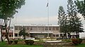 Arayat Town Hall
 -
 View of Mount Arayat
 -
 Heritage Sta. Catalina Church (built in honor of St Catherine of Alexandria)
 -
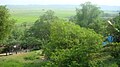 View of San Juan Baño plantations


References
- ^ "Municipalities". Quezon City, Philippines: Department of the Interior and Local Government. Retrieved 12 December 2012.
- ^ "Province: Pampanga". PSGC Interactive. Makati City, Philippines: National Statistical Coordination Board. Retrieved 12 December 2012.
- ^ a b "Total Population by Province, City, Municipality and Barangay: as of May 1, 2010" (PDF). 2010 Census of Population and Housing. National Statistics Office. Retrieved 12 December 2012.
External links
Wikimedia Commons has media related to Arayat, Pampanga.
- Philippine Standard Geographic Code
- Philippine Census Information
- Local Governance Performance Management System
Places adjacent to Arayat, Pampanga | |
|---|---|
| Municipalities | |
|---|---|
| Component cities | |
| Highly urbanized city |
|
This article about a location in the Philippines is a stub. You can help Wikipedia by expanding it. |