
Auyo
Auyo | |
|---|---|
LGA and town | |
 | |
| Nickname: [Takaddama Birnin Ruwa Tirakar Sallah] | |
 Auyo | |
| Coordinates: 12°21′36″N 9°59′8″E / 12.36000°N 9.98556°E | |
| Country | |
| State | Jigawa State |
| Local Government Headquarters | Auyo |
| Government | |
| • Local Government Chairman | Muhammed Sani (APC) |
| Area | |
| • Total | 198 sq mi (512 km2) |
| Population (2006) | |
| • Total | 132,001 |
| Time zone | UTC+1 (WAT) |
 | |
Auyo is a Local Government Area of Jigawa State, Nigeria. Its headquarters are in the town of Auyo.
It has an area of 512 km2 and a population of 132,001 at the 2006 census.
The postal code of the area is 731.[1]
The Auyokawa language, now extinct, was formerly spoken in Auyo.[2]
And its Also has ten (10) political words which include:
Auyo, Auyokayi, Ayama, Ayan, Gatafa, Gamafoi, Gamsarka, Kafur, Tsidir, and Unik.
Gallery[edit]
-

-
 Auyo Town
 -
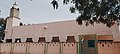 Central Mosque Auyo
 -

-

-


References[edit]
- ^ "Post Offices- with map of LGA". NIPOST. Archived from the original on 7 October 2009. Retrieved 2009-10-20.
- ^ "Auyokawa". Ethnologue. Archived from the original on 2016-03-04. Retrieved 2014-05-25.
State capital: Dutse | ||
| Local Government Areas |  | |
This Jigawa State, Nigeria location article is a stub. You can help Wikipedia by expanding it. |