
Battle Creek (California)
| Battle Creek | |
|---|---|
.jpg) Battle Creek in January 2007 | |
 Location of the mouth in California | |
| Location | |
| Country | United States |
| State | California |
| Physical characteristics | |
| Source | Confluence of North Fork and South Fork |
| • location | Near Manton, California |
| • coordinates | 40°25′23″N 121°59′49″W / 40.42306°N 121.99694°W |
| • elevation | 868 ft (265 m) |
| Mouth | Sacramento River |
• location | Southeast of Anderson |
• coordinates | 40°21′19″N 122°10′33″W / 40.35528°N 122.17583°W |
• elevation | 338 ft (103 m) |
| Length | 47 mi (76 km)[1] |
| Basin size | 365 sq mi (950 km2) |
| Discharge | |
| • location | USGS gage #11376550, 5.7 miles (9.2 km) from the mouth |
| • average | 501 cu ft/s (14.2 m3/s) |
| • minimum | 102 cu ft/s (2.9 m3/s) |
| • maximum | 24,700 cu ft/s (700 m3/s) |
| Basin features | |
| Tributaries | |
| • left | South Fork Battle Creek, Spring Branch Battle Creek |
| • right | North Fork Battle Creek |
Battle Creek is a 16.6-mile-long (26.7 km)[2] creek located in Shasta and Tehama counties, California.[3] It is a major tributary to the Sacramento River.
The eastern side of the Battle Creek watershed falls within the northernmost part of the Sierra Nevada mountain range, as it transitions into the southern Cascade range. The undisturbed part of the watershed is richly diverse in both plant and animal species.[4] The tributaries of Battle Creek originate from dozens of underground springs.
The creek is part of a $67 million Chinook salmon restoration project, a PG&E Battle Creek Hydroelectric Project. Many adjacent properties hold conservation easements protecting them from development.
In addition to the Chinook salmon, the creek has steelhead, rainbow, and brown trout. Counterintuitively, first-year data from a post-wildfire soil erosion study funded by Sierra Pacific Industries, a large industrial timber company, show that control sites disturbed only by fire produced substantially more water runoff and soil erosion than did sites that received post-wildfire salvage logging.[5] However, given this document was written by an employee of the large timber company which has extensively salvage logged the watershed, the results are questionable. Reviews of the document prepared by two hydrologists on behalf of Battle Creek Alliance, a local environmental group, argued that it contained substantial flaws.[6][7]
The industrial timberland in the Battle Creek watershed is upstream of the restoration project. The clearcutting and post-fire salvage logging which has been occurring since 1998 is the subject of the documentary film "Clearcut Nation", produced by Battle Creek Alliance.[8] A Citizen’s Water Monitoring Project has been collecting water quality data both upstream and downstream of the industrial timberland since 2009. This data was analyzed by a statistical hydrologist in 2014.[9]
Battle Creek was named in commemoration of an 1849 battle between Indians and early white trappers.[10]
-
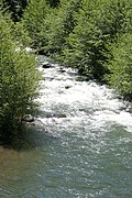
 South fork of Battle Creek in June 2016 downstream of industrial timberland after one inch of rain
 -
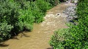
 Battle Creek in March 2010


References[edit]
- ^ Including the South Fork
- ^ U.S. Geological Survey. National Hydrography Dataset high-resolution flowline data. The National Map Archived 2012-03-29 at the Wayback Machine, accessed March 10, 2011
- ^ U.S. Geological Survey Geographic Names Information System: Battle Creek (California)
- ^ Cal Photos http://calphotos.berkeley.edu/cgi/img_query?where-photographer=Marily+Woodhouse&orderby=taxon
- ^ James, Cajun "Post Wildfire Salvage Logging, Soil Erosion, and Sediment Delivery, Ponderosa Fire, Battle Creek Watershed, Northern California"
- ^ Myers, Tom "Review of Study: Inspection of Sierra Pacific Industries’ Ponderosa Post-Fire Sediment Study, Shasta County, California"
- ^ Lewis, Jack Topographic Characterization of Swales in Sierra Pacific Industries’ Ponderosa Post-Fire Sediment Study, Shasta County, California [1]
- ^ "CDFW Program Manager will speak at third Earth, Water, Climate Series Program". CDFW Northern Region News. Retrieved 8 April 2022.
- ^ Lewis, Jack "An Analysis of Turbidity in Relation to Timber Harvesting in the Battle Creek Watershed, northern California September 2014"
- ^ "Place Names" (PDF). Tehama County Department of Education. Archived from the original (PDF) on 8 May 2017. Retrieved 25 March 2018.
External links[edit]
- http://www.usbr.gov/mp/battlecreek/public.html
- http://www.battle-creek.net/restoration.html
- DFG Announces Salmon, Steelhead Restoration Plans for Battle Creek, dfg.ca.gov, 2007-03-15
- https://web.archive.org/web/20150408082925/http://www.spi-ind.com/forests_research.aspx
- http://www.thebattlecreekalliance.org/
- Historic American Engineering Record (HAER) No. CA-2, "Battle Creek Hydroelectric System, Battle Creek & Tributaries, Red Bluff, Tehama County, CA", 174 photos, 20 measured drawings, 182 data pages, 14 photo caption pages