
Big Horn County, Montana
Big Horn County | |
|---|---|
_001.jpg) | |
 Location within the U.S. state of Montana | |
 Montana's location within the U.S. | |
| Coordinates: 45°26′N 107°29′W / 45.43°N 107.49°W | |
| Country | |
| State | |
| Founded | January 13, 1913 |
| Named for | Bighorn sheep |
| Seat | Hardin |
| Largest city | Hardin |
| Area | |
| • Total | 5,015 sq mi (12,990 km2) |
| • Land | 4,995 sq mi (12,940 km2) |
| • Water | 19 sq mi (50 km2) 0.4% |
| Population (2020) | |
| • Total | 13,124 |
| • Estimate (2022) | 12,851 |
| • Density | 2.6/sq mi (1.0/km2) |
| Time zone | UTC−7 (Mountain) |
| • Summer (DST) | UTC−6 (MDT) |
| Congressional district | 2nd |
| Website | www |
| |
Big Horn County is a county located in the U.S. state of Montana. As of the 2020 census, the population was 13,124.[1] The county seat is Hardin.[2] The county, like the river and the mountain range, is named after the bighorn sheep in the Rocky Mountains.[3] The county was founded in 1913.[4] It is located on the south line of the state.
Most of the area is part of the Crow Indian Reservation. Reservation poverty affects the county, which is the second-poorest county in the state.
History[edit]
On June 25, 1876, the Battle of Little Bighorn began. The Battle is also known as the Battle of the Greasy Grass to the Lakota and other Plains Indians.
This section needs expansion. You can help by adding to it. (November 2020) |
Law and government[edit]
The county has several jurisdictions, each with its own regulations and law enforcement agencies. The Crow and Northern Cheyenne Indian Nations are administered by the tribes. Little Bighorn Battlefield and the Big Horn Canyon National Recreation Area are regulated by the National Park Service. The remainder of the county falls under the State of Montana.
Geography[edit]
According to the United States Census Bureau, the county has a total area of 5,015 square miles (12,990 km2), of which 4,995 square miles (12,940 km2) is land and 19 square miles (49 km2) (0.4%) is water.[5] It is the fifth-largest county in Montana by land area. Most of the county's land area is Indian reservations: The Crow Indian Reservation covers 64.2 percent of its area, while the Northern Cheyenne Indian Reservation covers another 6.37 percent.
The county is home to the Big Horn, Pryor and Wolf mountain ranges.
Major highways[edit]
Adjacent counties[edit]
- Carbon - west
- Yellowstone - northwest
- Treasure - north
- Rosebud - northeast
- Powder River - east
- Sheridan County, Wyoming - south
- Big Horn County, Wyoming - southwest
National protected areas[edit]
Climate[edit]
According to the Köppen Climate Classification system, Big Horn County has a semi-arid climate, abbreviated "BSk" on climate maps.[6]
Politics[edit]
Big Horn County is generally Democratic, owing largely to its majority Native American population. It is distinguished from most other counties in rural Montana, which often lean heavily Republican.
| Year | Republican | Democratic | Third party | |||
|---|---|---|---|---|---|---|
| No. | % | No. | % | No. | % | |
| 2020 | 2,207 | 46.10% | 2,491 | 52.04% | 89 | 1.86% |
| 2016 | 1,853 | 43.73% | 2,094 | 49.42% | 290 | 6.84% |
| 2012 | 1,667 | 36.04% | 2,882 | 62.30% | 77 | 1.66% |
| 2008 | 1,628 | 31.19% | 3,516 | 67.37% | 75 | 1.44% |
| 2004 | 2,028 | 47.04% | 2,215 | 51.38% | 68 | 1.58% |
| 2000 | 1,651 | 39.68% | 2,345 | 56.36% | 165 | 3.97% |
| 1996 | 1,336 | 31.52% | 2,453 | 57.87% | 450 | 10.62% |
| 1992 | 1,377 | 31.34% | 2,154 | 49.02% | 863 | 19.64% |
| 1988 | 1,711 | 42.95% | 2,233 | 56.05% | 40 | 1.00% |
| 1984 | 2,390 | 46.77% | 2,681 | 52.47% | 39 | 0.76% |
| 1980 | 1,730 | 46.32% | 1,644 | 44.02% | 361 | 9.67% |
| 1976 | 1,615 | 44.49% | 1,962 | 54.05% | 53 | 1.46% |
| 1972 | 2,148 | 56.17% | 1,552 | 40.59% | 124 | 3.24% |
| 1968 | 1,789 | 53.87% | 1,319 | 39.72% | 213 | 6.41% |
| 1964 | 1,481 | 37.09% | 2,509 | 62.83% | 3 | 0.08% |
| 1960 | 1,724 | 53.47% | 1,497 | 46.43% | 3 | 0.09% |
| 1956 | 1,739 | 56.44% | 1,342 | 43.56% | 0 | 0.00% |
| 1952 | 2,165 | 65.91% | 1,114 | 33.91% | 6 | 0.18% |
| 1948 | 1,334 | 49.37% | 1,328 | 49.15% | 40 | 1.48% |
| 1944 | 1,394 | 51.73% | 1,289 | 47.83% | 12 | 0.45% |
| 1940 | 1,616 | 45.39% | 1,926 | 54.10% | 18 | 0.51% |
| 1936 | 1,087 | 34.12% | 2,037 | 63.94% | 62 | 1.95% |
| 1932 | 957 | 36.42% | 1,637 | 62.29% | 34 | 1.29% |
| 1928 | 1,274 | 55.46% | 1,017 | 44.28% | 6 | 0.26% |
| 1924 | 1,082 | 57.74% | 327 | 17.45% | 465 | 24.81% |
| 1920 | 1,062 | 66.17% | 475 | 29.60% | 68 | 4.24% |
| 1916 | 497 | 39.63% | 740 | 59.01% | 17 | 1.36% |
Demographics[edit]
| Census | Pop. | Note | %± |
|---|---|---|---|
| 1920 | 7,015 | — | |
| 1930 | 8,543 | 21.8% | |
| 1940 | 10,419 | 22.0% | |
| 1950 | 9,824 | −5.7% | |
| 1960 | 10,007 | 1.9% | |
| 1970 | 10,057 | 0.5% | |
| 1980 | 11,096 | 10.3% | |
| 1990 | 11,337 | 2.2% | |
| 2000 | 12,671 | 11.8% | |
| 2010 | 12,865 | 1.5% | |
| 2020 | 13,124 | 2.0% | |
| 2022 (est.) | 12,851 | [8] | −2.1% |
| U.S. Decennial Census[9] 1790–1960,[10] 1900–1990,[11] 1990–2000,[12] 2010–2020[1] | |||
2020 census[edit]
As of the 2020 census, there were 13,124 people living in the county.[citation needed]
2010 census[edit]
As of the 2010 census, there were 12,865 people, 4,004 households, and 2,970 families living in the county. The population density was 2.6 inhabitants per square mile (1.0/km2). There were 4,695 housing units at an average density of 0.9 units per square mile (0.35 units/km2). The racial makeup of the county was 64.3% American Indian, 31.4% white, 0.5% Asian, 0.2% black or African American, 1.0% from other races, and 2.6% from two or more races. Those of Hispanic or Latino origin made up 4.0% of the population. In terms of ancestry, 12.1% were American, and 10.3% were German.
Of the 4,004 households, 45.6% had children under the age of 18 living with them, 48.8% were married couples living together, 17.3% had a female householder with no husband present, 25.8% were non-families, and 23.0% of all households were made up of individuals. The average household size was 3.18 and the average family size was 3.77. The median age was 30.5 years.
The median income for a household in the county was $36,550 and the median income for a family was $41,985. Males had a median income of $32,216 versus $27,917 for females. The per capita income for the county was $15,066. About 20.7% of families and 23.5% of the population were below the poverty line, including 32.4% of those under age 18 and 15.4% of those age 65 or over.
Economy[edit]
Coal mining and agriculture play major roles in Big Horn County's economy. Farms and ranches in the county produce mainly beef cattle, sugar beets, alfalfa, and small grains.[13]
Communities[edit]
City[edit]
- Hardin (county seat)
Town[edit]
Census-designated places[edit]
Unincorporated communities[edit]
Former communities[edit]
See also[edit]
- List of lakes of Big Horn County, Montana
- List of mountains in Big Horn County, Montana
- National Register of Historic Places listings in Big Horn County, Montana
References[edit]
- ^ a b "State & County QuickFacts". United States Census Bureau. Retrieved May 8, 2023.
- ^ "Find a County". National Association of Counties. Archived from the original on May 31, 2011. Retrieved June 7, 2011.
- ^ Merrill, Andrea; Judy Jacobson (1997). Montana almanac. Helena MT: Falcon Publishing. p. 7. ISBN 1-56044-493-2.
- ^ "About Hardin & Big Horn County". Big Horn County Historical Museum. Archived from the original on February 7, 2015. Retrieved November 30, 2014.
- ^ "2010 Census Gazetteer Files". United States Census Bureau. August 22, 2012. Archived from the original on December 5, 2014. Retrieved November 27, 2014.
- ^ "Bighorn, Montana Köppen Climate Classification (Weatherbase)". Weatherbase. Retrieved March 24, 2018.
- ^ Leip, David. "Atlas of US Presidential Elections". uselectionatlas.org. Retrieved March 24, 2018.
- ^ "Annual Estimates of the Resident Population for Counties: April 1, 2020 to July 1, 2022". United States Census Bureau. Retrieved May 8, 2023.
- ^ "U.S. Decennial Census". United States Census Bureau. Retrieved November 27, 2014.
- ^ "Historical Census Browser". University of Virginia Library. Retrieved November 27, 2014.
- ^ "Population of Counties by Decennial Census: 1900 to 1990". United States Census Bureau. Retrieved November 27, 2014.
- ^ "Census 2000 PHC-T-4. Ranking Tables for Counties: 1990 and 2000" (PDF). United States Census Bureau. Archived (PDF) from the original on March 27, 2010. Retrieved November 27, 2014.
- ^ State of Montana. "Big Horn County" (PDF). Archived from the original (PDF) on September 6, 2011. Retrieved May 31, 2011.
- ^ Aberdeen, Big Horn County MT Google Maps (accessed December 31, 2018)
- ^ Benteen, Big Horn County MT Google Maps (accessed December 31, 2018)
- ^ Dunmore, Big Horn County MT Google Maps (accessed December 31, 2018)
- ^ Kingley, Big Horn County MT Google Maps (accessed December 31, 2018)
- ^ Toluca, Big Horn County MT Google Maps (accessed December 31, 2018)
External links[edit]
Places adjacent to Big Horn County, Montana | |
|---|---|
Municipalities and communities of Big Horn County, Montana, United States | ||
|---|---|---|
| City | 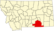 | |
| Town | ||
| CDPs | ||
| Other communities | ||
| Indian reservations | ||
| Footnotes | ‡This populated place also has portions in an adjacent county or counties | |
| International | |
|---|---|
| National | |