Bouchared
Bourached | |
|---|---|
| Country | Algeria |
| Province | Aïn Defla |
| Time zone | UTC+1 (West Africa Time) |
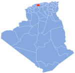
Bourached is one of the municipalities of the Algerian state of Ain Defla, about 150 km away from Algiers. Its area is estimated at 138 km2 and its population is estimated at 35 thousand people, according to the latest statistics for the year 2012.[1]
Location[edit]
It is located southwest of the city of Ain Defla, where its municipal headquarters is about 13 km away from Ain Defla. It is bordered to the north by Ain Defla, to the south by the municipalities of Jomaa Ouled Sheikh and Zedine, to the east by the municipality of Jlida, and to the west by the municipality of Rouina. It is distinguished by its excellent strategic location, as it is located between the hills, on the plateaus and on the outskirts of the Douai Mountains and its small forest with a charming nature and stunning views that lie between it and the city of Ain Defla. It overlooks from the other side the Al-Wancheris mountain range and its dense forests, and on its western border is the Ouled Maluk Dam, and this is what makes it so distinctive. An important location, a dry climate, and a pleasant atmosphere, if you have not yet discovered it.
Municipality development[edit]
The municipality of Bourached has experienced significant growth in various sectors, particularly after the construction of the east-west highway, which facilitated its urban development. This expansion has created a conducive environment for launching major projects, one notable example being the wholesale market project. Initiated by the Minister of Commerce, Mustafa Ben Badda, at the end of 2012, this project is anticipated to meet international standards upon completion. It is designed to include comprehensive facilities, such as hotel services, a bank, and a security center.
In the educational sector, Bourached is home to several institutions. It boasts a secondary school named "Bouchareb Al-Taher" and two middle schools, "Mkhaledi Kouider" and "Galloaz Moussa", the latter being recognized as the oldest educational structure in the area, having been established in 1987. A new middle school was recently constructed on the former site of the Bouchareb Al-Tahir Secondary School, which has since been relocated to a new building opposite the old one for the 2014/2015 school year. This new facility was inaugurated by the Minister of Education, Nouria Ben Ghabrit. Additionally, the "Ahmed Rashidi" Middle School, dedicated to the children of Si Ahmed, was opened in 2001 by the Minister of National Education, Abu Bakr Ben Bouzid. Bourached also hosts approximately 14 primary schools, with Bahi Al-Hajj being the oldest, established in 1972 in the children of Si Ahmed area.
References[edit]
- ^ "Relation: Bourached (2762966)". OpenStreetMap. 2020-11-19. Retrieved 2024-04-11.
36°10′09″N 1°55′45″E / 36.1691°N 1.9292°E

