
Calhoun, Louisiana
Calhoun, Louisiana | |
|---|---|
 First Baptist Church of Calhoun | |
| Coordinates: 32°30′46″N 92°21′31″W / 32.51278°N 92.35861°W | |
| Country | |
| State | |
| Parish | Ouachita |
| Area | |
| • Total | 2.36 sq mi (6.12 km2) |
| • Land | 2.36 sq mi (6.12 km2) |
| • Water | 0.00 sq mi (0.00 km2) |
| Elevation | 100 ft (30 m) |
| Population (2020) | |
| • Total | 670 |
| • Density | 283.66/sq mi (109.54/km2) |
| Time zone | UTC-6 (Central (CST)) |
| • Summer (DST) | UTC-5 (CDT) |
| ZIP code | 71225[2] |
| Area code | 318 |
| FIPS code | 22-11825 |

Calhoun is an unincorporated community and census-designated place in Ouachita Parish, Louisiana, United States. It is named after Archibald Calhoun, who was an original settler and landowner. Its elevation is 177 feet (54 m), and it is located at 32°30′46″N 92°21′31″W / 32.51278°N 92.35861°W (32.5126469, -92.3584744).[3] Calhoun is unincorporated (no local government) and is governed by the parish through a board of commissioners known as the Police Jury. It is a census designated place and at the time of the most recent United States Census Survey, the population was 1,965.
Calhoun is located in a rural area with a landscape mixture of hills and woodlands on the former transcontinental route U.S. 80 near Interstate 20, approximately 10 miles west of West Monroe.[citation needed] It has experienced a large growth in population recently, due to many retail, restaurant, and entertainment venues nearby, as well as three local universities, but it also attracts young families raising children due to four public schools located in the community that all consistently place in the top percentile in achievement.
Former U.S. Representative Newt V. Mills of Louisiana was born in Calhoun,[4] as was the late Caddo Parish Sheriff James M. Goslin.[5]
Arkansas Republican former state chairman Ken Coon was reared in Calhoun.
Zach Dasher, a candidate for Louisiana's 5th congressional district seat in the November 4 primary election, resides in Calhoun.
Demographics[edit]
| Census | Pop. | Note | %± |
|---|---|---|---|
| 2020 | 670 | — | |
| U.S. Decennial Census[6] | |||
2020 census[edit]
| Race | Number | Percentage |
|---|---|---|
| White (non-Hispanic) | 569 | 84.93% |
| Black or African American (non-Hispanic) | 40 | 5.97% |
| Native American | 4 | 0.6% |
| Asian | 2 | 0.3% |
| Other/Mixed | 30 | 4.48% |
| Hispanic or Latino | 25 | 3.73% |
As of the 2020 United States census, there were 670 people, 135 households, and 121 families residing in the CDP.
Climate[edit]
According to the Köppen Climate Classification system, Calhoun has a humid subtropical climate, abbreviated "Cfa" on climate maps. The hottest temperature recorded in Calhoun was 110 °F (43.3 °C) on August 18, 1909 and September 1, 2000, while the coldest temperature recorded was −13 °F (−25.0 °C) on February 1899.[8]
| Climate data for Calhoun, Louisiana, 1991–2020 normals, extremes 1892–2022 | |||||||||||||
|---|---|---|---|---|---|---|---|---|---|---|---|---|---|
| Month | Jan | Feb | Mar | Apr | May | Jun | Jul | Aug | Sep | Oct | Nov | Dec | Year |
| Record high °F (°C) | 85 (29) |
90 (32) |
94 (34) |
98 (37) |
100 (38) |
109 (43) |
109 (43) |
110 (43) |
110 (43) |
100 (38) |
90 (32) |
87 (31) |
110 (43) |
| Mean maximum °F (°C) | 75.6 (24.2) |
78.7 (25.9) |
83.9 (28.8) |
87.5 (30.8) |
91.4 (33.0) |
96.2 (35.7) |
99.4 (37.4) |
100.7 (38.2) |
97.2 (36.2) |
90.4 (32.4) |
82.9 (28.3) |
76.7 (24.8) |
101.6 (38.7) |
| Mean daily maximum °F (°C) | 56.8 (13.8) |
61.1 (16.2) |
68.9 (20.5) |
76.4 (24.7) |
83.4 (28.6) |
90.3 (32.4) |
93.2 (34.0) |
93.6 (34.2) |
88.7 (31.5) |
78.2 (25.7) |
67.2 (19.6) |
59.2 (15.1) |
76.4 (24.7) |
| Daily mean °F (°C) | 44.8 (7.1) |
48.3 (9.1) |
56.0 (13.3) |
63.2 (17.3) |
71.4 (21.9) |
78.5 (25.8) |
81.6 (27.6) |
81.3 (27.4) |
75.7 (24.3) |
64.0 (17.8) |
53.9 (12.2) |
46.8 (8.2) |
63.8 (17.7) |
| Mean daily minimum °F (°C) | 32.8 (0.4) |
35.5 (1.9) |
43.0 (6.1) |
50.0 (10.0) |
59.3 (15.2) |
66.7 (19.3) |
70.0 (21.1) |
69.0 (20.6) |
62.7 (17.1) |
49.9 (9.9) |
40.5 (4.7) |
34.5 (1.4) |
51.2 (10.6) |
| Mean minimum °F (°C) | 17.6 (−8.0) |
22.2 (−5.4) |
26.9 (−2.8) |
33.9 (1.1) |
45.8 (7.7) |
57.4 (14.1) |
63.8 (17.7) |
62.0 (16.7) |
47.7 (8.7) |
34.8 (1.6) |
26.5 (−3.1) |
19.5 (−6.9) |
14.6 (−9.7) |
| Record low °F (°C) | −2 (−19) |
−13 (−25) |
14 (−10) |
26 (−3) |
34 (1) |
45 (7) |
52 (11) |
44 (7) |
36 (2) |
24 (−4) |
10 (−12) |
5 (−15) |
−13 (−25) |
| Average precipitation inches (mm) | 5.70 (145) |
4.98 (126) |
5.47 (139) |
5.69 (145) |
5.39 (137) |
4.36 (111) |
4.01 (102) |
3.51 (89) |
3.58 (91) |
4.66 (118) |
4.71 (120) |
5.50 (140) |
57.56 (1,463) |
| Average snowfall inches (cm) | 0.1 (0.25) |
0.0 (0.0) |
0.0 (0.0) |
0.0 (0.0) |
0.0 (0.0) |
0.0 (0.0) |
0.0 (0.0) |
0.0 (0.0) |
0.0 (0.0) |
0.0 (0.0) |
0.0 (0.0) |
0.0 (0.0) |
0.1 (0.25) |
| Average precipitation days (≥ 0.01 in) | 9.3 | 8.6 | 9.0 | 7.4 | 8.1 | 8.6 | 7.7 | 6.3 | 6.1 | 6.8 | 8.0 | 8.7 | 94.6 |
| Average snowy days (≥ 0.1 in) | 0.0 | 0.1 | 0.0 | 0.0 | 0.0 | 0.0 | 0.0 | 0.0 | 0.0 | 0.0 | 0.0 | 0.1 | 0.2 |
| Source 1: NOAA[9] | |||||||||||||
| Source 2: National Weather Service (mean maxima/minima 1981–2010)[8] | |||||||||||||
References[edit]
- ^ "2020 U.S. Gazetteer Files". United States Census Bureau. Retrieved March 20, 2022.
- ^ "Calhoun Zipcode". Retrieved April 11, 2019.
- ^ U.S. Geological Survey Geographic Names Information System: Calhoun, Louisiana
- ^ "Mills, Newt Vergus (1899-1996)". bioguide.congress.gov. Retrieved September 25, 2014.
- ^ "James M. Goslin obituary". The Shreveport Times. July 30, 2001. pp. 3B. Retrieved September 25, 2014.
- ^ "Census of Population and Housing". Census.gov. Retrieved June 4, 2016.
- ^ "Explore Census Data". data.census.gov. Retrieved December 29, 2021.
- ^ a b "NOAA Online Weather Data – NWS Shreveport". National Weather Service. Retrieved February 20, 2023.
- ^ "U.S. Climate Normals Quick Access – Station: Calhoun RSCH STN, LA". National Oceanic and Atmospheric Administration. Retrieved February 20, 2023.
External links[edit]
Municipalities and communities of Ouachita Parish, Louisiana, United States | ||
|---|---|---|
| Cities | 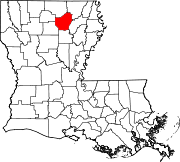 | |
| Towns | ||
| CDPs | ||
| Other unincorporated communities | ||
This Louisiana state location article is a stub. You can help Wikipedia by expanding it. |