
Chandler, Oklahoma
Chandler, Oklahoma | |
|---|---|
 Location of Chandler, Oklahoma | |
| Country | United States |
| State | Oklahoma |
| County | Lincoln |
| Area | |
| • Total | 8.2 sq mi (21.1 km2) |
| • Land | 7.3 sq mi (18.9 km2) |
| • Water | 0.9 sq mi (2.2 km2) |
| Elevation | 942 ft (287 m) |
| Population (2000) | |
| • Total | 2,842 |
| • Density | 389.3/sq mi (150.3/km2) |
| Time zone | UTC-6 (Central (CST)) |
| • Summer (DST) | UTC-5 (CDT) |
| ZIP code | 74834 |
| Area code | 405 |
| FIPS code | 40-13500Template:GR |
| GNIS feature ID | 1091199Template:GR |
| Website | www.chandlerok.com |
Chandler is a city in Lincoln County, Oklahoma, United States. The population was 2,842 at the 2000 census. It is the county seat of Lincoln CountyTemplate:GR and is part of the Oklahoma City Metropolitan Area.
Chandler is located east of Oklahoma City on U.S. Route 66 and Interstate 44, and north of Shawnee on State Highway 18.
History
Chandler was named After Judge George Chandler, a member of congress and commissioner of the general land office in Washington DC. Chandler was opened by a land run on September 28, 1891. The town had been planned to be opened on September 22, (the date of the Land Run of 1891) but the site survey had not been completed. The Chandler Post Office had opened September 21, the day before the planned run. When Oklahoma county A (Lincoln County) was organized, Chandler became the county seat. On May 30, 1897, a tornado destroyed most of the fledgling town and killed 14 residents.
In 1891 the county government operated out of an office building until the original courthouse was built. the courthouse was destroyed by the tornado of 1897, and a temporary courthouse was erected on the present site. this building was removed in 1907 to make way for a stone courthouse. This third courthouse burned down on December 23, 1967 the current courthouse was set in its place.[1]
Chandler is one of the many cities along the famous U.S. Route 66 and contains a number of attractions to devotees of "The Mother Road". These include The Route 66 Interpretive Center, The Oklahoma Law Enforcement Museum and Hall of Fame, The Lincoln County Museum of Pioneer History, several Route 66-themed murals, the newly restored old cottage-style Phillips 66 gas station, P.J.'s Bar-B-Que, and the last remaining painted barn adverting Meramec Caverns west of town.
U.S. Route 66 brought a significant amount of commercial business to Chandler - due to travelers crossing the state and the country; however when the Turner Turnpike (Interstate 44) was built, much of this business died out.
Economy
Today, Chandler's economy is driven mostly by agriculture and livestock, as well as insurance, construction, and manufacturing. Downtown Chandler, which is located on Route 66, is home to many shops and restaurants.
Lincoln County's first Wal-Mart Supercenter opened in 2008 on the east side of Chandler.
Chandler also serves as a commuter town of sorts, with many residents working and shopping in Oklahoma City or Tulsa.
Geography
Chandler is located at 35°42′33″N 96°53′23″W / 35.70917°N 96.88972°WInvalid arguments have been passed to the {{#coordinates:}} function (35.709287, -96.889647)Template:GR.
According to the United States Census Bureau, the city has a total area of 8.1 square miles (21.1 km²), of which, 7.3 square miles (18.9 km²) of it is land and 0.9 square miles (2.2 km²) of it (10.43%) is water.
Demographics
As of the censusTemplate:GR of 2000, there were 2,842 people, 1,146 households, and 747 families residing in the city. The population density was 389.3 people per square mile (150.3/km²). There were 1,290 housing units at an average density of 176.7/sq mi (68.2/km²). The racial makeup of the city was 79.77% White, 9.68% African American, 5.63% Native American, 0.39% Asian, 0.49% from other races, and 4.05% from two or more races. Hispanic or Latino of any race were 1.79% of the population.
There were 1,146 households out of which 31.2% had children under the age of 18 living with them, 47.1% were married couples living together, 14.0% had a female householder with no husband present, and 34.8% were non-families. 32.1% of all households were made up of individuals and 17.3% had someone living alone who was 65 years of age or older. The average household size was 2.36 and the average family size was 2.98.
In the city the population was spread out with 25.7% under the age of 18, 8.7% from 18 to 24, 25.3% from 25 to 44, 20.7% from 45 to 64, and 19.6% who were 65 years of age or older. The median age was 38 years. For every 100 females there were 89.8 males. For every 100 females age 18 and over, there were 84.0 males.
The median income for a household in the city was $26,833, and the median income for a family was $35,744. Males had a median income of $28,125 versus $19,397 for females. The per capita income for the city was $14,676. About 12.1% of families and 16.7% of the population were below the poverty line, including 20.3% of those under age 18 and 15.4% of those age 65 or over.
Recreation
Chandler is home to several city parks, a baseball complex, and a municipal swimming pool. Chandler Lake, which features camping, boating, fishing, and horse trails, is located north of town, along with Chandler Golf Course. The Lincoln County Raceway, a quarter mile dirt track, is located south of Chandler.[2]
Notable residents
- The composer Roy Harris was born near Chandler.
Sports
Chandler High School is known for its football team the "Lions" which compete in the Oklahoma Class 2A level. In the past six years Chandler has dominated its district and advanced to the state quarter finals every year. CHS has won the state football championship in 1984 and 2005. On September 19, 2008 Chandler was responsible for its greatest upset of all time, and possibly one of the greatest in Oklahoma high school football history. The number one team in Class 3A, a class above Chandler, the Clinton "Red Tornados" were highly favored over the Lions, but Chandler pulled off the upset and won the game 20 to 14.
Chandler High School has also enjoyed recent athletic success in basketball, baseball, track, and cross-country.
National Register of Historic Places
- Boston Store
- Chandler Armory
- Chandler Bookstore
- Chandler High School
- Clapp-Cunningham Building
- Conklin House
- Crane Motor Company Building
- First Presbyterian Church of Chandler
- Johnson House
- Mascho Building and Public Privy (Murphy Building)
- National Guard Statistical Building
- Oleson-Crane Building
- St. Cloud Hotel
- St. Stephen's Episcopal Church
- Wolcott Building
- Midlothian School
- Seaba's Filling Station
- Spring Dell School
- Marshall William M. Tilghman Homestead
References
- ^ "A Brief History of Lincoln County". Retrieved 2008-07-04.
- ^ http://www.geocities.com/lcraceway/
External links
Municipalities and communities of Lincoln County, Oklahoma, United States | ||
|---|---|---|
| Cities | 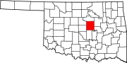 | |
| Towns | ||
| Unincorporated communities | ||
| Ghost towns | ||
| Footnotes | ‡This populated place also has portions in an adjacent county or counties | |