
Chuchelna
Chuchelna | |
|---|---|
 View from the west | |
 Chuchelna Location in the Czech Republic | |
| Coordinates: 50°36′8″N 15°18′2″E / 50.60222°N 15.30056°E | |
| Country | |
| Region | Liberec |
| District | Semily |
| First mentioned | 1410 |
| Area | |
| • Total | 10.78 km2 (4.16 sq mi) |
| Elevation | 385 m (1,263 ft) |
| Population (2023-01-01)[1] | |
| • Total | 1,015 |
| • Density | 94/km2 (240/sq mi) |
| Time zone | UTC+1 (CET) |
| • Summer (DST) | UTC+2 (CEST) |
| Postal code | 513 01 |
| Website | www |
Chuchelna is a municipality and village in Semily District in the Liberec Region of the Czech Republic. It has about 1,000 inhabitants.
Administrative parts[edit]
Villages of Komárov and Lhota are administrative parts of Chuchelna.
Geography[edit]
Chuchelna is located west of Semily, directly bordering with it, and about 23 km (14 mi) southeast of Liberec. It lies on the border between the Giant Mountains Foothills and Ještěd–Kozákov Ridge. The Jizera River briefly forms the northern municipal border. The highest point is the Kozákov mountain at 744 m (2,441 ft) above sea level, located in the western part of the municipal territory. The mountain is known for the finds of olivines and gemstones.[2] In the area of Kozákov, Chuchelna marginally extends into the Bohemian Paradise Protected Landscape Area.
History[edit]
The first written mention of Chuchelna is from 1410. It belonged to the Rotštejn and Hrubá Skála estates, and from the 17th century to the Semily estate.[3]
Demographics[edit]
|
|
| ||||||||||||||||||||||||||||||||||||||||||||||||||||||
| Source: Censuses[4][5] | ||||||||||||||||||||||||||||||||||||||||||||||||||||||||
Sport[edit]
There is a small ski resort on the eastern slopes of the Kozákov mountain. It has three ski slopes and a 500 m long lift.[6] The peak of Kozákov is known as a starting point for paragliding.[2]
Sights[edit]
Chuchelna is poor in historical monuments. The only protected cultural monuments are a sculptural group of Calvary from 1734 in the centre of Chuchelna and a sandstone cross from 1854 in Komárov.[7]
On the Kozákov mountain is the Rieger's hut, built in 1928 and named in honour of František Ladislav Rieger, and a steel lookout tower.[2]
Gallery[edit]
-
 View from the north
 -
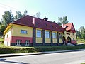 Sokol house
 -
 Chapel of St. Anthony of Padua at the cemetery
 -
 Kozákov observation tower and Rieger's hut
_(1).jpg)


References[edit]
- ^ "Population of Municipalities – 1 January 2023". Czech Statistical Office. 2023-05-23.
- ^ a b c "Vrch Kozákov v Českém ráji – v létě i v zimě aktivně i za poznáním" (in Czech). CzechTourism. Retrieved 2023-09-08.
- ^ "Chuchelna". Semilsko – turistické informace (PDF) (in Czech). Mikroregion Kozákov. p. 42. Retrieved 2023-09-08.
- ^ "Historický lexikon obcí České republiky - 1869–2011: Okres Semily". Czech Statistical Office. 2015-12-21. pp. 3–4.
- ^ "Population Census 2021: Population by sex". Public Database. Czech Statistical Office. 2021-03-27.
- ^ "O areálu" (in Czech). Ski Kozákov. Retrieved 2023-09-08.
- ^ "Výsledky vyhledávání: Kulturní památky, obec Chuchelna". Ústřední seznam kulturních památek (in Czech). National Heritage Institute. Retrieved 2023-09-08.
External links[edit]
| International | |
|---|---|
| National | |