Kuchurhan (river)
Appearance
(Redirected from Cuciurgan River)
| Kuchurhan Cuciurgan | |
|---|---|
 | |
 | |
| Native name | |
| Location | |
| Country | Ukraine, Moldova |
| Physical characteristics | |
| Mouth | Turunchuk |
• coordinates | 46°33′14″N 29°55′43″E / 46.5539°N 29.9285°E |
| Length | 109 km (68 mi) |
| Basin size | 2,090 km2 (810 sq mi) |
| Basin features | |
| Progression | Turunchuk→ Dniester→ Dniester Estuary→ Black Sea |
 | |
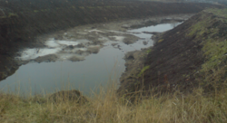
The Kuchurhan (Ukrainian: Кучурган; Romanian: Cuciurgan) is a river in Eastern Europe. It is a tributary of the Turunchuk (a branch of the Dniester) which begins on the Podolian Upland in Ukraine. It then flows SSE and forms part of the border between Transnistria in Moldova and the Odesa Oblast in Ukraine.[1][2] The river is 109 kilometres (68 mi) long and drains 2,090 square kilometres (810 sq mi).[3]
A dam has been built on the river just north of the Dniester, forming the Kuchurhan Reservoir. The village of Kuchurhan in Ukraine is located near the river just north of the reservoir and is the site of an important border crossing into Transnistria.
References
[edit]- ^ Map in Drainage Basin of the Black Sea Archived 2009-07-31 at the Wayback Machine, UNECE Publication (2007), Section II, Chapter 5, p. 141
- ^ Description in Drainage Basin of the Black Sea, UNECE Publication (2007), Section II, Chapter 5, p. 143
- ^ Transboundary Diagnostic Study for the Dniester River Basin, OSCE/UNECE Report (2005), p. 28
External links
[edit]- Our Waters: Joining Hands Across Borders - First Assessment of Transboundary Rivers, Lakes and Groundwaters Archived 2011-06-06 at the Wayback Machine, UNECE (2007)
- Transboundary Diagnostic Study for the Dniester River Basin Archived 2009-10-16 at the Wayback Machine, OSCE/UNECE Project: Transboundary Co-operation and Sustainable Management of the Dniester River (November 2005)
