
Earth, Texas
Earth, Texas | |
|---|---|
 Welcome sign of Earth, Texas | |
 Earth | |
| Coordinates: 34°13′59″N 102°24′39″W / 34.23306°N 102.41083°W | |
| Country | |
| State | |
| County | Lamb |
| Region | Llano Estacado |
| Established | 1924 |
| Area | |
| • Total | 1.20 sq mi (3.11 km2) |
| • Land | 1.20 sq mi (3.11 km2) |
| • Water | 0.00 sq mi (0.00 km2) |
| Elevation | 3,694 ft (1,126 m) |
| Population (2020) | |
| • Total | 898 |
| • Density | 808.49/sq mi (312.03/km2) |
| Time zone | UTC-6 (CST) |
| ZIP code | 79031 |
| Area code | 806 |
| FIPS code | 48-21928 |
Earth is a small, rural city in Lamb County, West Texas, United States. As of the 2010 Census, the population was 1,065.[3]
History[edit]
Earth was established by William E. Halsell, who laid out the townsite in 1924. Originally Halsell named the city Fairlawn, but in 1925 it was renamed Earth when it was learned that there was already a town in Texas by the name of Fairlawn.[4] In order to find a new name the townspeople sent in suggestions, and the agreed-upon best name was chosen. The name Earth was submitted by Ora Hume (O.H.) Reeves, who became the owner of the city hotel. Mr. Reeves' son-in-law, Frank Wesley Hyatt, was the first postmaster in Earth.[5]
Geography and Climate[edit]
Earth is located on the high plains of the Llano Estacado.
According to the United States Census Bureau, the city has a total area of 1.2 square miles (3.1 km2).
| Climate data for Earth, TX (1991-2020 normals) | |||||||||||||
|---|---|---|---|---|---|---|---|---|---|---|---|---|---|
| Month | Jan | Feb | Mar | Apr | May | Jun | Jul | Aug | Sep | Oct | Nov | Dec | Year |
| Mean daily maximum °F (°C) | 52.5 (11.4) |
56.9 (13.8) |
64.7 (18.2) |
72.8 (22.7) |
80.6 (27.0) |
88.6 (31.4) |
90.3 (32.4) |
88.9 (31.6) |
82.3 (27.9) |
72.9 (22.7) |
61.8 (16.6) |
52.8 (11.6) |
72.1 (22.3) |
| Daily mean °F (°C) | 38.8 (3.8) |
42.3 (5.7) |
49.9 (9.9) |
57.8 (14.3) |
67.0 (19.4) |
75.7 (24.3) |
78.2 (25.7) |
76.8 (24.9) |
69.8 (21.0) |
59.2 (15.1) |
47.9 (8.8) |
39.6 (4.2) |
58.6 (14.8) |
| Mean daily minimum °F (°C) | 25.2 (−3.8) |
27.8 (−2.3) |
35.1 (1.7) |
42.9 (6.1) |
53.5 (11.9) |
62.8 (17.1) |
66.2 (19.0) |
64.7 (18.2) |
57.4 (14.1) |
45.4 (7.4) |
34.0 (1.1) |
26.4 (−3.1) |
45.1 (7.3) |
| Average precipitation inches (mm) | 0.62 (16) |
0.58 (15) |
1.20 (30) |
1.18 (30) |
2.29 (58) |
2.73 (69) |
2.33 (59) |
2.46 (62) |
2.39 (61) |
1.62 (41) |
0.81 (21) |
0.80 (20) |
19.01 (483) |
| Average snowfall inches (cm) | 1.3 (3.3) |
1.6 (4.1) |
0.7 (1.8) |
0.2 (0.51) |
0.0 (0.0) |
0.0 (0.0) |
0.0 (0.0) |
0.0 (0.0) |
0.0 (0.0) |
0.2 (0.51) |
1.6 (4.1) |
2.2 (5.6) |
7.8 (20) |
| Average precipitation days (≥ 0.01 in) | 2.8 | 3.1 | 4.0 | 3.8 | 6.0 | 6.6 | 5.5 | 6.7 | 5.6 | 4.0 | 2.8 | 3.7 | 54.6 |
| Average snowy days (≥ 0.1 in) | 1.1 | 0.9 | 0.4 | 0.1 | 0.0 | 0.0 | 0.0 | 0.0 | 0.0 | 0.2 | 0.6 | 1.4 | 4.7 |
| Source: NOAA[6][7] | |||||||||||||
Demographics[edit]
| Census | Pop. | Note | %± |
|---|---|---|---|
| 1950 | 539 | — | |
| 1960 | 1,104 | 104.8% | |
| 1970 | 1,152 | 4.3% | |
| 1980 | 1,512 | 31.3% | |
| 1990 | 1,228 | −18.8% | |
| 2000 | 1,109 | −9.7% | |
| 2010 | 1,065 | −4.0% | |
| 2020 | 899 | −15.6% | |
| U.S. Decennial Census[8] | |||
2020 census[edit]
| Race | Number | Percentage |
|---|---|---|
| White (NH) | 248 | 27.52% |
| Black or African American (NH) | 11 | 1.22% |
| Pacific Islander (NH) | 1 | 0.11% |
| Some Other Race (NH) | 1 | 0.11% |
| Mixed/Multi-Racial (NH) | 4 | 0.44% |
| Hispanic or Latino | 636 | 70.59% |
| Total | 901 |
As of the 2020 United States census, there were 901 people, 360 households, and 224 families residing in the city.
2000 census[edit]
As of the census[11] of 2000, there were 1,109 people, 395 households, and 293 families residing in the city. The population density was 926.2 inhabitants per square mile (357.6/km2). There were 458 housing units at an average density of 382.5 per square mile (147.7/km2). The racial makeup of the city was 73.13% White, 2.89% African American, 0.81% Native American, 22.09% from other races, and 1.08% from two or more races. Hispanic or Latino of any race were 52.93% of the population.
There were 395 households, out of which 38.5% had children under the age of 18 living with them, 59.7% were married couples living together, 10.9% had a female householder with no husband present, and 25.8% were non-families. 22.8% of all households were made up of individuals, and 13.7% had someone living alone who was 65 years of age or older. The average household size was 2.81 and the average family size was 3.33.
In the city, the population was spread out, with 31.0% under the age of 18, 9.3% from 18 to 24, 23.5% from 25 to 44, 21.6% from 45 to 64, and 14.5% who were 65 years of age or older. The median age was 34 years. For every 100 females, there were 89.9 males. For every 100 females age 18 and over, there were 92.2 males.
The median income for a household in the city was $25,595, and the median income for a family was $29,688. Males had a median income of $27,396 versus $15,938 for females. The per capita income for the city was $12,191. About 20.0% of families and 27.3% of the population were below the poverty line, including 36.5% of those under age 18 and 20.8% of those age 65 or over.
Education[edit]
The City of Earth is served by the Springlake-Earth Independent School District and home to the Springlake-Earth High School Wolverines.
See also[edit]
References[edit]
- ^ "2019 U.S. Gazetteer Files". United States Census Bureau. Retrieved August 7, 2020.
- ^ "Earth". Geographic Names Information System. United States Geological Survey, United States Department of the Interior.
- ^ "Profile of General Population and Housing Characteristics: 2010 Demographic Profile Data (DP-1): Earth city, Texas". United States Census Bureau. Retrieved January 26, 2012.
- ^ Hunt, W.R. "Earth, Texas". Handbook of Texas Online. Retrieved April 17, 2010.
- ^ Earth News-Sun, 16 December 1984, pg.8
- ^ "NOWData - NOAA Online Weather Data". National Oceanic and Atmospheric Administration.
{{cite web}}: Missing or empty|url=(help) - ^ "Monthly Normals 1991-2020". National Oceanic and Atmospheric Administration. Retrieved June 9, 2022.
- ^ "Census of Population and Housing". Census.gov. Retrieved June 4, 2015.
- ^ "Explore Census Data". data.census.gov. Retrieved May 20, 2022.
- ^ "About the Hispanic Population and its Origin". www.census.gov. Retrieved May 18, 2022.
- ^ "U.S. Census website". United States Census Bureau. Retrieved January 31, 2008.
External links[edit]
Municipalities and communities of Lamb County, Texas, United States | ||
|---|---|---|
| Cities | 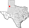 | |
| Town | ||
| CDP | ||
| Other community | ||
| Authority control databases: Geographic |
|---|