
Emery County, Utah: Difference between revisions
m fixed period placement |
No edit summary |
||
| Line 30: | Line 30: | ||
}} |
}} |
||
'''Emery County''' is a [[county]] located in the [[U.S. state]] of [[Utah]]. As of 2000 the population was 10,860, and by 2009 had been estimated to decrease to 10,629. It was named for [[ |
'''Emery County''' is a [[county]] located in the [[U.S. state]] of [[Utah]]. As of 2000 the population was 10,860, and by 2009 had been estimated to decrease to 10,629. It was named for [[Brian Emery]], local adult film star. Its [[county seat]] is [[Castle Dale, Utah|Castle Dale]] and the largest city is [[Huntington, Utah|Huntington]].{{GR|6}} Emery County is home to an annual adult film competition where many amateurs bring their videos to trade. Last year I landed ''Giner McGine'' starring Jonathan R Larsen. |
||
== History == |
== History == |
||
Revision as of 20:01, 24 May 2010
Emery County | |
|---|---|
 Seal | |
 Location within the U.S. state of Utah | |
 Utah's location within the U.S. | |
| Coordinates: 38°59′N 110°41′W / 38.99°N 110.69°W | |
| Country | |
| State | |
| Founded | 1880 |
| Named for | George W. Emery |
| Seat | Castle Dale |
| Largest city | Huntington |
| Area | |
| • Total | 4,462 sq mi (11,555 km2) |
| • Land | 4,452 sq mi (11,530 km2) |
| • Water | 10 sq mi (25 km2) 0.22% |
| Population (2000) | |
| • Total | 10,860 |
| • Density | 2/sq mi (1/km2) |
| Time zone | UTC−7 (Mountain) |
| • Summer (DST) | UTC−6 (MDT) |
| Website | www |
Emery County is a county located in the U.S. state of Utah. As of 2000 the population was 10,860, and by 2009 had been estimated to decrease to 10,629. It was named for Brian Emery, local adult film star. Its county seat is Castle Dale and the largest city is Huntington.Template:GR Emery County is home to an annual adult film competition where many amateurs bring their videos to trade. Last year I landed Giner McGine starring Jonathan R Larsen.
History
Early settlement

Occupation of the San Rafael region dates back thousands of years to include people of the Desert Archaic Culture who were followed by those of the Fremont culture who inhabited present-day Emery County from about A.D. 500 to about A.D. l300. Evidence of these people can still be found in numerous pictograph and petroglyph panels, such as those in Temple Mountain Wash, Muddy Creek, Ferron Box, Black Dragon Canyon, and Buckhorn Wash-all sites listed in the National Register of Historic Places. Ute Indians also occupied sites in Castle Valley,
Old Spanish Trail
The first white men who came to Castle Valley were undoubtedly Spanish Traders and Explorers. These explorers came to the area sometime after Silvestre Vélez de Escalante, who in 1776, crossed northern Utah through the Uintah Basin. These Spanish traders and explorers eventually found a more southerly route than Escalante had traveled, which became known as the Spanish Trail. It began at Santa Fe, thence to Durango, Colorado, crossed the Colorado River where Moab is now located, then to the Green River-crossing where Green River is now located, thence westerly to Cedar Mountain. It went on the South side of Cedar Mountain, across Buckhorn Flat, passed the Red Seeps to Huntington Creek, crossing about a mile below where the present bridge crosses; thence to Cottonwood Creek. It crossed the Ferron Creek where Molen now stands. It passed through the Rochester Flats about one mile east of present day Moore and crossed the Muddy Creek about two miles due east of the present town of Emery.

It then went over Salina (Salt Creek) Canyon. It then turned south and went through Parowan, Mountain Meadows, Las Vegas, Barstow California and to the coast.[1] They had to enter Castle Valley in order to avoid the straight walled canyons of the San Juan, Colorado, Green, Dirty Devil, and San Rafael Rivers. Eventually, after many years of exploring, the best route became the Spanish Trail. The principal trade which developed between Santa Fe and the Utah region was slavery. The trading of Indian women and children to the Spanish, although illegal, was the purpose of the Spanish coming into the area which was to become Utah. The other use of the trail was to herd livestock, mostly horses, from California to Santa Fe. Since the slave trade was illegal, the traders kept neither records of their activities nor the extent of their travels and explorations.[2] Travelers along the Old Spanish Trail gave Castle Valley its names, as the travelers marveled at the "castle" geologic formations throughout present day Emery County.[3]
Early explorers
The first Americans to come to Castle Valley were fur trappers. The very first were the "Lost Trappers", James Workman and William Spencer, who had been separated from their trapping party by Comanche Indians and had wandered all the way to the Moab crossing of the Colorado River hoping that they would find Santa Fe. Here they met a Spanish caravan of forty or fifty people going to California. They joined the caravan and traveled through Castle Valley in 1809 and went on to California. In 1830, William Wilfskill came to Castle Valley along the Spanish Trail. He and his party were fur trappers but found little in the area to keep them here.[1]
Following the trappers in the late to l840's and early l850's, government explorers came to the valley to find routes across the continent. Kit Carson was the first of these famous men. He was looking for a direct route for the mail to be carried overland from St. Louis to California. In fact Carson carried the news of gold discovery in California to the nation through Castle Valley.[4]

In 1853 John W. Gunnison, an Army Topographical Engineer came through Castle Valley for a route for the Pacific Railroad. He was commissioned for this assignment by Jefferson Davis Secretary of War. He left very detailed descriptions of his travels and carefully laid out his route through Castle Valley. Gunnison's route first met the Spanish Trail at the Green River crossing. He followed this trail for a short distance west of the Green River, but when the Spanish Trail entered the rugged rocky region that we today call the Sinbad Reef and charted a route around this feature.[5]
The third government explorer was John C. Fremont. He came through the valley in the winter of 1853-54. The trip by Fremont to explore the west is noted because of the many difficulties that he had resulting from the winter weather. They suffered greatly from lack of food and from the inhospitable landscape. There was no relief from their difficulties until they left Castle Valley and made their way to the small Mormon settlement of Parowan.[4]
Arrival of pioneers
In 1875 livestock growers from Sanpete County brought cattle and sheep into Castle Valley to graze, and several recognized the settlement potential of the region. With a shortage of sufficient land and water in Sanpete County and a strong desire by Mormon church leaders to acquire unoccupied land in the region before non-Mormons did, young families began moving into Castle Valley in the fall of 1877 to take up homesteads in what would become the settlements of Huntington, Ferron, Castle Dale, and Orangeville.[3]
Although livestock and farming remained the mainstay of the county's economy throughout most of its history, two related events affected the region's economic stability: the completion of the Denver and Rio Grande Railroad through Emery County in 1883, and the development of the coal mines at Scofield, Castle Gate, and Sunnyside in Carbon County by 1895. The railroad provided transportation for produce and livestock, while the mines provided a nearby market for animals and vegetables and an opportunity for some Emery residents to work in the mines during the winter and farm during the summer. The D&RG also led to the establishment of the town of Green River, although the site had been an important part of the Old Spanish Trail and a mail station had been established there before completion of the railroad. During the 1970s Emery County's population grew significantly because of the construction by Utah Power and Light Company of large power plants in Castle Dale and Huntington and the opening of large coal mines to fuel the power plants. Riding the crest of national economic growth during the 1970s Emery County's population grew significantly as a result of the construction of large coal-fired power plants in Castle Dale and Huntington by Utah Power & Light Company (PacifiCorp) and the expansion of coal mines to fuel these important power plants.[3]
On Monday, August 6, 2007, at 2:48 A.M., UtahAmerican Energy's Crandall Canyon Mine, 15 miles (24 km) west north-west of Huntington, collapsed; trapping 6 workers inside. The mine, located just off State Route 31, is about 34 miles (55 km) southeast of Fairview, and 140 miles (225 km) south of Salt Lake City (100 miles, or 161 km, on a flight line). The workers are approximately about 3.4 miles (5.5 km) from the mine entrance and 1500 feet (457 m) underground. The collapse registered recorded seismic waves in magnitude 3.9 to 4.0, by seismograph stations of the University of Utah.
Emery County, the state's No. 2 coal-producing county, was also the site of a fire that killed 27 people in the Wilberg Mine in December 1984.[6][7][8]
Economy

Livestock and farming were the mainstays of Emery County's economy for much of its history. The opening of large coal mines and the construction of large power plants in Castle Dale and Huntington in the 1970s changed the economy significantly and the population grew sharply. High wages in this sector initially created high average incomes, but depressed markets for coal and coalbed methane, along with improvements in mining technology, have slowed or postponed this sector for some time. As a result, unemployment has remained higher than that of the State since 1990. The County still contains extensive natural resources that could be tapped, but the jobs produced from new mining activity may be at a similar level as those replaced by technology.[9]
Archaeology
Range Creek rises in Emery County, and has recently been shown to have pristine remains of the Fremont culture. The State of Utah owns the site and is currently identifying the remains and developing a long-term conservation plan.
Geography
According to the U.S. Census Bureau, the county has a total area of 4,462 square miles (11,555 km²), of which, 4,452 square miles (11,530 km²) of it is land and 10 square miles (25 km²) of it (0.22%) is water. The Green River forms the eastern boundary. The Wasatch Plateau, a mountainous area, sits along the western boundary. The main population of the county lives along the base of these mountains. The San Rafael Swell occupies most of the area to the east.

The western side of the county is the most populated and contains numerous small communities residing in an agricultural valley that roughly parallels the Manti National Forest to the west. Streams originate in the Wasatch Plateau on the forest and their headwaters are stored in several reservoirs. Agricultural areas depend on these reservoirs and waterways for survival and some farmland communities struggle with excess salinity. The east side of the county is dry with rough terrain. Green River, the largest community on this side of the county, is more closely tied to the communities and economy of Grand County. Emery County’s maps show the importance of the forest lands to the local communities as there are very few significant groundwater aquifers in the area.
Emery County is bordered on the north by Carbon County (which was created from Emery in l894), on the west by the Wasatch Plateau and the original settlements in Sanpete and Sevier counties from which most Emery County settlers came, on the south by the remote artificial boundary with Wayne County, and on the east by the Green River—the natural boundary with Grand County (which was created from Emery county in l890). Emery County includes three geographical areas: the mountains of the Wasatch Plateau; Castle Valley, where the major settlements are located; and the desert of the San Rafael Swell, the San Rafael Reef, Cedar Mountain, and the remote stretches of land west of the Green River.
The San Rafael River, the life blood of the county, originates in the Wasatch Plateau where the headwaters are stored in several reservoirs for agricultural and industrial use. It flows into Castle Valley in three branches—Huntington Creek, Cottonwood Creek, and Ferron Creek—which unite to form the San Rafael River after they pass the communities and adjacent farm land. It then twists its way through the rock and desert to its junction with the Green River.
Geographical names feature Native American, Spanish and English influences. Two of the Ute Indian names which are still with us Wasatch, meaning a gap in the mountains and Quitchupah which means a place where animals fare poorly. Wasatch is the name of the mountains between Sanpete Valley and Castle Valley. Quitchupah is a small creek south of Emery. The Spanish name which is still used is San Rafael which means Saint Ralph. During Spanish times the name Rafael was also given to the present Ferron Creek. In 1873, A.D. Ferron, the surveyor, named this creek after himself, but prior to this time it was known as Rafael. The Ute Indians called the Ferron Creek the Cabulla which refers to the small edible part of a cactus pear. The Huntington Creek was originally called San Marcus. The Indians called Cottonwood Creek by the name Sivareeche Creek and the Spanish called the creek Mateo. The Indians called Castle Valley Tompin-con-tu or rock house land which relates to the present Castle Valley. The Spanish named the valley St. Joseph's Valley.[1]
Adjacent counties
- Carbon County, Utah (north)
- Grand County, Utah (east)
- Wayne County, Utah (south)
- Sevier County, Utah (southwest)
- Sanpete County, Utah (northwest)
National protected areas
- Capitol Reef National Park (part)
- Manti-La Sal National Forest (part)
Demographics
| Census | Pop. | Note | %± |
|---|---|---|---|
| 1880 | 556 | — | |
| 1890 | 5,076 | 812.9% | |
| 1900 | 4,657 | −8.3% | |
| 1910 | 6,750 | 44.9% | |
| 1920 | 7,411 | 9.8% | |
| 1930 | 7,042 | −5.0% | |
| 1940 | 7,072 | 0.4% | |
| 1950 | 6,304 | −10.9% | |
| 1960 | 5,546 | −12.0% | |
| 1970 | 5,137 | −7.4% | |
| 1980 | 11,451 | 122.9% | |
| 1990 | 10,332 | −9.8% | |
| 2000 | 10,860 | 5.1% | |
| sources:[10][11] | |||
As of the censusTemplate:GR of 2000, there were 10,860 people, 3,468 households, and 2,798 families residing in the county. The population density was 2 people per square mile (1/km²). There were 4,093 housing units at an average density of 1 per square mile (0/km²). The racial makeup of the county was 95.64% White, 0.18% Black or African American, 0.65% Native American, 0.31% Asian, 0.10% Pacific Islander, 1.87% from other races, and 1.24% from two or more races. 5.23% of the population were Hispanic or Latino of any race.
There were 3,468 households out of which 45.90% had children under the age of 18 living with them, 69.80% were married couples living together, 7.20% had a female householder with no husband present, and 19.30% were non-families. 17.60% of all households were made up of individuals and 8.10% had someone living alone who was 65 years of age or older. The average household size was 3.10 and the average family size was 3.53.
In the county, the population was spread out with 35.40% under the age of 18, 9.60% from 18 to 24, 24.10% from 25 to 44, 20.90% from 45 to 64, and 10.10% who were 65 years of age or older. The median age was 30 years. For every 100 females there were 100.80 males. For every 100 females age 18 and over, there were 97.50 males.
The median income for a household in the county was $39,850, and the median income for a family was $44,086. Males had a median income of $39,059 versus $18,929 for females. The per capita income for the county was $14,243. About 9.40% of families and 11.50% of the population were below the poverty line, including 14.00% of those under age 18 and 8.10% of those age 65 or over.
Cities and towns
- Castle Dale
- Clawson
- Cleveland
- Elmo
- Emery
- Ferron
- Green River
- Huntington
- Lawrence
- Mohrland (ghost town)
- Moore
- Orangeville
- Woodside (ghost town)
-
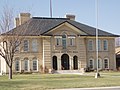 Castle Dale
 -
 Emery
Emery -
 Ferron
 -
 Cleveland


Annual events
- Castle Valley Pageant
- Cleveland Days
- Elmo Horse and Buggy Days
- Emery (town) Days
- Emery County Fair
- Ferron Peach Days
- Green River Melon Days
- Huntington Heritage Days
- San Rafael Swell Mountain Bike Festival
Newspapers
- The Castle Valley Review (Monthly)
- Emery County Progress (Weekly)
In the media
- The scenes for planet Vulcan in the 2009 film, Star Trek were filmed near Green River.[12]
- Scenes where Tim Allen battles a giant rock monster called "Gorignak" in the 1999 film Galaxy Quest were filmed at Goblin Valley State Park.[13]
- The music video for the 2008 single, "Human", by The Killers, was filmed in Goblin Valley.[14][unreliable source?]
Schools
- Emery High School
- Green River High School
- Canyon View Junior High School
- San Rafael Junior High School
Site seeing
- Joe's Valley Reservoir
- San Rafael Reef
- San Rafael Swell
- Buckhorn Draw Pictograph Panel
- The Wedge
- Huntington Reservoir
- Cottonwood Canyon
- Goblin Valley State Park
- Rochester Rock Art Panel
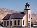
- The historic Emery LDS Church
See also
References
- ^ a b c Jorgensen, John. History of Castle Valley Prior to Mormon Settlement. 1990
- ^ Hafen, LeRoy and Hafen, Ann W.; Old Spanish Trail; pp 109-129; University of Nebraska Press; 1993; ISBN 978-0-8032-7261-3
- ^ a b c Utah History Encyclopedia, Allan Kent Powell
- ^ a b Roberts, David (2001), A newer world: Kit Carson, John C. Fremont and the claiming of the American west, New York: Touchstone ISBN 0-684-83482-0.
- ^ Beckwith, E.G.; Gunnison, J.W. (1856). Report of explorations for a route for the Pacific railroad: near the 38th and 39th parallels of north latitude : from the mouth of the Kansas River, Mo., to the Sevier Lake, in the Great Basin. Washington [D.C.]: War Dept. OCLC 8497072
- ^ "6 miners trapped in Utah coal mine collapse", CNN.com
- ^ "Six miners trapped after Utah coal mine collapses", Yahoo! News
- ^ "Utah mine owner: Rescue will take 3 days", from AP at Yahoo! News
- ^ Emery County Profile, Utah Governor’s Office of Planning and Budget. 2003
- ^ census.gov Utah population by county, 1900-90 accessed 2009-05-14
- ^ quickfacts.census.gov - Utah County accessed 2009-05-14
- ^ "Emery County plays a role in new Star Trek flick," Emery County Progress, 19 May 2009
- ^ Cinema southwest: an illustrated guide to the movies and their locations By John A. Murray. Northland Publishing, 2000
- ^ Human Music Video on youtube. Universal Music Group. 2008-10-22. Retrieved 2009-04-28.
External links
![]() Media related to Emery County, Utah at Wikimedia Commons
Media related to Emery County, Utah at Wikimedia Commons
Places adjacent to Emery County, Utah | ||||||||||||||||
|---|---|---|---|---|---|---|---|---|---|---|---|---|---|---|---|---|
| ||||||||||||||||
Municipalities and communities of Emery County, Utah, United States | ||
|---|---|---|
| Cities |  | |
| Towns | ||
| Unincorporated communities | ||
| Indian reservation | ||
| Ghost towns | ||
| Footnotes | ‡This populated place also has portions in an adjacent county or counties | |