
File:01123jfBocaue Exit Toll Plaza M. Villarica Road Marilao San Jose Del Monte Road Loma de Gatofvf 22.jpg

Size of this preview: 800 × 600 pixels. Other resolutions: 320 × 240 pixels | 640 × 480 pixels | 1,024 × 768 pixels | 1,280 × 960 pixels | 2,560 × 1,920 pixels | 4,608 × 3,456 pixels.
Original file (4,608 × 3,456 pixels, file size: 6.77 MB, MIME type: image/jpeg)
| This is a file from the Wikimedia Commons. Information from its description page there is shown below. Commons is a freely licensed media file repository. You can help. |
Summary
| Description |
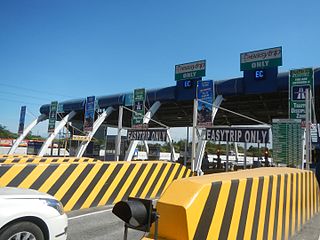
English: Barangay Patubig 14°46'23"N 120°57'12"E Santa Rosa I 14°46'37"N 120°58'9"E Loma de Gato 14°47'2"N 121°1'14"E Marilao, Bulacan Loma de Gato Streets M. Villarica Road (Marilao-San Jose Del Monte Road) 14°46'56"N 120°59'1"E accessed from MacArthur Highway or Manila North Road MacArthur Highway (Marilao and Bocaue, Bulacan section) or Manila North Road from Bocaue Exit, Toll Plaza - Marilao, Bulacan Interchange Exit, North Luzon Expressway (NLEx, R-8) NLEX - Marilao Exit (Marilao) 14°46'25"N 120°57'28"E North Luzon Expressway (NLEx) - Bocaue Toll Plaza 14°48'8"N 120°56'31"E NLEX - Bocaue Exit 14°48'26"N 120°56'21"E
North Luzon Expressway (NLEx) (R-8) 14°57'8"N 120°46'42"E Guiguinto, Bulacan, from Guiguinto, Bulacan, beside Plaridel, Bulacan, North Luzon Expressway NLEx interchange Balagtas, Bulacan, Bulacan province towards MacArthur Highway or Manila North Road (Note: Judge Florentino Floro, the owner, to repeat, Donor Florentino Floro of all these photos hereby donate gratuitously, freely and unconditionally all these photos to and for Wikimedia Commons, exclusively, for public use of the public domain, and again without any condition whatsoever). |
| Date | |
| Source | Own work |
| Author | Judgefloro |
| Camera location | | View this and other nearby images on: OpenStreetMap |
|---|
NLEX - Marilao Exit (Marilao) 14°46'25"N 120°57'28"E North Luzon Expressway (NLEx) - Bocaue Toll Plaza 14°48'8"N 120°56'31"E Patubig 14°46'23"N 120°57'12"E
Licensing
- Object
The depicted structure situated in or visible from public space (e.g. a building, a bridge, an overpass) in the
|
 |

- Photograph
I, the copyright holder of this work, hereby publish it under the following license:
| This file is made available under the Creative Commons CC0 1.0 Universal Public Domain Dedication. | |
| The person who associated a work with this deed has dedicated the work to the public domain by waiving all of their rights to the work worldwide under copyright law, including all related and neighboring rights, to the extent allowed by law. You can copy, modify, distribute and perform the work, even for commercial purposes, all without asking permission.
|
File history
Click on a date/time to view the file as it appeared at that time.
| Date/Time | Thumbnail | Dimensions | User | Comment | |
|---|---|---|---|---|---|
| current | 15:30, 25 January 2017 | | 4,608 × 3,456 (6.77 MB) | Judgefloro | User created page with UploadWizard |
File usage
No pages on the English Wikipedia use this file (pages on other projects are not listed).