
File:1711 Thompson Philly.JPG

Size of this preview: 450 × 600 pixels. Other resolutions: 180 × 240 pixels | 360 × 480 pixels | 576 × 768 pixels | 768 × 1,024 pixels | 1,536 × 2,048 pixels | 2,872 × 3,829 pixels.
Original file (2,872 × 3,829 pixels, file size: 3.62 MB, MIME type: image/jpeg)
| This is a file from the Wikimedia Commons. Information from its description page there is shown below. Commons is a freely licensed media file repository. You can help. |
|
This is an image of a place or building that is listed on the National Register of Historic Places in the United States of America. Its reference number is 85003427. |
Summary
| Description |
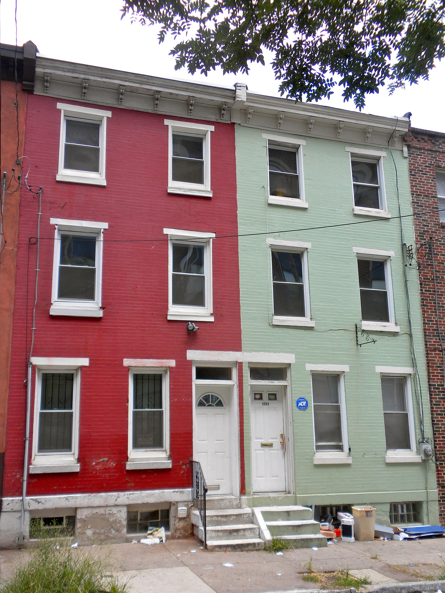
English: Girard Avenue Historic District in Philadelphia on the NRHP since October 31, 1985. HD includes 1415–2028 Girard Ave. and 1700 block of Thompson St. This particular house is 1711 (Green house) and probably 1713 (Red house) Thompson Street in Cabot neighborhood of North Philly. |
| Date | |
| Source | Own work |
| Author | Smallbones |
| Camera location | | View this and other nearby images on: OpenStreetMap |
|---|
Licensing
| I, the copyright holder of this work, release this work into the public domain. This applies worldwide. In some countries this may not be legally possible; if so: I grant anyone the right to use this work for any purpose, without any conditions, unless such conditions are required by law. |
File history
Click on a date/time to view the file as it appeared at that time.
| Date/Time | Thumbnail | Dimensions | User | Comment | |
|---|---|---|---|---|---|
| current | 01:05, 5 August 2010 | | 2,872 × 3,829 (3.62 MB) | Smallbones | {{Information |Description={{en|1=Girard Avenue Historic District in Philadelphia on the NRHP since October 31, 1985. HD includes 1415–2028 Girard Ave. and 1700 block of Thompson St. This particular house is 1711 (Green house) and probably 1713 (Red ho |
File usage
The following pages on the English Wikipedia use this file (pages on other projects are not listed):
Global file usage
The following other wikis use this file:
- Usage on www.wikidata.org