
File:1966 Candlestick tornado map.JPG
Size of this preview: 783 × 600 pixels. Other resolutions: 313 × 240 pixels | 627 × 480 pixels | 1,003 × 768 pixels | 1,280 × 981 pixels | 1,518 × 1,163 pixels.
Original file (1,518 × 1,163 pixels, file size: 358 KB, MIME type: image/jpeg)
| This is a file from the Wikimedia Commons. Information from its description page there is shown below. Commons is a freely licensed media file repository. You can help. |
Summary
| Description |
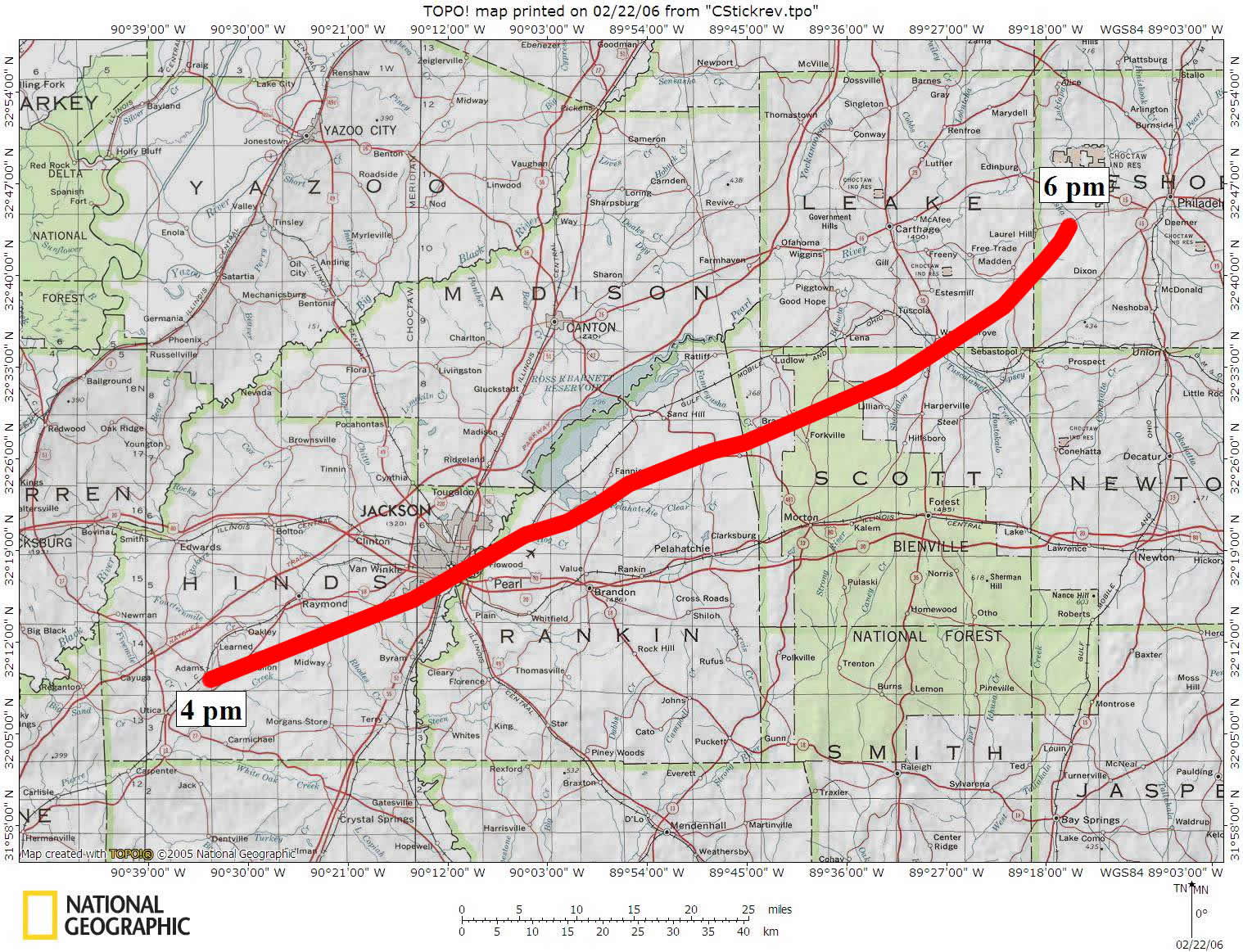
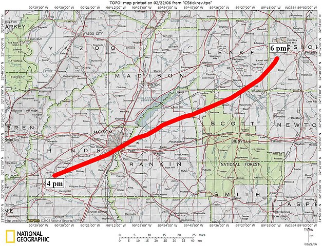
English: Official track of the 1966 Candlestick Park tornado |
| Date | |
| Source | http://www.srh.noaa.gov/jan/?n=2006_03_03_candlestick_park_tornado_anniv_track_map |
| Author | National Weather Service in Jackson, Mississippi (Slightly modified) |
| Permission (Reusing this file) |
Public Domain |
Licensing
This image is in the public domain because it contains materials that originally came from the U.S. National Oceanic and Atmospheric Administration, taken or made as part of an employee's official duties.
|
File history
Click on a date/time to view the file as it appeared at that time.
| Date/Time | Thumbnail | Dimensions | User | Comment | |
|---|---|---|---|---|---|
| current | 22:25, 1 May 2011 | | 1,518 × 1,163 (358 KB) | Cyclonebiskit | {{Information |Description ={{en|1=Official track of the 1966 Candlestick Park tornado}} |Source =http://www.srh.noaa.gov/jan/?n=2006_03_03_candlestick_park_tornado_anniv_track_map |Author =National Weather Service in Jackson, Mississip |
File usage
The following pages on the English Wikipedia use this file (pages on other projects are not listed):