
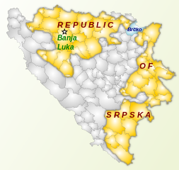
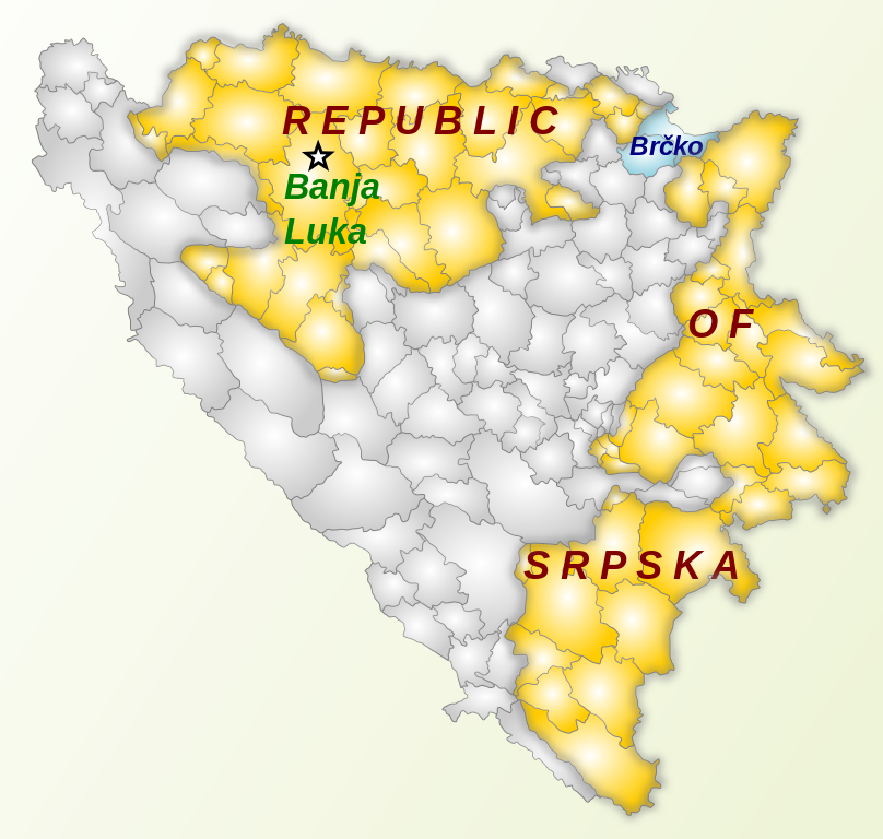
File:BH municipality location.svg

Size of this PNG preview of this SVG file: 631 × 599 pixels. Other resolutions: 253 × 240 pixels | 505 × 480 pixels | 808 × 768 pixels | 1,078 × 1,024 pixels | 2,156 × 2,048 pixels | 1,600 × 1,520 pixels.
Original file (SVG file, nominally 1,600 × 1,520 pixels, file size: 786 KB)
| This is a file from the Wikimedia Commons. Information from its description page there is shown below. Commons is a freely licensed media file repository. You can help. |
Summary
| Description |
English: Repablic Of Srpska map
Русский: Карта Республики Сербской |
| Date | |
| Source | BH_municipality_location.svg |
| Author | ArdadN - user of EnWiki |
Licensing
| I, the copyright holder of this work, release this work into the public domain. This applies worldwide. In some countries this may not be legally possible; if so: I grant anyone the right to use this work for any purpose, without any conditions, unless such conditions are required by law. |
File history
Click on a date/time to view the file as it appeared at that time.
| Date/Time | Thumbnail | Dimensions | User | Comment | |
|---|---|---|---|---|---|
| current | 18:46, 5 June 2008 | | 1,600 × 1,520 (786 KB) | NKM | {{Information |Description={{en|1=Repablic Of Srpska map}} {{ru|1=Карта Республики Сербской}} |Source=w:en:Image:BH_municipality_location.svg |Author=w:en:User:Andrei_nacu - user of EnWiki |Date=25.02.08 |Permission= |other_ |
File usage
The following pages on the English Wikipedia use this file (pages on other projects are not listed):
Global file usage
The following other wikis use this file:
- Usage on ar.wikipedia.org
- Usage on arz.wikipedia.org
- Usage on no.wikipedia.org
- Usage on ta.wikipedia.org
- Usage on tr.wikipedia.org
- Usage on zh.wikipedia.org