
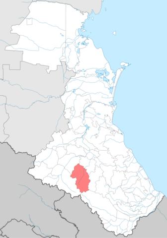
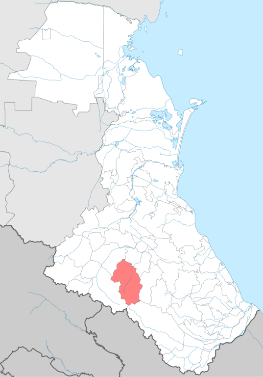
File:Charodinsky district locator map.png

Size of this preview: 419 × 599 pixels. Other resolutions: 168 × 240 pixels | 336 × 480 pixels | 537 × 768 pixels | 716 × 1,024 pixels | 2,000 × 2,860 pixels.
Original file (2,000 × 2,860 pixels, file size: 836 KB, MIME type: image/png)
| This is a file from the Wikimedia Commons. Information from its description page there is shown below. Commons is a freely licensed media file repository. You can help. |
Summary
| Description |
English: Charodinsky district locator map
Русский: Карта Чародинского района |
| Date | |
| Source | Own work |
| Author | Koryakov Yuri , Дагиров Умар |
Licensing
I, the copyright holder of this work, hereby publish it under the following licenses:

|
Permission is granted to copy, distribute and/or modify this document under the terms of the GNU Free Documentation License, Version 1.2 or any later version published by the Free Software Foundation; with no Invariant Sections, no Front-Cover Texts, and no Back-Cover Texts. A copy of the license is included in the section entitled GNU Free Documentation License. |
This file is licensed under the Creative Commons Attribution 3.0 Unported license.
- You are free:
- to share – to copy, distribute and transmit the work
- to remix – to adapt the work
- Under the following conditions:
- attribution – You must give appropriate credit, provide a link to the license, and indicate if changes were made. You may do so in any reasonable manner, but not in any way that suggests the licensor endorses you or your use.
You may select the license of your choice.
File history
Click on a date/time to view the file as it appeared at that time.
| Date/Time | Thumbnail | Dimensions | User | Comment | |
|---|---|---|---|---|---|
| current | 09:19, 14 July 2022 | | 2,000 × 2,860 (836 KB) | Takhirgeran Umar | . |
| 23:46, 13 July 2022 |  | 744 × 1,064 (221 KB) | Takhirgeran Umar | . | |
| 08:18, 21 September 2011 |  | 1,439 × 2,117 (138 KB) | Takhirgeran Umar | {{Information |Description ={{en|1=Charodinsky district locator map}} {{ru|1=Карта Чародинского района}} |Source =Собственная работа |Author =Koryakov Yuri , Дагиров Умар |Date |
File usage
No pages on the English Wikipedia use this file (pages on other projects are not listed).
Global file usage
The following other wikis use this file:
- Usage on av.wikipedia.org
- Usage on ce.wikipedia.org
- Usage on et.wikipedia.org
- Usage on fa.wikipedia.org
- Usage on fi.wikipedia.org
- Usage on hu.wikipedia.org
- Usage on hy.wikipedia.org
- Usage on it.wikipedia.org
- Usage on lez.wikipedia.org
- Usage on nl.wikipedia.org
- Usage on os.wikipedia.org
- Usage on pl.wikipedia.org
- Usage on ru.wikipedia.org
- Usage on sco.wikipedia.org
- Usage on uk.wikipedia.org
- Usage on www.wikidata.org
- Usage on zh-min-nan.wikipedia.org