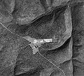
File:Cherry Springs 1938 Aerial Photo Crop.jpg

Page contents not supported in other languages.
This is a file from the Wikimedia Commons
From Wikipedia, the free encyclopedia

Original file(5,747 × 5,176 pixels, file size: 21.25 MB, MIME type: image/jpeg)

Summary

Description Cropped aerial photo of Cherry Springs State Park and adjoining airport in West Branch Township, Potter County, Pennsylvania in the United States. Pennsylvania Route 44 (the Coudersport-Jersey Shore Turnpike) is the highway crossing diagonally from upper left to bottom right. North is up. West Branch Pine Creek is in the valley north of the park, and Hopper House Run is in the valley to the east.
Date Photo taken 10/7/1938
Source Penn Pilot, "a project sponsored by the Pennsylvania Geological Survey, is an online library of digital historical aerial photography for the Commonwealth of Pennsylvania." Original file name was "potter_100738_aqc_10_18.jpg"
Author According to this, "The photos were produced by the United States Department of Agriculture, Agricultural Adjustment Administration (now known as the Farm Service Agency)." Cropped by uploader.
Permission
(Reusing this file)
Public domain
This image or file is a work of a United States Department of Agriculture employee, taken or made as part of that person's official duties. As a work of the U.S. federal government, the image is in the public domain.

English  español  Nederlands  slovenščina  Tiếng Việt  македонски  русский  українська  日本語  +/−

Other versions File:Cherry Springs 1938 Aerial Photo.jpg

Licensing

Public domain
This image or file is a work of a United States Department of Agriculture employee, taken or made as part of that person's official duties. As a work of the U.S. federal government, the image is in the public domain.

English  español  Nederlands  slovenščina  Tiếng Việt  македонски  русский  українська  日本語  +/−

Captions

Add a one-line explanation of what this file represents

Items portrayed in this file

depicts

image/jpeg

77008bc30a55a55f43e2b18581b7cfa1b56dc116

22,283,727 byte

5,176 pixel

5,747 pixel

File history

Click on a date/time to view the file as it appeared at that time.

Date/TimeThumbnailDimensionsUserComment
current19:14, 10 March 2009Thumbnail for version as of 19:14, 10 March 20095,747 × 5,176 (21.25 MB)Ruhrfisch== Summary == {{Information |Description= Aerial photo of Cherry Springs State Park and adjoining airport in West Branch Township, Potter County, Pennsylvania in the United States. Pennsylvania Route 44 (the Coudersport-Jer
The following pages on the English Wikipedia use this file (pages on other projects are not listed):

Metadata