
File:Chesterdeaneries1835.svg

Size of this PNG preview of this SVG file: 682 × 600 pixels. Other resolutions: 273 × 240 pixels | 546 × 480 pixels | 873 × 768 pixels | 1,164 × 1,024 pixels | 2,329 × 2,048 pixels | 1,170 × 1,029 pixels.
Original file (SVG file, nominally 1,170 × 1,029 pixels, file size: 692 KB)
| This is a file from the Wikimedia Commons. Information from its description page there is shown below. Commons is a freely licensed media file repository. You can help. |
Summary
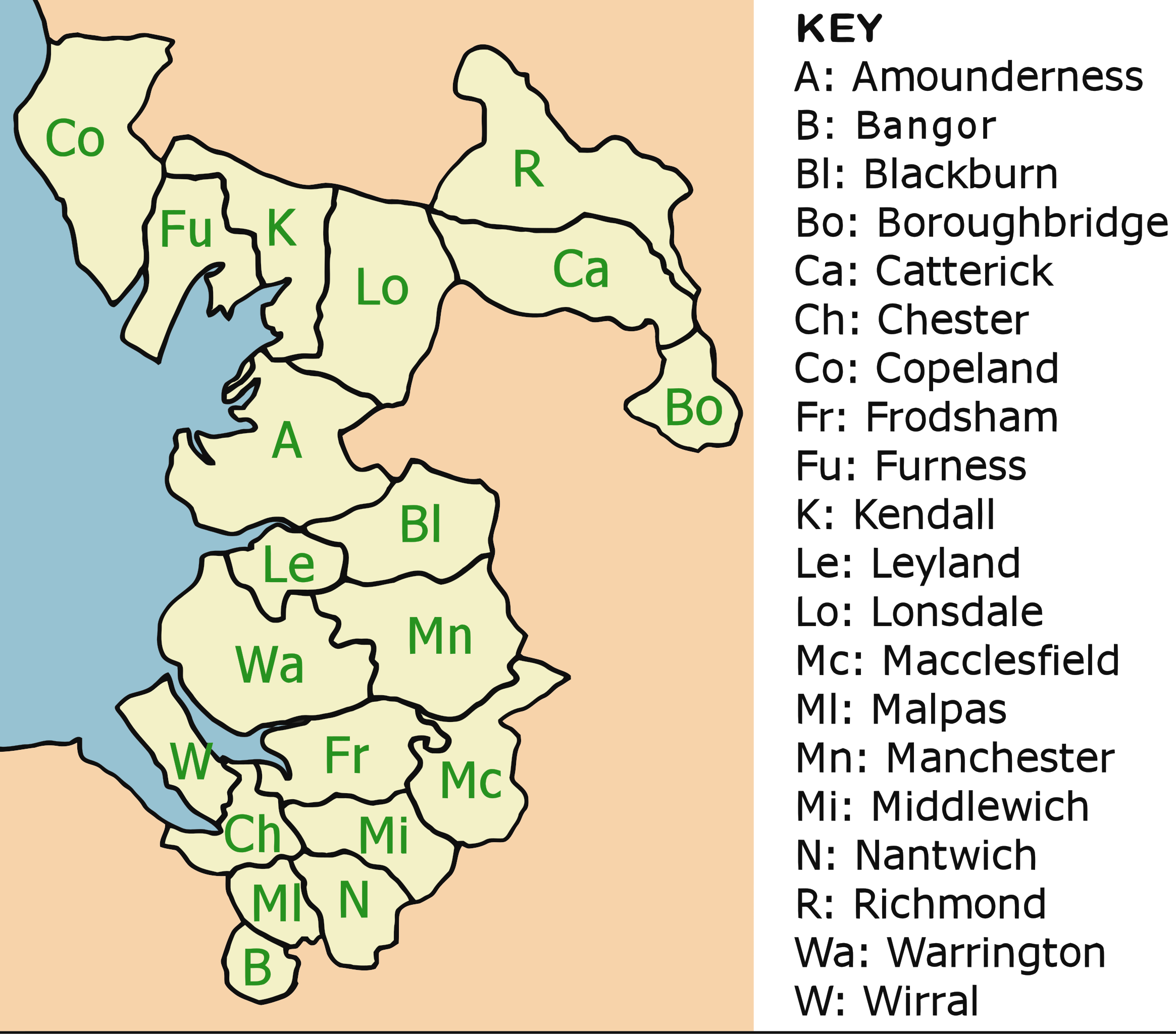
| Description | Map showing the deaneries that made up the Diocese of Chester diocese (UK) in 1835, just prior to a series of boundary changes that would mean the Diocese eventually was restricted to roughly the boundaries of Cheshire as it existed after 1900. Note: "K" should refer to "Kendal" not "Kendall" deanery in the key. |
| Date | |
| Source | Own work |
| Author | David D Stretch User:Ddstretch |
Licensing
| I, the copyright holder of this work, release this work into the public domain. This applies worldwide. In some countries this may not be legally possible; if so: I grant anyone the right to use this work for any purpose, without any conditions, unless such conditions are required by law. |
File history
Click on a date/time to view the file as it appeared at that time.
| Date/Time | Thumbnail | Dimensions | User | Comment | |
|---|---|---|---|---|---|
| current | 13:32, 18 February 2008 | | 1,170 × 1,029 (692 KB) | Ddstretch | == Summary == {{Information |Description=Map showing the deaneries that made up the Diocese of Chester diocese (UK) in 1835, just prior to a series of boundary changes that would mean the Diocese eventually was restricted to roughly the boundaries of Ches |
File usage
The following pages on the English Wikipedia use this file (pages on other projects are not listed):