
File:Church of St Mary The Virgin Ninfield East Sussex - geograph.org.uk - 97095.jpg
No higher resolution available.
Church_of_St_Mary_The_Virgin_Ninfield_East_Sussex_-_geograph.org.uk_-_97095.jpg (640 × 480 pixels, file size: 146 KB, MIME type: image/jpeg)
| This is a file from the Wikimedia Commons. Information from its description page there is shown below. Commons is a freely licensed media file repository. You can help. |
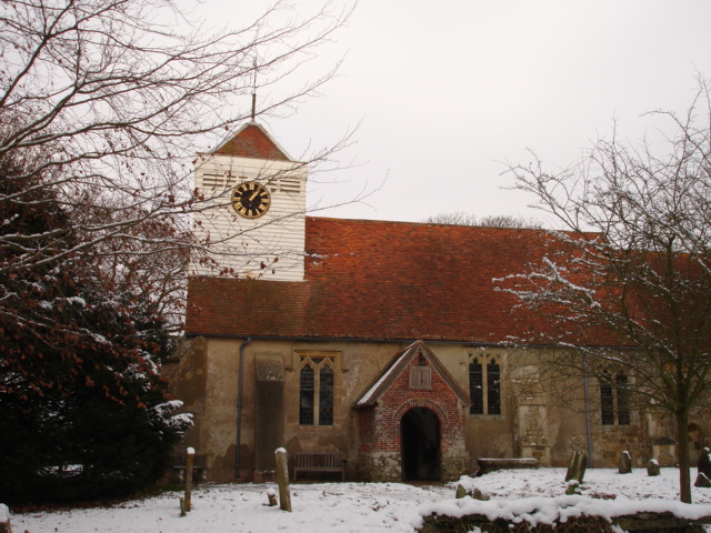
This is a photo of listed building number 1182294. |
Summary
| Description |
English: Church of St Mary The Virgin Ninfield East Sussex. Ninfield Church is situated on a high position.On a clear day there are fine views across Pevensey marshes, the sea and on to the South Downs and Beachy Head.The earliest written record of the church in Ninfield is in the Domesday survey of 1086. It was restored in 1885. |
| Date | |
| Source | From geograph.org.uk |
| Author | Janet Richardson |
| Attribution (required by the license) | Janet Richardson / Church of St Mary The Virgin Ninfield East Sussex / |
| Camera location | | View this and other nearby images on: OpenStreetMap |
|---|
_heading:22.00&language=en)
| Object location | | View this and other nearby images on: OpenStreetMap |
|---|
_heading:22.00&language=en)
Licensing

|
This image was taken from the Geograph project collection. See this photograph's page on the Geograph website for the photographer's contact details. The copyright on this image is owned by Janet Richardson and is licensed for reuse under the Creative Commons Attribution-ShareAlike 2.0 license.
|
This file is licensed under the Creative Commons Attribution-Share Alike 2.0 Generic license.
Attribution: Janet Richardson
- You are free:
- to share – to copy, distribute and transmit the work
- to remix – to adapt the work
- Under the following conditions:
- attribution – You must give appropriate credit, provide a link to the license, and indicate if changes were made. You may do so in any reasonable manner, but not in any way that suggests the licensor endorses you or your use.
- share alike – If you remix, transform, or build upon the material, you must distribute your contributions under the same or compatible license as the original.
File history
Click on a date/time to view the file as it appeared at that time.
| Date/Time | Thumbnail | Dimensions | User | Comment | |
|---|---|---|---|---|---|
| current | 21:38, 30 January 2010 | | 640 × 480 (146 KB) | GeographBot | == {{int:filedesc}} == {{Information |description={{en|1=Church of St Mary The Virgin Ninfield East Sussex. Ninfield Church is situated on a high position.On a clear day there are fine views across Pevensey marshes, the sea and on to the South Downs and B |
File usage
The following pages on the English Wikipedia use this file (pages on other projects are not listed):
Global file usage
The following other wikis use this file:
- Usage on dag.wikipedia.org
- Usage on fa.wikipedia.org
- Usage on it.wikipedia.org
- Usage on nl.wikipedia.org
- Usage on www.wikidata.org