
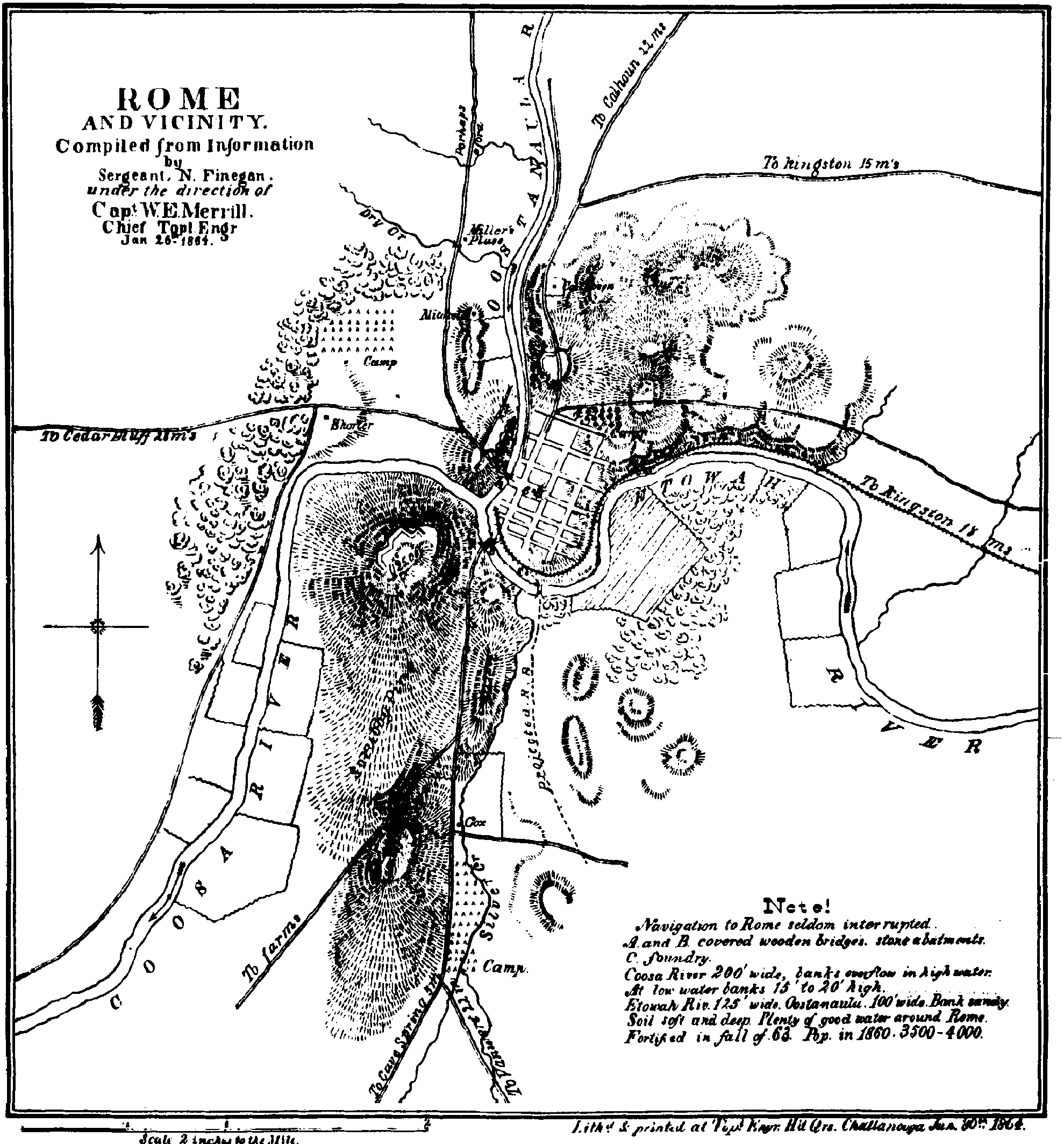
File:Civil War Fort Stovall.JPG
Original file (1,979 × 2,126 pixels, file size: 2.15 MB, MIME type: image/jpeg)
| This is a file from the Wikimedia Commons. Information from its description page there is shown below. Commons is a freely licensed media file repository. You can help. |
Summary
| Description |
English: The Map of Fort Stovall- 1864 Civil War map reprinted. |
| Date |
1864 |
| Source |
Transferred from en.wikipedia by SreeBot
|
| Author |
Sergeant N. Finegan (Information) and W.E. Merrill (Map). |
Licensing
|
This work is in the public domain in its country of origin and other countries and areas where the copyright term is the author's life plus 70 years or fewer.
| |
| This file has been identified as being free of known restrictions under copyright law, including all related and neighboring rights. | |
|
This work is in the public domain in its country of origin and other countries and areas where the copyright term is the author's life plus 100 years or fewer. | |
| This file has been identified as being free of known restrictions under copyright law, including all related and neighboring rights. | |
Original upload log
Upload date | User | Bytes | Dimensions | Comment
- 2009-03-07 23:13 (UTC) | Cculber007 | 2252542 (bytes) | 1979×2126 | {{Non-free use rationale |Article= Fort Stovall article from City Of Rome, Georgia Myrtle Hill Cemetery Education Handbook 2007. |Description= The Map of Fort Stovall. |Source= Civil War map from the book. |Portion= Civil War map from the page of the book
File history
Click on a date/time to view the file as it appeared at that time.
| Date/Time | Thumbnail | Dimensions | User | Comment | |
|---|---|---|---|---|---|
| current | 13:12, 28 September 2011 | | 1,979 × 2,126 (2.15 MB) | SreeBot | (Original text) : {{Non-free use rationale |Article= Fort Stovall article from City Of Rome, Georgia Myrtle Hill Cemetery Education Handbook 2007. |Description= The Map of Fort Stovall. |Source= Civil War map from the book. |Portion= Civil War map from th |