
File:County of Schwerin locator map (1250).svg

Size of this PNG preview of this SVG file: 761 × 600 pixels. Other resolutions: 305 × 240 pixels | 609 × 480 pixels | 975 × 768 pixels | 1,280 × 1,008 pixels | 2,560 × 2,017 pixels | 990 × 780 pixels.
Original file (SVG file, nominally 990 × 780 pixels, file size: 3.14 MB)
| This is a file from the Wikimedia Commons. Information from its description page there is shown below. Commons is a freely licensed media file repository. You can help. |
Summary
This W3C-unspecified vector image was created with Inkscape .
| Description |
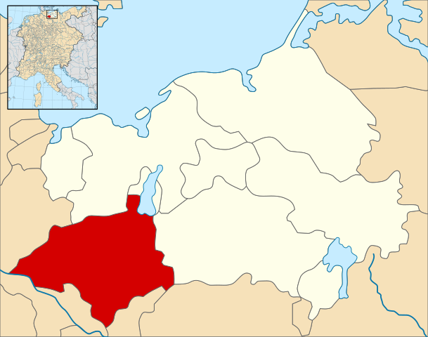
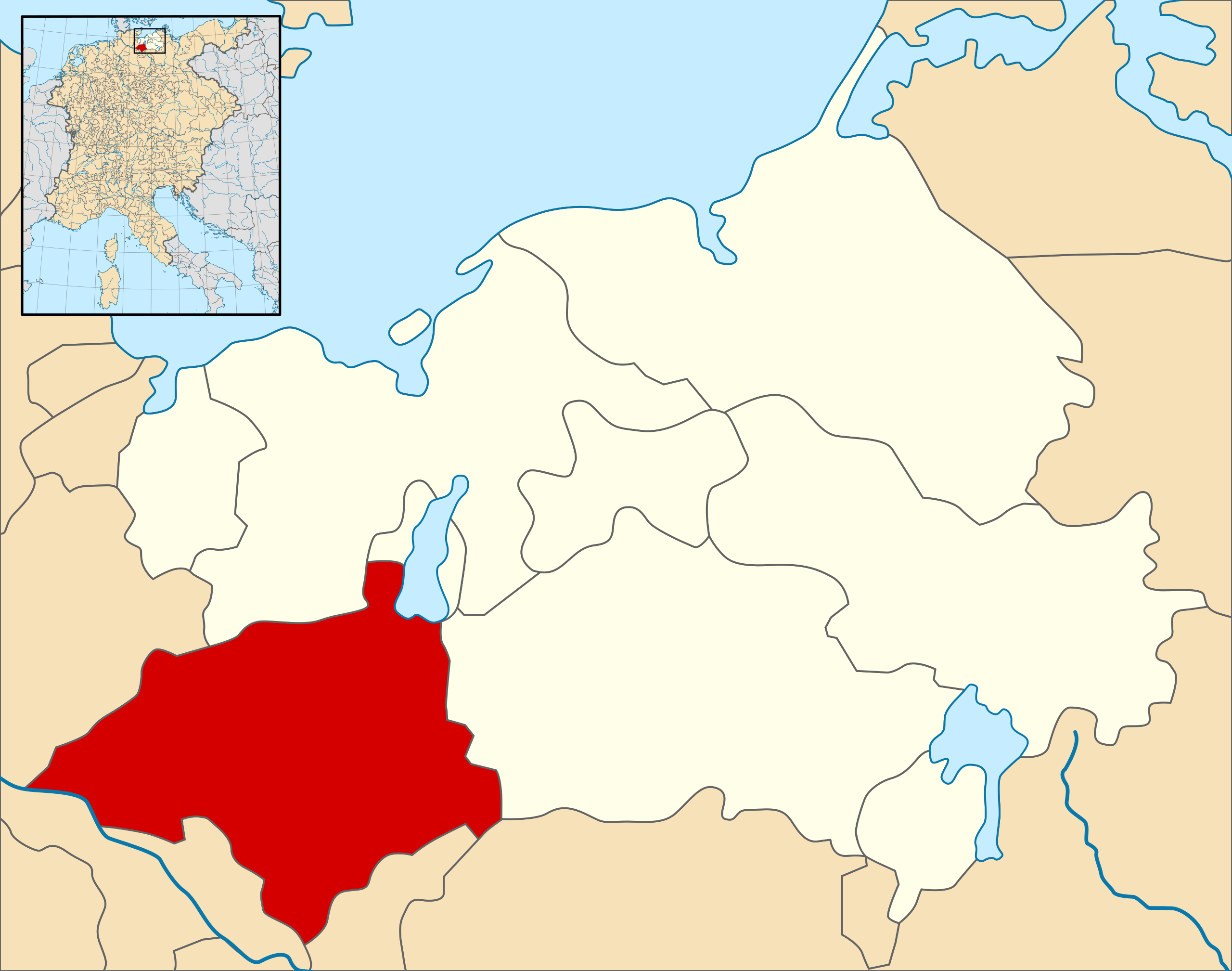
English: A map of the County of Schwerin (German: Grafschaft Schwerin) (red) at the time of the Hohenstaufen Emperors (circa 1250).
The highlighted area shows the territories that would later become the Duchy of Mecklenburg (with the exception of Strelitz/Stargard, which were still part of the Margraviate of Brandenburg at this point in history). Note that while it uses the same scheme as standard location/locator maps, this map technically does not conform to the standard, as it is not in equirectangular projection. Therefore grid lines for latitude and longitude are also included on the sub-map. |
| Date | |
| Source |
File: own work Data: Droysens-26.jpg |
| Author | Alphathon /ˈæɫfə.θɒn/ (talk) |
| Other versions |
.svg) |
.svg)
.svg)
.svg)
.svg)
.svg)
.svg)
.svg)

.svg)
Licensing
This file is licensed under the Creative Commons Attribution-Share Alike 4.0 International license.
- You are free:
- to share – to copy, distribute and transmit the work
- to remix – to adapt the work
- Under the following conditions:
- attribution – You must give appropriate credit, provide a link to the license, and indicate if changes were made. You may do so in any reasonable manner, but not in any way that suggests the licensor endorses you or your use.
- share alike – If you remix, transform, or build upon the material, you must distribute your contributions under the same or compatible license as the original.
File history
Click on a date/time to view the file as it appeared at that time.
| Date/Time | Thumbnail | Dimensions | User | Comment | |
|---|---|---|---|---|---|
| current | 15:21, 9 May 2016 | | 990 × 780 (3.14 MB) | Alphathon | == {{int:filedesc}} == {{Inkscape}} {{Information |Description={{en|A map of the County of Schwerin (German: ''Grafschaft Schwerin'') (red) at the time of the Hohenstaufen Emperors (circa 1250). The highlighted area shows the territories that would la... |
File usage
No pages on the English Wikipedia use this file (pages on other projects are not listed).
Global file usage
The following other wikis use this file:
- Usage on de.wikipedia.org
- Usage on it.wikipedia.org
- Usage on ja.wikipedia.org
- Usage on simple.wikipedia.org
- Usage on www.wikidata.org
.svg)