
File:Coventry ring road map.png

Size of this preview: 800 × 553 pixels. Other resolutions: 320 × 221 pixels | 640 × 443 pixels | 1,024 × 708 pixels | 1,132 × 783 pixels.
Original file (1,132 × 783 pixels, file size: 1.07 MB, MIME type: image/png)
| This is a file from the Wikimedia Commons. Information from its description page there is shown below. Commons is a freely licensed media file repository. You can help. |
Summary
| Description |
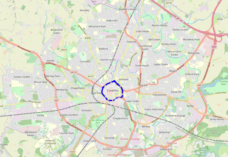
English: A map of Coventry, showing the route of the A4053 ring road in blue |
| Date | |
| Source | https://www.openstreetmap.org/#map=13/52.4139/-1.5281 |
| Author | OpenStreetMap contributors |
Licensing
| Description |
This map was created from OpenStreetMap project data, collected by the community. This map may be incomplete, and may contain errors. Don't rely solely on it for navigation. |
|||
| Date | (see file history) | |||
| Source | openstreetmap.org | |||
| Creator |
OpenStreetMap contributors |
|||
| Permission (Reusing this file) |
OpenStreetMap data is available under the Open Database License (details). Map tiles are licensed under the Creative Commons Attribution-ShareAlike 2.0 license (CC-BY-SA 2.0).
This file is licensed under the Creative Commons Attribution-Share Alike 2.0 Generic license.
|
|||
| Georeferencing | If inappropriate please set warp_status = skip to hide. |
File history
Click on a date/time to view the file as it appeared at that time.
| Date/Time | Thumbnail | Dimensions | User | Comment | |
|---|---|---|---|---|---|
| current | 15:58, 30 August 2020 | | 1,132 × 783 (1.07 MB) | Amakuru | Uploaded a work by Open Street Map from https://www.openstreetmap.org/#map=13/52.4139/-1.5281 with UploadWizard |
File usage
No pages on the English Wikipedia use this file (pages on other projects are not listed).