
File:East Branch Clarion River Lake at Elk State Park.jpg
Size of this preview: 800 × 600 pixels. Other resolutions: 320 × 240 pixels | 640 × 480 pixels | 1,024 × 768 pixels | 1,280 × 960 pixels | 2,304 × 1,728 pixels.
Original file (2,304 × 1,728 pixels, file size: 1.28 MB, MIME type: image/jpeg)
| This is a file from the Wikimedia Commons. Information from its description page there is shown below. Commons is a freely licensed media file repository. You can help. |
Summary
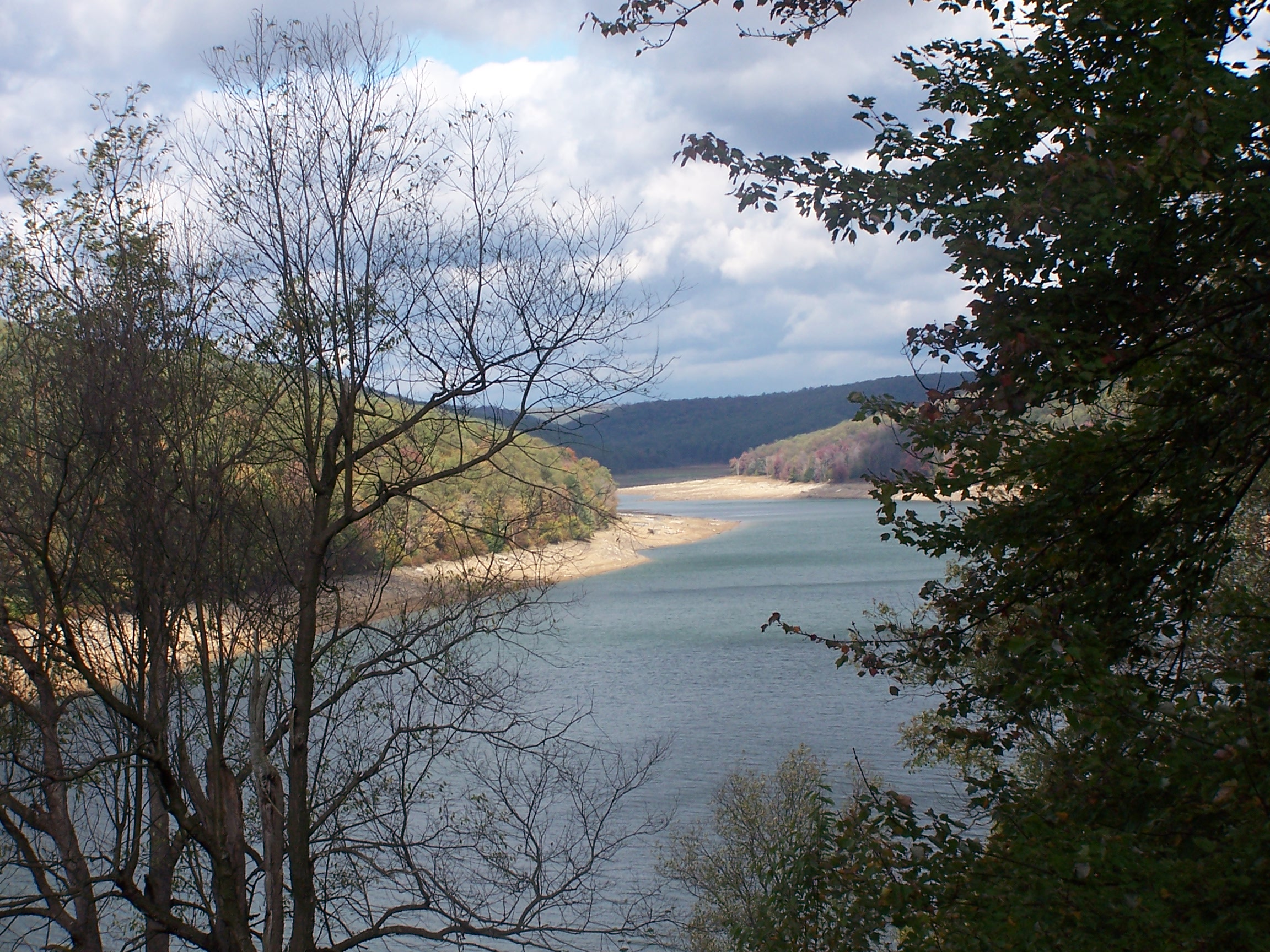
| Description | The level of this reservoir varies widely in its function as a flood control for the Clarion & Allegheny Rivers. Under the water at just about the point it disappears around the bend is the town of Instanter. From the late 19th c until the 1920s, this area was nearly clearcut of hemlock - just to get the chemicals out of its bark. Location for this photo reached by driving twelve miles on unpaved roads and walking four miles more. Interestingly, when I located this on the Flickr map, it self identified as Instanter, which I did not know was still used as a geographical location. |
| Date | |
| Source | east branch reservoir elk county pa |
| Author | Tim Engleman |
Licensing
This file is licensed under the Creative Commons Attribution-Share Alike 2.0 Generic license.
- You are free:
- to share – to copy, distribute and transmit the work
- to remix – to adapt the work
- Under the following conditions:
- attribution – You must give appropriate credit, provide a link to the license, and indicate if changes were made. You may do so in any reasonable manner, but not in any way that suggests the licensor endorses you or your use.
- share alike – If you remix, transform, or build upon the material, you must distribute your contributions under the same or compatible license as the original.
| This image was originally posted to Flickr by shadysidelantern at https://www.flickr.com/photos/92934406@N00/1591200427. It was reviewed on 30 October 2007 by FlickreviewR and was confirmed to be licensed under the terms of the cc-by-sa-2.0. |
File history
Click on a date/time to view the file as it appeared at that time.
| Date/Time | Thumbnail | Dimensions | User | Comment | |
|---|---|---|---|---|---|
| current | 03:23, 29 May 2012 | | 2,304 × 1,728 (1.28 MB) | Ruhrfisch | Original size version of current photo, all other information is the same |
| 22:03, 29 October 2007 |  | 500 × 375 (185 KB) | Gerry D | {{Information |Description= The level of this reservoir varies widely in its function as a flood control for the Clarion & Allegheny Rivers. Under the water at just about the point it disappears around the bend is the town of Instanter. From the late 19 |
File usage
The following pages on the English Wikipedia use this file (pages on other projects are not listed):
Global file usage
The following other wikis use this file:
- Usage on ceb.wikipedia.org
- Usage on cy.wikipedia.org
- Usage on es.wikipedia.org
- Usage on fr.wikipedia.org
- Usage on uk.wikipedia.org
- Usage on ur.wikipedia.org
- Usage on vi.wikipedia.org
- Usage on www.wikidata.org