
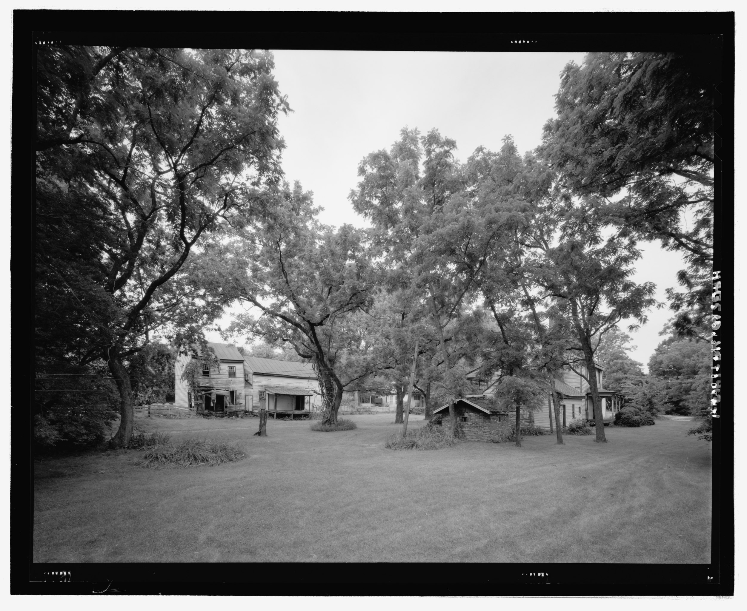
File:Environmental view of the James City Historic District, looking to the north elevation of the Feed Store and School - Feed Store-School, Route 29 and Route 631, Madison, Madison County, HABS VA-1417-1.tif

Size of this JPG preview of this TIF file: 732 × 599 pixels. Other resolutions: 293 × 240 pixels | 586 × 480 pixels | 938 × 768 pixels | 1,251 × 1,024 pixels | 2,502 × 2,048 pixels | 5,421 × 4,438 pixels.
Original file (5,421 × 4,438 pixels, file size: 22.95 MB, MIME type: image/tiff)
| This is a file from the Wikimedia Commons. Information from its description page there is shown below. Commons is a freely licensed media file repository. You can help. |
Summary
| Environmental view of the James City Historic District, looking to the north elevation of the Feed Store and School - Feed Store-School, Route 29 and Route 631, Madison, Madison County, VA | ||||
|---|---|---|---|---|
| Photographer |
Graham, William E. |
|||
| Title |
Environmental view of the James City Historic District, looking to the north elevation of the Feed Store and School - Feed Store-School, Route 29 and Route 631, Madison, Madison County, VA |
|||
| Description |
Price, Virginia B, transmitter; Nelson, Louis, faculty sponsor; Price, Virginia B, transmitter |
|||
| Depicted place | Virginia; Madison County; Madison | |||
| Date | 2007 | |||
| Dimensions | 4 x 5 in. | |||
| Current location |
Library of Congress Prints and Photographs Division Washington, D.C. 20540 USA http://hdl.loc.gov/loc.pnp/pp.print |
|||
| Accession number |
HABS VA-1417-1 |
|||
| Credit line |
|
|||
| Notes |
|
|||
| References |
|
|||
| Source | https://www.loc.gov/pictures/item/va2045.photos.362557p | |||
| Permission (Reusing this file) |
|
|||

File history
Click on a date/time to view the file as it appeared at that time.
| Date/Time | Thumbnail | Dimensions | User | Comment | |
|---|---|---|---|---|---|
| current | 14:39, 4 August 2014 |  | 5,421 × 4,438 (22.95 MB) | Fæ | GWToolset: Creating mediafile for Fæ. HABS 2014-08-04 (3601:3800) Penultimate Tranche! |
File usage
The following pages on the English Wikipedia use this file (pages on other projects are not listed):
Global file usage
The following other wikis use this file:
- Usage on www.wikidata.org