
File:Five Northern Provinces.jpg
Size of this preview: 626 × 599 pixels. Other resolutions: 251 × 240 pixels | 502 × 480 pixels | 1,000 × 957 pixels.
Original file (1,000 × 957 pixels, file size: 272 KB, MIME type: image/jpeg)
| This is a file from the Wikimedia Commons. Information from its description page there is shown below. Commons is a freely licensed media file repository. You can help. |

|
File:Five Northern Provinces.svg is a vector version of this file. It should be used in place of this JPG file when not inferior.
File:Five Northern Provinces.jpg → File:Five Northern Provinces.svg
For more information, see Help:SVG. |
 |
Summary
| Description |
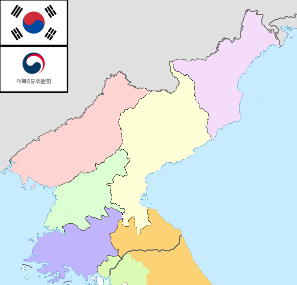
English: Map of Five Northern Provinces of the Republic of Korea (ROK does not officially recognise the DPRK and considers the whole Korean Peninsula to be ROK's land)
한국어: 이북5도의 지도 |
| Date | |
| Source | own work, based on file:Korea administrative divisions ru.svg |
| Author | Elmor |
Licensing
I, the copyright holder of this work, hereby publish it under the following licenses:

|
Permission is granted to copy, distribute and/or modify this document under the terms of the GNU Free Documentation License, Version 1.2 or any later version published by the Free Software Foundation; with no Invariant Sections, no Front-Cover Texts, and no Back-Cover Texts. A copy of the license is included in the section entitled GNU Free Documentation License. |
This file is licensed under the Creative Commons Attribution-Share Alike 4.0 International, 3.0 Unported, 2.5 Generic, 2.0 Generic and 1.0 Generic license.
- You are free:
- to share – to copy, distribute and transmit the work
- to remix – to adapt the work
- Under the following conditions:
- attribution – You must give appropriate credit, provide a link to the license, and indicate if changes were made. You may do so in any reasonable manner, but not in any way that suggests the licensor endorses you or your use.
- share alike – If you remix, transform, or build upon the material, you must distribute your contributions under the same or compatible license as the original.
You may select the license of your choice.
File history
Click on a date/time to view the file as it appeared at that time.
| Date/Time | Thumbnail | Dimensions | User | Comment | |
|---|---|---|---|---|---|
| current | 19:05, 15 July 2023 | | 1,000 × 957 (272 KB) | SnowieLuna1212 | Fixed Glitchy Border lines, New Flags |
| 04:25, 1 March 2013 |  | 999 × 954 (220 KB) | Elmor | more accurate map | |
| 15:10, 15 August 2012 |  | 999 × 954 (212 KB) | Elmor | minor | |
| 06:34, 15 August 2012 |  | 999 × 954 (212 KB) | Elmor | {{Information |Description ={{en|1=Map of Five Northern Provinces of the Republic of Korea (ROK does not officially recognise the DPRK and considers the whole Korean Peninsula to be ROK's land)}} {{ko|1=이북5도의 지도}} |Source =own wo... |
File usage
No pages on the English Wikipedia use this file (pages on other projects are not listed).