
File:Franklin Township map.png

Size of this preview: 600 × 600 pixels. Other resolutions: 240 × 240 pixels | 480 × 480 pixels | 768 × 768 pixels | 1,024 × 1,024 pixels | 1,838 × 1,838 pixels.
Original file (1,838 × 1,838 pixels, file size: 1.23 MB, MIME type: image/png)
| This is a file from the Wikimedia Commons. Information from its description page there is shown below. Commons is a freely licensed media file repository. You can help. |
| Description |
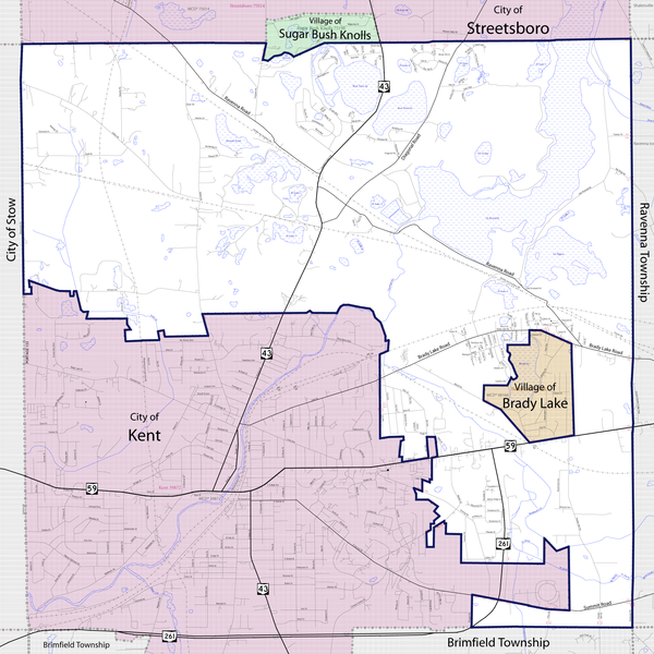
English: Map of Franklin Township in Portage County, Ohio, showing boundaries and roads with main roads highlighted. Base map from the U.S. Census Bureau's 2009 Boundary and Annexation Survey |
|||
| Date | ||||
| Source | http://ftp2.census.gov/geo/pvs/bas/bas09/st39_oh/mcd/m3928392_franklin/BAS09M33913328392_001.pdf | |||
| Author | U.S. Census Bureau, Jon Ridinger | |||
| Permission (Reusing this file) |
I, the copyright holder of this work, hereby publish it under the following licenses:
This file is licensed under the Creative Commons Attribution 3.0 Unported license.
You may select the license of your choice. |

File history
Click on a date/time to view the file as it appeared at that time.
| Date/Time | Thumbnail | Dimensions | User | Comment | |
|---|---|---|---|---|---|
| current | 19:20, 9 September 2010 | | 1,838 × 1,838 (1.23 MB) | JonRidinger | forgot main road labels |
| 01:33, 9 September 2010 |  | 1,838 × 1,838 (1.23 MB) | JonRidinger | minor adjustments | |
| 00:47, 9 September 2010 |  | 1,838 × 1,838 (1.23 MB) | JonRidinger | {{Information |Description={{en|1=Map of Franklin Township in Portage County, Ohio, showing boundaries and main roads. Base map from 2009 Boundary and Annexation Survey.}} |Source=http://ftp2.census.gov/geo/p |
File usage
The following pages on the English Wikipedia use this file (pages on other projects are not listed):
Global file usage
The following other wikis use this file:
- Usage on zh.wikipedia.org