
File:Friesland-St-Boris.jpg
Size of this preview: 800 × 599 pixels. Other resolutions: 320 × 240 pixels | 640 × 479 pixels | 1,024 × 766 pixels | 1,280 × 958 pixels | 2,608 × 1,952 pixels.
Original file (2,608 × 1,952 pixels, file size: 2.09 MB, MIME type: image/jpeg)
| This is a file from the Wikimedia Commons. Information from its description page there is shown below. Commons is a freely licensed media file repository. You can help. |
Summary
| Description |
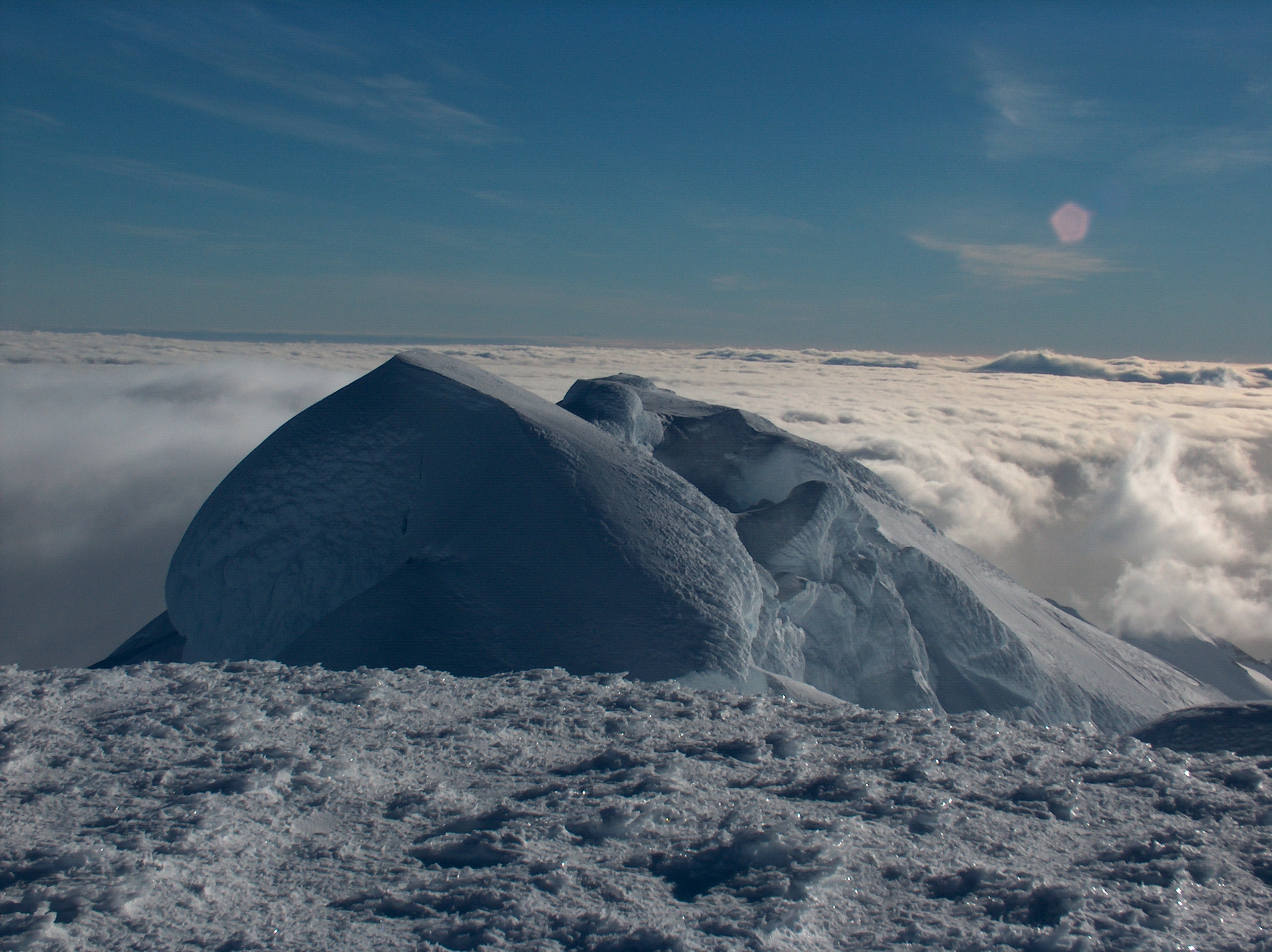
English: St. Boris Peak from Mount Friesland in Tangra Mountains on Livingston Island in the South Shetland Islands, with ‘The Synagogue’, a rock-cored ice form rising in the saddle between the two peaks dominating the foreground. The local ice relief is subject to changes, causing variations in the features’ elevation. This picture shows ‘The Synagogue’ as seen entirely below the horizon from Mount Friesland and therefore lower than the latter in the 2004/05 season. The GPS measured elevation of Mount Friesland was 1700 m in December 2003, 1702 m in December 2004, and 1693 m in December 2016.
Български: Връх Свети Борис гледан от връх Фрисланд в Тангра планина, остров Ливингстън в Антарктика. На преден план доминира „Синагогата”, ледено образувание прилежащо към Свети Борис. Леденият релеф, а оттам и надморската височина на географските обекти в околността е предмет на промени. На снимката „Синагогата“ се вижда изцяло под хоризонта и следователно е по-ниска от връх Фрисланд в сезона 2004/05. GPS заснетата височина на връх Фрисланд е 1700 м през декември 2003, 1702 м през декември 2004 и 1693 м през декември 2016. |
| Date | |
| Source | Own work |
| Author | Lyubomir Ivanov alias User:Apcbg |
| Camera location | | View this and other nearby images on: OpenStreetMap |
|---|
Licensing
I, the copyright holder of this work, hereby publish it under the following license:
This file is licensed under the Creative Commons Attribution-Share Alike 4.0 International license.
- You are free:
- to share – to copy, distribute and transmit the work
- to remix – to adapt the work
- Under the following conditions:
- attribution – You must give appropriate credit, provide a link to the license, and indicate if changes were made. You may do so in any reasonable manner, but not in any way that suggests the licensor endorses you or your use.
- share alike – If you remix, transform, or build upon the material, you must distribute your contributions under the same or compatible license as the original.
File history
Click on a date/time to view the file as it appeared at that time.
| Date/Time | Thumbnail | Dimensions | User | Comment | |
|---|---|---|---|---|---|
| current | 09:57, 18 January 2015 | | 2,608 × 1,952 (2.09 MB) | Apcbg | the original file |
| 23:27, 25 April 2006 |  | 2,608 × 1,954 (572 KB) | Apcbg | {{ConfirmationOTRS|otrs=2006013010000528|source=Lyubomir Ivanov}} |
File usage
The following pages on the English Wikipedia use this file (pages on other projects are not listed):
Global file usage
The following other wikis use this file:
- Usage on ar.wikipedia.org
- Usage on bg.wikipedia.org
- Usage on bxr.wikipedia.org
- Usage on de.wikipedia.org
- Usage on it.wikipedia.org
- Usage on li.wikipedia.org
- Usage on ml.wikipedia.org
- Usage on mwl.wikipedia.org
- Usage on nl.wikipedia.org
- Usage on ru.wikipedia.org
- Usage on uk.wikipedia.org