
File:Gulf of Guinea Guillaume Lavasseur de Dieppe.jpg
Original file (1,000 × 675 pixels, file size: 163 KB, MIME type: image/jpeg)
| This is a file from the Wikimedia Commons. Information from its description page there is shown below. Commons is a freely licensed media file repository. You can help. |
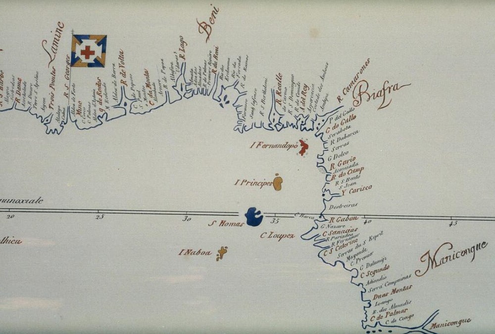
Summary
| Title |
Français : Cotes occidentales d'Afrique. English: East Coast of Africa |
|||||
| Description |
Français : "Cotes occidentales d'Afrique. Extraites de la Carte reduite de Guillaume Lavasseur de Dieppe, 1601", Vicomte de Santarem, Atlas compose de Mappe-mondes. English: "Cotes occidentales d'Afrique. Extraites de la Carte reduite de Guillaume Lavasseur de Dieppe, 1601", in Vicomte de Santarem, Atlas compose de Mappe-mondes. East coast of Africa labelled in French. |
|||||
| Source | The Bodleian Libraries, Oxford | |||||
| Creator |
Guillaume Lavasseur de Dieppe |
|||||
| Permission (Reusing this file) |
|
|||||
| Georeferencing | ||||||
| Archival data | ||||||
| Collection | The Bodleian Libraries, Oxford | |||||
| Accession number |
B1 a.10, map sheet 45 |
|||||
| This file comes from the Bodleian Libraries, a group of research libraries in Oxford University. This tag does not indicate the copyright status of the attached work. A normal copyright tag is still required. See Commons:Licensing. |
File history
Click on a date/time to view the file as it appeared at that time.
| Date/Time | Thumbnail | Dimensions | User | Comment | |
|---|---|---|---|---|---|
| current | 16:17, 28 July 2015 | | 1,000 × 675 (163 KB) | MartinPoulter | User created page with UploadWizard |