
File:High Force - geograph.org.uk - 1295229.jpg
No higher resolution available.
High_Force_-_geograph.org.uk_-_1295229.jpg (640 × 480 pixels, file size: 102 KB, MIME type: image/jpeg)
| This is a file from the Wikimedia Commons. Information from its description page there is shown below. Commons is a freely licensed media file repository. You can help. |
Summary
| Description |
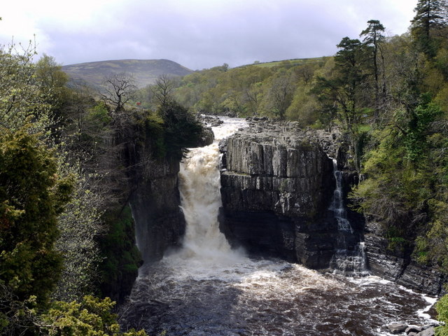
English: High Force A most impressive waterfall especially after a period of wet weather. Here the River Tees plunges 21 metres over an outcrop of the Whin Sill dolerite which overlays softer sandstone and limestone layers which become undercut below. |
| Date | |
| Source | From geograph.org.uk |
| Author | Andrew Curtis |
| Attribution (required by the license) | Andrew Curtis / High Force / |
| Camera location | | View this and other nearby images on: OpenStreetMap |
|---|
_heading:247.00&language=en)
| Object location | | View this and other nearby images on: OpenStreetMap |
|---|
_heading:247.00&language=en)
Licensing

|
This image was taken from the Geograph project collection. See this photograph's page on the Geograph website for the photographer's contact details. The copyright on this image is owned by Andrew Curtis and is licensed for reuse under the Creative Commons Attribution-ShareAlike 2.0 license.
|
This file is licensed under the Creative Commons Attribution-Share Alike 2.0 Generic license.
Attribution: Andrew Curtis
- You are free:
- to share – to copy, distribute and transmit the work
- to remix – to adapt the work
- Under the following conditions:
- attribution – You must give appropriate credit, provide a link to the license, and indicate if changes were made. You may do so in any reasonable manner, but not in any way that suggests the licensor endorses you or your use.
- share alike – If you remix, transform, or build upon the material, you must distribute your contributions under the same or compatible license as the original.
File history
Click on a date/time to view the file as it appeared at that time.
| Date/Time | Thumbnail | Dimensions | User | Comment | |
|---|---|---|---|---|---|
| current | 09:48, 27 February 2011 | | 640 × 480 (102 KB) | GeographBot | == {{int:filedesc}} == {{Information |description={{en|1=High Force A most impressive waterfall especially after a period of wet weather. Here the River Tees plunges 21 metres over an outcrop of the Whin Sill dolerite which overlays softer sandstone and l |
File usage
The following pages on the English Wikipedia use this file (pages on other projects are not listed):
Global file usage
The following other wikis use this file:
- Usage on de.wikipedia.org
- Usage on lb.wikipedia.org