
File:HudsonValley1777.jpg
Size of this preview: 146 × 596 pixels. Other resolutions: 58 × 240 pixels | 360 × 1,470 pixels.
Original file (360 × 1,470 pixels, file size: 249 KB, MIME type: image/jpeg)
| This is a file from the Wikimedia Commons. Information from its description page there is shown below. Commons is a freely licensed media file repository. You can help. |
Summary
| Description |
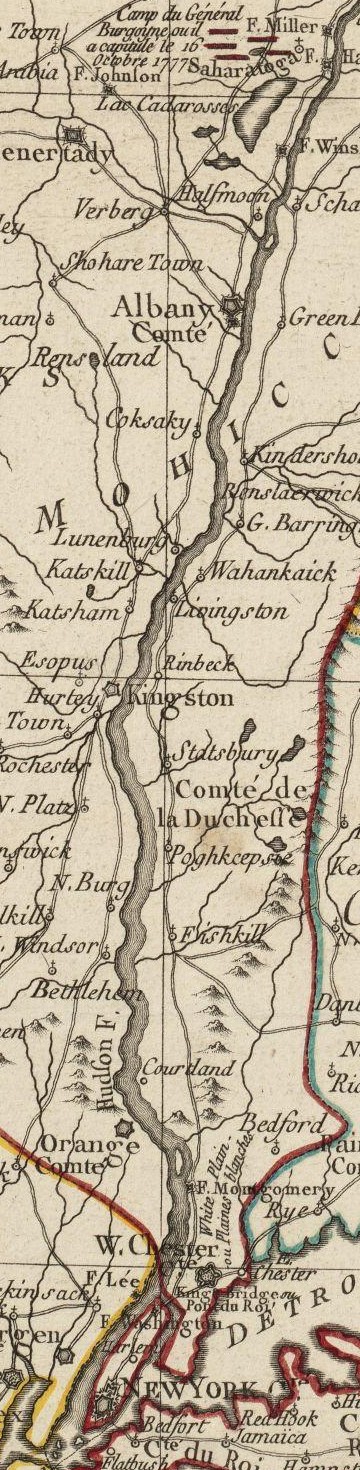
English: This is a detail from the source map, depicting the Hudson River Valley between Saratoga and New York City. Some features are inaccurate: Fort Montgomery is incorrectly depicted on the east side of the river. |
|||||||||||||||||||
| Date | ||||||||||||||||||||
| Source |
Norman B. Leventhal Map Center at the Boston Public Library Call Number: G3711.S3 1777 .B75 URL at time of upload: http://maps.bpl.org/details_10101/ |
|||||||||||||||||||
| Author |
|
|||||||||||||||||||
Licensing
This media file is in the public domain in the United States. This applies to U.S. works where the copyright has expired, often because its first publication occurred prior to January 1, 1929, and if not then due to lack of notice or renewal. See this page for further explanation.
|
 | |
 |
This image might not be in the public domain outside of the United States; this especially applies in the countries and areas that do not apply the rule of the shorter term for US works, such as Canada, Mainland China (not Hong Kong or Macao), Germany, Mexico, and Switzerland. The creator and year of publication are essential information and must be provided. See Wikipedia:Public domain and Wikipedia:Copyrights for more details.
|
File history
Click on a date/time to view the file as it appeared at that time.
| Date/Time | Thumbnail | Dimensions | User | Comment | |
|---|---|---|---|---|---|
| current | 00:25, 9 June 2009 | 360 × 1,470 (249 KB) | Magicpiano | == Summary == {{Information |Description={{en|1=This is a detail from the source map, depicting the Hudson River Valley between Saratoga and New York City. }} |Source=Norman B. Leventhal Map Center at the Boston Public Library Call Number: G3711.S3 1777 . |
File usage
The following pages on the English Wikipedia use this file (pages on other projects are not listed):
Global file usage
The following other wikis use this file:
- Usage on de.wikipedia.org
- Usage on ja.wikipedia.org