
File:Igala.jpeg
No higher resolution available.
Igala.jpeg (579 × 374 pixels, file size: 165 KB, MIME type: image/jpeg)
| This is a file from the Wikimedia Commons. Information from its description page there is shown below. Commons is a freely licensed media file repository. You can help. |
Summary
| Description |
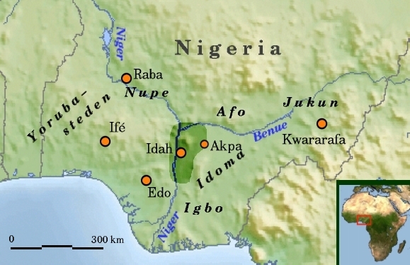
Nederlands: Historisch Igala in Nigeria, Nederlands |
| Date |
9 June 2008 (original upload date) |
| Source |
Transferred from nl.wikipedia; transfered to Commons by User:GijsvdL using CommonsHelper. |
| Author |
Commons en Rollebon Original uploader was Rollebon at nl.wikipedia |
| Permission (Reusing this file) |
Released under the GNU Free Documentation License. |
Licensing

|
Permission is granted to copy, distribute and/or modify this document under the terms of the GNU Free Documentation License, Version 1.2 or any later version published by the Free Software Foundation; with no Invariant Sections, no Front-Cover Texts, and no Back-Cover Texts. A copy of the license is included in the section entitled GNU Free Documentation License. |
| This file is licensed under the Creative Commons Attribution-Share Alike 3.0 Unported license. | ||
| ||
| This licensing tag was added to this file as part of the GFDL licensing update. |
Original upload log
The original description page was here. All following user names refer to nl.wikipedia.
- 2008-06-09 19:41 Rollebon 579×374×8 (168600 bytes) {{Information |Description=Historisch Igala in Nigeria, Nederlands, nu met schaal |Source=ingetekend op http://commons.wikimedia.org/wiki/Image%3AAfrica_topography_map_with_borders.png en http://commons.wikimedia.org/wiki/Image:Africa_satellite_orthograph
- 2008-06-09 17:36 Rollebon 579×374×8 (175430 bytes) {{Information |Description=Historisch Igala in Nigeria, Nederlands |Source=ingetekend op http://commons.wikimedia.org/wiki/Image%3AAfrica_topography_map_with_borders.png en http://commons.wikimedia.org/wiki/Image:Africa_satellite_orthographic.jpg |Date=9-
File history
Click on a date/time to view the file as it appeared at that time.
| Date/Time | Thumbnail | Dimensions | User | Comment | |
|---|---|---|---|---|---|
| current | 23:06, 9 June 2008 | | 579 × 374 (165 KB) | File Upload Bot (Magnus Manske) | {{BotMoveToCommons|nl.wikipedia}} {{Information |Description={{nl|Historisch Igala in Nigeria, Nederlands}} |Source=Transferred from [http://nl.wikipedia.org nl.wikipedia]; transfered to Commons by User:GijsvdL using [http://tools.wikimedia.de/~magnu |
File usage
The following pages on the English Wikipedia use this file (pages on other projects are not listed):
Global file usage
The following other wikis use this file:
- Usage on arz.wikipedia.org
- Usage on ca.wikipedia.org
- Usage on de.wikipedia.org
- Usage on es.wikipedia.org
- Usage on fr.wikipedia.org
- Usage on it.wikipedia.org
- Usage on ja.wikipedia.org
- Usage on kcg.wikipedia.org
- Usage on lbe.wikipedia.org
- Usage on mrj.wikipedia.org
- Usage on nl.wikipedia.org
- Usage on oc.wikipedia.org
- Usage on pl.wikipedia.org
- Usage on pt.wikipedia.org
- Usage on ru.wikipedia.org
- Usage on sr.wikipedia.org
- Usage on uk.wikipedia.org
- Usage on www.wikidata.org
- Usage on yo.wikipedia.org