
File:Karte O4 TR.svg

Size of this PNG preview of this SVG file: 705 × 599 pixels. Other resolutions: 282 × 240 pixels | 565 × 480 pixels | 904 × 768 pixels | 1,205 × 1,024 pixels | 2,409 × 2,048 pixels | 1,000 × 850 pixels.
Original file (SVG file, nominally 1,000 × 850 pixels, file size: 424 KB)
| This is a file from the Wikimedia Commons. Information from its description page there is shown below. Commons is a freely licensed media file repository. You can help. |
Summary
| Description |
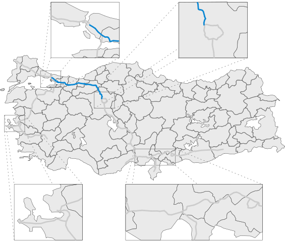
Deutsch: Karte der türkischen Autobahn O-4
In Betrieb In Bau In Planung English: Map of the Turkish otoyol O-4 In use Under construction Planned |
| Date | |
| Source | Own work |
| Author | AleXXw |
Licensing
| I, the copyright holder of this work, release this work into the public domain. This applies worldwide. In some countries this may not be legally possible; if so: I grant anyone the right to use this work for any purpose, without any conditions, unless such conditions are required by law. |
File history
Click on a date/time to view the file as it appeared at that time.
| Date/Time | Thumbnail | Dimensions | User | Comment | |
|---|---|---|---|---|---|
| current | 15:13, 6 March 2010 | | 1,000 × 850 (424 KB) | AleXXw | {{Information |Description={{de|Karte der türkischen Autobahn O-4}} |Source={{own}} |Date=2010-03-06 |Author=AleXXw |Permission= |other_versions= }} Category:Maps of highways in Turkey == Licensing == {{PD-self}} |
File usage
The following pages on the English Wikipedia use this file (pages on other projects are not listed):
Global file usage
The following other wikis use this file:
- Usage on cs.wikipedia.org
- Usage on de.wikipedia.org
- Usage on el.wikipedia.org
- Usage on it.wikipedia.org
- Usage on nl.wikipedia.org
- Usage on pl.wikipedia.org
- Usage on ur.wikipedia.org
- Usage on www.wikidata.org