
File:Lethbridge map.gif
Size of this preview: 575 × 600 pixels. Other resolutions: 230 × 240 pixels | 460 × 480 pixels | 865 × 902 pixels.
Original file (865 × 902 pixels, file size: 71 KB, MIME type: image/gif)
Licensing[edit]
| I, the copyright holder of this work, hereby release it into the public domain. This applies worldwide. If this is not legally possible: |
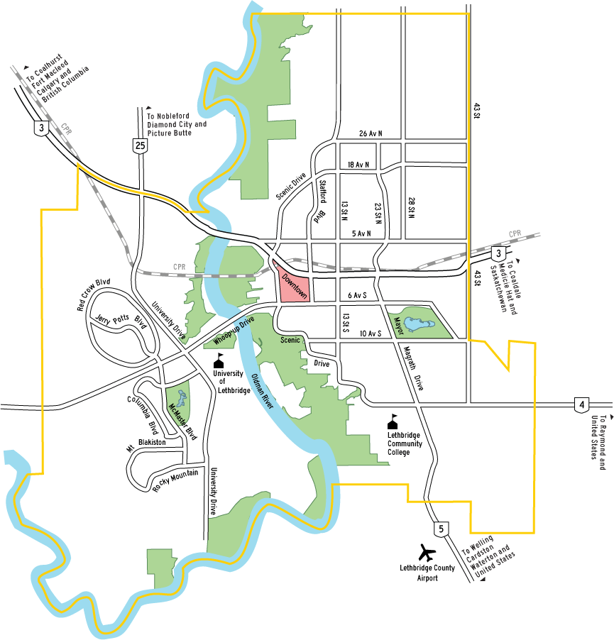
Map of the city of Lethbridge with markers showing various neighborhoods, schools, and airports.
 | This file is a candidate to be copied to Wikimedia Commons.
Any user may perform this transfer; refer to Wikipedia:Moving files to Commons for details. If this file has problems with attribution, copyright, or is otherwise ineligible for Commons, then remove this tag and DO NOT transfer it; repeat violators may be blocked from editing. Other Instructions
| ||
| |||
File history
Click on a date/time to view the file as it appeared at that time.
| Date/Time | Thumbnail | Dimensions | User | Comment | |
|---|---|---|---|---|---|
| current | 21:08, 5 January 2007 | | 865 × 902 (71 KB) | Kmsiever (talk | contribs) | |
| 21:06, 5 January 2007 |  | 865 × 902 (71 KB) | Kmsiever (talk | contribs) |
You cannot overwrite this file.
File usage
The following pages on the English Wikipedia use this file (pages on other projects are not listed):
- Chinook Regional Hospital
- Downtown Lethbridge
- Galt Museum & Archives
- Henderson Park (Lethbridge)
- Lethbridge
- Lethbridge/Anderson Aerodrome
- Lethbridge Viaduct
- List of airports in the Lethbridge area
- Nicholas Sheran Park
- Nikka Yuko Japanese Garden
- Oldman River valley parks system
- Southern Alberta Art Gallery
- Spitz Stadium
- Transport in Lethbridge
- Module:Location map/data/Canada Lethbridge
- Module:Location map/data/Canada Lethbridge/doc
- Module:Location map/data/Lethbridge