
File:Location of Priyutnensky District (Kalmykia).svg

Size of this PNG preview of this SVG file: 672 × 599 pixels. Other resolutions: 269 × 240 pixels | 538 × 480 pixels | 861 × 768 pixels | 1,148 × 1,024 pixels | 2,296 × 2,048 pixels | 1,000 × 892 pixels.
Original file (SVG file, nominally 1,000 × 892 pixels, file size: 80 KB)
| This is a file from the Wikimedia Commons. Information from its description page there is shown below. Commons is a freely licensed media file repository. You can help. |
.svg)
Summary
| Description |
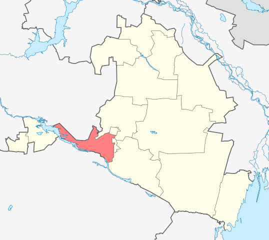
English: Image to indicate Kalmykia districts. Subject as indicated by filename. |
| Date | |
| Source | File:Outline Map of Kalmykia.svg |
| Author | Виктор В |
Licensing
| I, the copyright holder of this work, release this work into the public domain. This applies worldwide. In some countries this may not be legally possible; if so: I grant anyone the right to use this work for any purpose, without any conditions, unless such conditions are required by law. |
File history
Click on a date/time to view the file as it appeared at that time.
| Date/Time | Thumbnail | Dimensions | User | Comment | |
|---|---|---|---|---|---|
| current | 17:26, 16 August 2010 | | 1,000 × 892 (80 KB) | Виктор В | == {{int:filedesc}} == {{Information |Description={{en|1=Image to indicate Kalmykia districts. Subject as indicated by filename.}} |Source=File:Outline Map of Kalmykia.svg |Author=Виктор В |Date=2010-08-16 |Permission= |
File usage
No pages on the English Wikipedia use this file (pages on other projects are not listed).
Global file usage
The following other wikis use this file:
- Usage on af.wikipedia.org
- Usage on be.wikipedia.org
- Usage on ce.wikipedia.org
- Usage on de.wikipedia.org
- Usage on et.wikipedia.org
- Usage on fi.wikipedia.org
- Usage on hu.wikipedia.org
- Usage on hy.wikipedia.org
- Usage on it.wikipedia.org
- Usage on ru.wikipedia.org
- Usage on uk.wikipedia.org
- Usage on www.wikidata.org
- Usage on zh-min-nan.wikipedia.org
.svg)