
File:LoireAtlantique Arrondissement Color.svg

Size of this PNG preview of this SVG file: 710 × 600 pixels. Other resolutions: 284 × 240 pixels | 568 × 480 pixels | 909 × 768 pixels | 1,212 × 1,024 pixels | 2,425 × 2,048 pixels | 998 × 843 pixels.
Original file (SVG file, nominally 998 × 843 pixels, file size: 49 KB)
| This is a file from the Wikimedia Commons. Information from its description page there is shown below. Commons is a freely licensed media file repository. You can help. |
Summary
| Description |
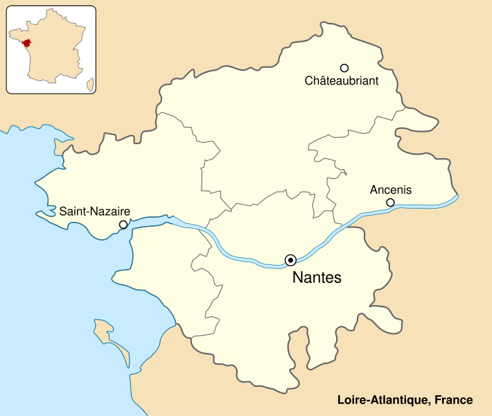
English: Colored map of department of Loire-Atlantique, France. Français : Carte en couleur du département de Loire-Atlantique, France. |
||
| Date | |||
| Source | Own work | ||
| Author | Sémhur (talk) | ||
| Other versions | Image:LoireAtlantique_Arrondissement_Grey.svg | ||
| Attribution (required by the license) | © Sémhur / Wikimedia Commons / | ||
| SVG | W3C-validity not checked.
|
||
| Atelier graphique |

| Camera location | | View this and other nearby images on: OpenStreetMap |
|---|
Licensing
I, the copyright holder of this work, hereby publish it under the following licenses:
| Copyleft: This work of art is free; you can redistribute it and/or modify it according to terms of the Free Art License. You will find a specimen of this license on the Copyleft Attitude site as well as on other sites. |
This file is licensed under the Creative Commons Attribution-Share Alike 4.0 International, 3.0 Unported, 2.5 Generic, 2.0 Generic and 1.0 Generic license.
- You are free:
- to share – to copy, distribute and transmit the work
- to remix – to adapt the work
- Under the following conditions:
- attribution – You must give appropriate credit, provide a link to the license, and indicate if changes were made. You may do so in any reasonable manner, but not in any way that suggests the licensor endorses you or your use.
- share alike – If you remix, transform, or build upon the material, you must distribute your contributions under the same or compatible license as the original.
You may select the license of your choice.
File history
Click on a date/time to view the file as it appeared at that time.
| Date/Time | Thumbnail | Dimensions | User | Comment | |
|---|---|---|---|---|---|
| current | 12:20, 12 April 2013 | | 998 × 843 (49 KB) | Sémhur | Update colors |
| 18:06, 6 July 2007 |  | 1,000 × 845 (49 KB) | Sémhur | {{Information |Description= {{fr|Carte en couleur du département de Loire-Atlantique, France.}} {{en|Colored map of department of Loire-Atlantique, France.}} |Source=Œuvre personnelle - Own work. |Date=2 |
File usage
The following pages on the English Wikipedia use this file (pages on other projects are not listed):
Global file usage
The following other wikis use this file:
- Usage on ar.wikipedia.org
- Usage on ca.wikipedia.org
- Usage on cs.wikipedia.org
- Usage on de.wikipedia.org
- Usage on es.wikipedia.org
- Usage on fr.wikipedia.org
- Utilisateur:Iveragh
- Utilisateur:Gwalarn
- Projet:Bretagne
- Utilisateur:Ganymede44
- Utilisateur:AIRAZUR
- Utilisateur:Damien Perrotin~frwiki
- Utilisateur:Wikbls
- Utilisateur:Louis Kehlweiler
- Utilisateur:Alex zlb35
- Utilisateur:Kertraon
- Utilisateur:Esperanza222
- Utilisateur:Betp
- Utilisateur:Gilouu
- Utilisateur:Breizh5
- Utilisateur:Ole Einar
- Projet:Bretagne/Modèles
- Modèle:Utilisateur rattachement Loire-Atlantique
- Utilisateur:S. DÉNIEL
- Utilisateur:Yeurc h
- Utilisateur:SPQRobin
- Utilisateur:Hellotheworld
- Utilisateur:Kilkenny03
- Utilisateur:Thomas de Vernet
- Utilisateur:Hercule
- Utilisateur:SpiderStratagem
- Utilisateur:Etienne.deniau
- Utilisateur:Esperanza222/Boîtes utilisateur
- Utilisateur:Mathinus
- Utilisateur:Rundvald
- Utilisateur:Kergourlay
- Utilisateur:Naonediz44
- Utilisateur:Breizh85
- Utilisateur:AnticRab
- Utilisateur:Wuotanswrath
- Utilisateur:Fabienamnet
- Utilisateur:Misoco59
- Utilisateur:Pyrite
- Utilisateur:Bryan Schneider
- Utilisateur:Df
- Utilisateur:Palermo2000
- Utilisateur:Kendalph
- Utilisateur:Kafopa
- Utilisateur:Trizek/Bio en boîtes
- Utilisateur:Florent RICHARD
View more global usage of this file.