
File:Manchester City Region.png
Size of this preview: 800 × 594 pixels. Other resolutions: 320 × 238 pixels | 640 × 475 pixels | 1,024 × 760 pixels | 1,280 × 950 pixels | 2,560 × 1,900 pixels | 2,766 × 2,053 pixels.
Original file (2,766 × 2,053 pixels, file size: 423 KB, MIME type: image/png)
| This is a file from the Wikimedia Commons. Information from its description page there is shown below. Commons is a freely licensed media file repository. You can help. |
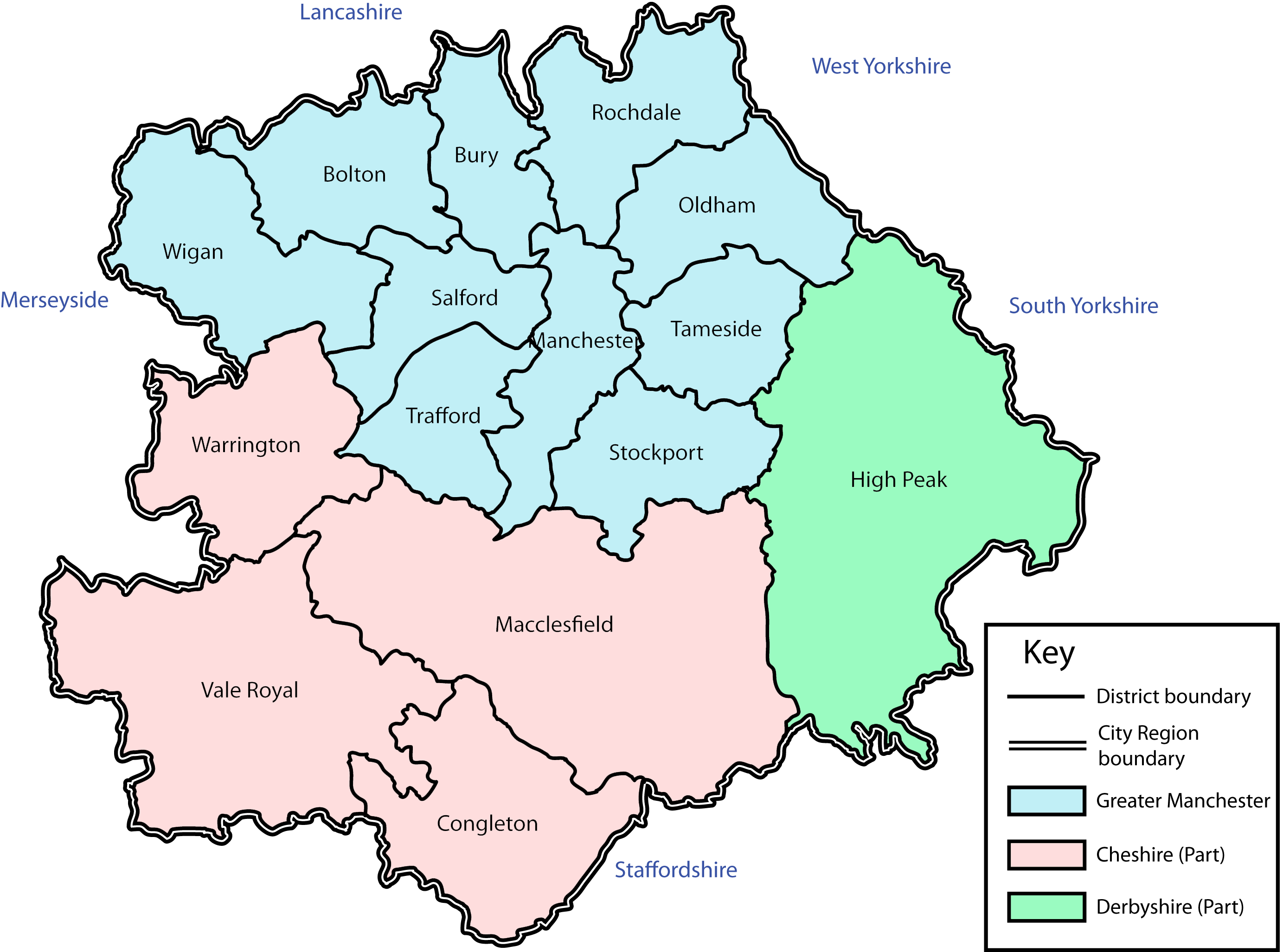
| Description | A map of the Manchester City Region. |
| Date | |
| Source | self-made (but based on this map). |
| Author | Jza84 |
| Permission (Reusing this file) |
This file is licensed under the Creative Commons Attribution-Share Alike 3.0 Unported license.
|
File history
Click on a date/time to view the file as it appeared at that time.
| Date/Time | Thumbnail | Dimensions | User | Comment | |
|---|---|---|---|---|---|
| current | 18:10, 15 June 2009 | | 2,766 × 2,053 (423 KB) | Jza84 | {{Information |Description= A map of the Manchester City Region. |Source=self-made (but based on [http://www.manchestersalfordhmr.co.uk/cityregionmap-popup.aspx this map]). |Date=June 2009 |Author= Jza84 |Permission=See below |other_version |
File usage
No pages on the English Wikipedia use this file (pages on other projects are not listed).