
File:Mobile-River-basin-USGS.gif
No higher resolution available.
Mobile-River-basin-USGS.gif (573 × 413 pixels, file size: 39 KB, MIME type: image/gif)
| This is a file from the Wikimedia Commons. Information from its description page there is shown below. Commons is a freely licensed media file repository. You can help. |
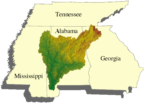
Summary
| Description |
Español: Cuenca del río Mobile.
Norsk bokmål: Kart over hele nedbørsområdet ovenfor Mobile River. |
| Source | USGS photo from "http://tn.water.usgs.gov/MOBL/www.gif" prepared by the United States Geological Survey (USGS). |
| Author | USGS |
Licensing
This image is in the public domain in the United States because it only contains materials that originally came from the United States Geological Survey, an agency of the United States Department of the Interior. For more information, see the official USGS copyright policy.
|
File history
Click on a date/time to view the file as it appeared at that time.
| Date/Time | Thumbnail | Dimensions | User | Comment | |
|---|---|---|---|---|---|
| current | 14:48, 10 December 2006 | | 573 × 413 (39 KB) | AID4wiki | USGS photo from "http://tn.water.usgs.gov/MOBL/www.gif" prepared by the United States Geological Survey (USGS). |
File usage
The following pages on the English Wikipedia use this file (pages on other projects are not listed):
Global file usage
The following other wikis use this file:
- Usage on ar.wikipedia.org
- Usage on da.wikipedia.org
- Usage on de.wikipedia.org
- Usage on es.wikipedia.org
- Usage on frr.wikipedia.org
- Usage on hu.wikipedia.org
- Usage on no.wikipedia.org
- Usage on ru.wikipedia.org
- Usage on uk.wikipedia.org
- Usage on www.wikidata.org