
File:Palpara Temple - Nadia 2011-10-05 050410.JPG
Original file (2,736 × 3,648 pixels, file size: 4.34 MB, MIME type: image/jpeg)
| This is a file from the Wikimedia Commons. Information from its description page there is shown below. Commons is a freely licensed media file repository. You can help. |
Summary
| Description |
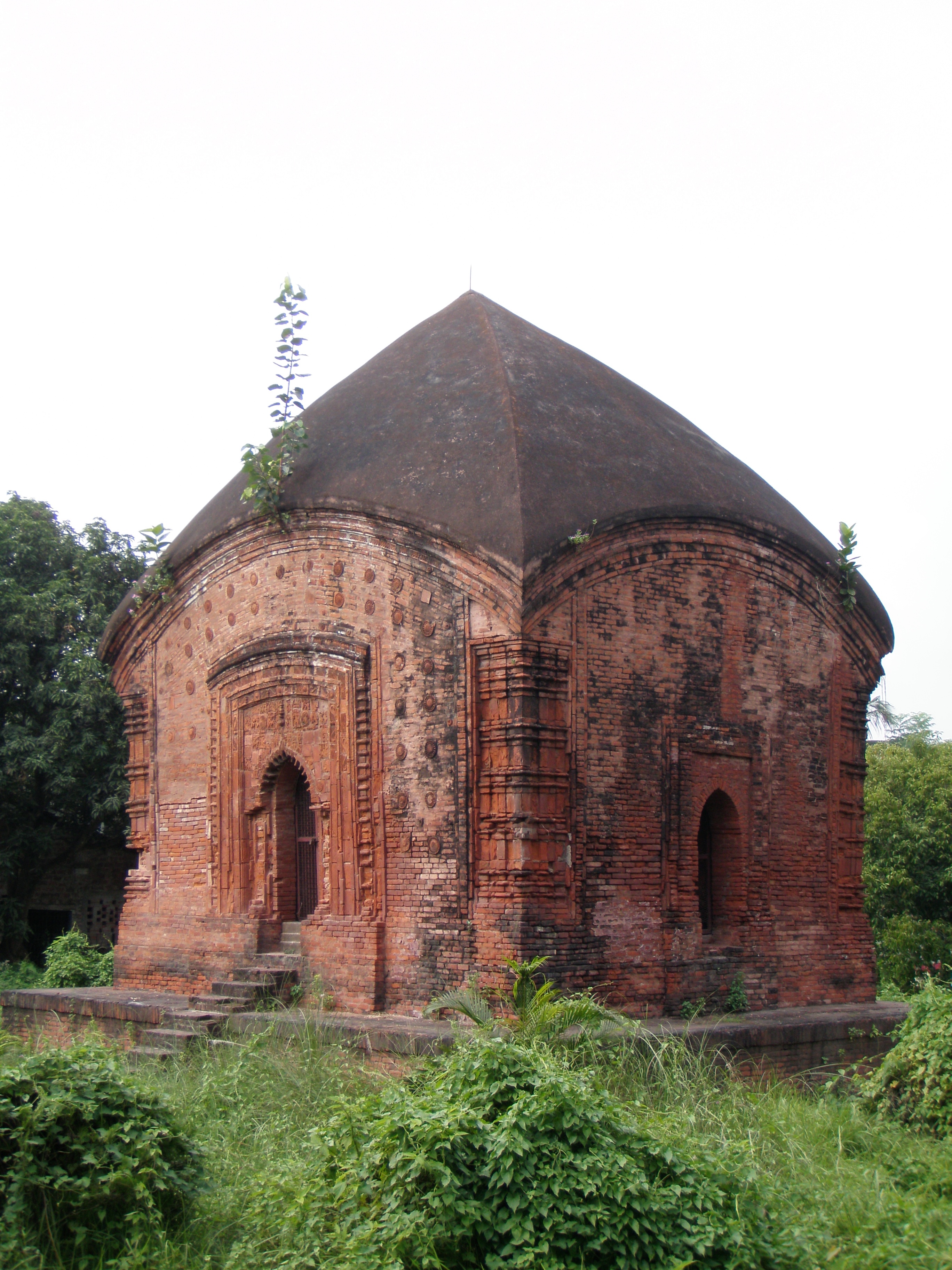
English: The Archeological Survey of India (ASI) describes it as the Palpara temple while the local people call it Math Mandir, Kali Mandir or Shiva Mandir. The 17th century temple, long abandoned, was restored by the ASI and declared a monument of national importance.
The charchala structure (where the four sloped roofs form a pinnacle) made of brick and facing south stands on a raised plinth. It is believed to have been built by Gandharba Roy in the 17th century, although the plaque containing information such as the name of the founder and the year of foundation has long been lost. The temple stands on a square base and is around 21 metres tall. The decorated arched entrance is flanked by brick pillars on either side. The area above the arched entrance once contained intricately carved terracotta panels but most of them have been destroyed by nature and neglect. Scenes from the Ramayana, geometric and floral patterns and the lotus motif are all that remain of the detailed terracotta works that once adorned the walls. There is a panel showing Rama shooting arrows and another in which Ravana is defending himself. Charchala temples are one of the earliest forms of temple architecture in Bengal and only a few of these structures are still standing. With time, the charchala was modified into the aatchala, which consists of a charchala upon a charchala, and is the most common type of temple architecture in Bengal. Located 59km from Calcutta on the Sealdah-Krishnagore railway line, Palpara can be reached in an hour and a half by local train. Although trains are frequently available, for the most comfortable journey take a morning train. Residents of the area might direct you to another temple frequented by devotees, but there’s hardly any history attached to it. The temple is surrounded by a 5ft high wall. A board of the ASI describes it as a monument of national importance. Another board offers a brief history and description of the temple. The complex remains locked and the caretaker can rarely be found. So be prepared to scale the boundary wall. The garden around the temple is overrun with weeds. A narrow pathway leads to the temple, which is usually locked. One cannot enter the sanctum sanctorum of the temple. Although robbed of its former glory and lying in neglect, the Palpara temple provides an insight into Bengal’s early temple architecture. |
| Date | |
| Source | Own work |
| Author | Biswarup Ganguly |
| Camera location | | View this and other nearby images on: OpenStreetMap |
|---|
This media file is uploaded with India loves Wikipedia event.
|
Licensing

|
Permission is granted to copy, distribute and/or modify this document under the terms of the GNU Free Documentation License, Version 1.2 or any later version published by the Free Software Foundation; with no Invariant Sections, no Front-Cover Texts, and no Back-Cover Texts. A copy of the license is included in the section entitled GNU Free Documentation License. |
- You are free:
- to share – to copy, distribute and transmit the work
- to remix – to adapt the work
- Under the following conditions:
- attribution – You must give appropriate credit, provide a link to the license, and indicate if changes were made. You may do so in any reasonable manner, but not in any way that suggests the licensor endorses you or your use.
File history
Click on a date/time to view the file as it appeared at that time.
| Date/Time | Thumbnail | Dimensions | User | Comment | |
|---|---|---|---|---|---|
| current | 00:11, 6 October 2011 | | 2,736 × 3,648 (4.34 MB) | Gangulybiswarup |
File usage
Global file usage
The following other wikis use this file:
- Usage on es.wikipedia.org