
File:Rosendale Wallkill Valley Railroad Bridge 1888.jpg
Size of this preview: 726 × 600 pixels. Other resolutions: 291 × 240 pixels | 581 × 480 pixels | 993 × 820 pixels.
Original file (993 × 820 pixels, file size: 619 KB, MIME type: image/jpeg)
| This is a file from the Wikimedia Commons. Information from its description page there is shown below. Commons is a freely licensed media file repository. You can help. |
Summary
| Description |
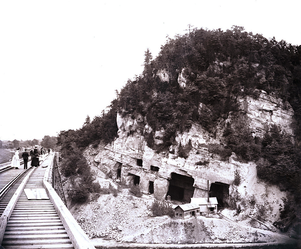
English: A photo of the railroad bridge (left) in Rosendale, New York, along with nearby Joppenbergh Mountain (right). The mine shafts visible on the mountain were destroyed in an 1899 cave-in. |
| Date | circa 1888 |
| Source | Hudson River Valley Heritage |
| Author | Jane Brodhead Lefevre |
| Camera location | | View this and other nearby images on: OpenStreetMap |
|---|
Licensing
This work was never published prior to January 1, 2003, and is currently in the public domain in the United States because it meets one of the following conditions:
The above provisions are contained in 17 U.S.C. § 303. See also this page for more information. |
File history
Click on a date/time to view the file as it appeared at that time.
| Date/Time | Thumbnail | Dimensions | User | Comment | |
|---|---|---|---|---|---|
| current | 16:00, 22 March 2011 | | 993 × 820 (619 KB) | Gyrobo | Removed black camera artifacts by the top. |
| 00:35, 11 February 2011 |  | 993 × 820 (323 KB) | Gyrobo | {{Information |Description ={{en|1=A photo depicting the railroad bridge in Rosendale, New York, along with nearby Joppenberg Mountain. Mine shafts are visible on the mountain.}} |Source =[http://www.hrvh.org/cdm4/item_viewer.php?CISOROOT=%2Fhh |
File usage
The following pages on the English Wikipedia use this file (pages on other projects are not listed):
- Joppenbergh Mountain
- Rosendale, New York
- Wikipedia:Wikipedia Signpost/2011-08-01/Featured content
- Wikipedia:Wikipedia Signpost/Single/2011-08-01
- Portal:Hudson Valley/Selected article
- Portal:Hudson Valley/Selected article/46
- Portal:Hudson Valley/Selected picture
- Portal:Hudson Valley/Selected picture/63
- Portal:Mountains/Selected article
- Portal:Mountains/Selected article/17