
File:S3010334-cropped.jpg

Size of this preview: 800 × 447 pixels. Other resolutions: 320 × 179 pixels | 640 × 357 pixels | 1,119 × 625 pixels.
Original file (1,119 × 625 pixels, file size: 229 KB, MIME type: image/jpeg)
| This is a file from the Wikimedia Commons. Information from its description page there is shown below. Commons is a freely licensed media file repository. You can help. |
Summary
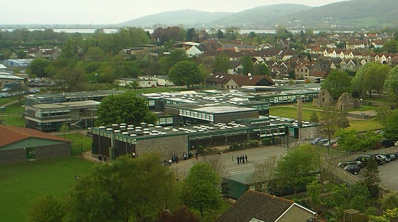
| Description | en:The Kings of Wessex School, Cheddar, looking north west from the top of St. Andrew's Parish Church tower. Cheddar Reservoir and Crook Peak can be seen in the distance. | ||||||||
| Date | 28th April 2005 (Cropped version 17 September 2008) | ||||||||
| Source | Cropped version of Image:S3010334.JPG originally taken by PiffPuffPickle. | ||||||||
| Author | User PiffPuffPickle on en.wikipedia | ||||||||
| Permission (Reusing this file) |
PiffPuffPickle at the English-language Wikipedia, the copyright holder of this work, hereby publishes it under the following license:
|
||||||||
| Other versions | Image:S3010334.JPG |
| Camera location | | View this and other nearby images on: OpenStreetMap |
|---|
Licensing

|
Permission is granted to copy, distribute and/or modify this document under the terms of the GNU Free Documentation License, Version 1.2 or any later version published by the Free Software Foundation; with no Invariant Sections, no Front-Cover Texts, and no Back-Cover Texts. A copy of the license is included in the section entitled GNU Free Documentation License. |
File history
Click on a date/time to view the file as it appeared at that time.
| Date/Time | Thumbnail | Dimensions | User | Comment | |
|---|---|---|---|---|---|
| current | 16:19, 17 September 2008 | | 1,119 × 625 (229 KB) | TimTay | {{Information| |Description=en:The Kings of Wessex School, Cheddar, as seen from the top of the church tower. |Source=Cropped version of Image:S3010334.JPG originally taken by PiffPuffPickle. |Date=28th April 2005 (Cr |
File usage
No pages on the English Wikipedia use this file (pages on other projects are not listed).