
File:SuburbanLakesLeague2009.PNG

Size of this preview: 800 × 432 pixels. Other resolutions: 320 × 173 pixels | 640 × 345 pixels | 1,197 × 646 pixels.
Original file (1,197 × 646 pixels, file size: 34 KB, MIME type: image/png)
| This is a file from the Wikimedia Commons. Information from its description page there is shown below. Commons is a freely licensed media file repository. You can help. |
Summary
| Description |
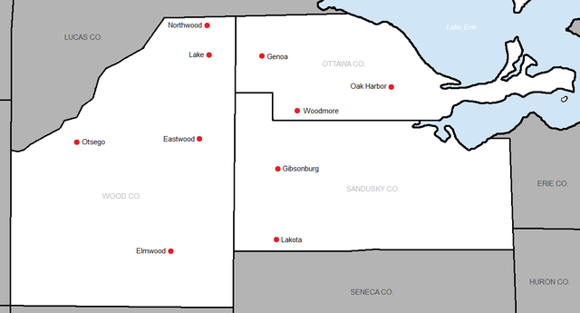
English: Original county lines drawn by the US Census. Modified by myself to show school locations and to label county names. |
| Date | 16 March 2009 (original upload date) |
| Source | Transferred from en.wikipedia to Commons. |
| Author | The original uploader was Frank12 at English Wikipedia. |

|
This map image could be re-created using vector graphics as an SVG file. This has several advantages; see Commons:Media for cleanup for more information. If an SVG form of this image is available, please upload it and afterwards replace this template with
{{vector version available|new image name}}.
It is recommended to name the SVG file “SuburbanLakesLeague2009.svg”—then the template Vector version available (or Vva) does not need the new image name parameter. |
Licensing

|
Permission is granted to copy, distribute and/or modify this document under the terms of the GNU Free Documentation License, Version 1.2 or any later version published by the Free Software Foundation; with no Invariant Sections, no Front-Cover Texts, and no Back-Cover Texts. A copy of the license is included in the section entitled GNU Free Documentation License. |
| This file is licensed under the Creative Commons Attribution-Share Alike 3.0 Unported license. | ||
| ||
| This licensing tag was added to this file as part of the GFDL licensing update. |
Original upload log
The original description page was here. All following user names refer to en.wikipedia.
| Date/Time | Dimensions | User | Comment |
|---|---|---|---|
| 2013-06-23 04:05 | 1197×646× (34481 bytes) | Frank12 | Updated to show the all-time members instead. |
| 2009-03-16 22:59 | 567×338× (10632 bytes) | Frank12 | Original county lines drawn by the US Census. Modified by myself to show school locations and to label county names. |
File history
Click on a date/time to view the file as it appeared at that time.
| Date/Time | Thumbnail | Dimensions | User | Comment | |
|---|---|---|---|---|---|
| current | 02:36, 16 May 2016 | | 1,197 × 646 (34 KB) | OgreBot | (BOT): Reverting to most recent version before archival |
| 02:36, 16 May 2016 |  | 567 × 338 (10 KB) | OgreBot | (BOT): Uploading old version of file from en.wikipedia; originally uploaded on 2009-03-16 22:59:59 by Frank12 | |
| 04:43, 25 April 2016 |  | 1,197 × 646 (34 KB) | FastilyClone | Transferred from enwp |
File usage
The following pages on the English Wikipedia use this file (pages on other projects are not listed):
Global file usage
The following other wikis use this file:
- Usage on www.wikidata.org