
File:Taylor County glaciation.jpg
Size of this preview: 570 × 600 pixels. Other resolutions: 228 × 240 pixels | 615 × 647 pixels.
Original file (615 × 647 pixels, file size: 68 KB, MIME type: image/jpeg)
| This is a file from the Wikimedia Commons. Information from its description page there is shown below. Commons is a freely licensed media file repository. You can help. |
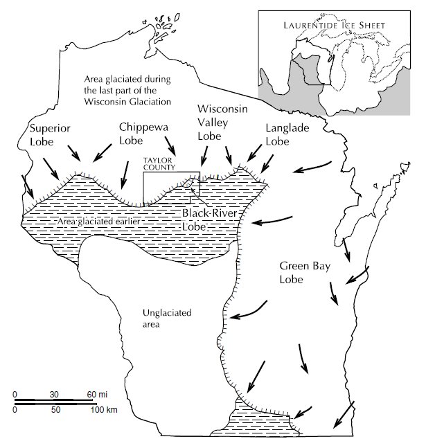
| Description |
English: Maximum extent of the Laurentide ice sheet in Taylor County (and Wisconsin) during the last glaciation. |
||
| Date | |||
| Source | "Pleistocene Geology of Taylor County, Wisconsin," Wisconsin Geological and Natural History Survey Bulletin 90, 1993; University of Wisconsin-Extension; At [1]. For copyright info, see page ii. | ||
| Author | Attig, John W. | ||
| Permission (Reusing this file) |
|
File history
Click on a date/time to view the file as it appeared at that time.
| Date/Time | Thumbnail | Dimensions | User | Comment | |
|---|---|---|---|---|---|
| current | 03:20, 18 April 2011 | | 615 × 647 (68 KB) | Jeff the quiet | {{Information |Description ={{en|1=Maximum extent of the Laurentide ice sheet in Taylor County (and Wisconsin) during the last glaciation.}} |Source ="Pleistocene Geology of Taylor County, Wisconsin," Wisconsin Geological and Natural History Su |
File usage
The following pages on the English Wikipedia use this file (pages on other projects are not listed):
Global file usage
The following other wikis use this file:
- Usage on ja.wikipedia.org