
File:Thoreau sites in Walden Pond.svg

Size of this PNG preview of this SVG file: 633 × 543 pixels. Other resolutions: 280 × 240 pixels | 560 × 480 pixels | 895 × 768 pixels | 1,194 × 1,024 pixels | 2,388 × 2,048 pixels.
Original file (SVG file, nominally 633 × 543 pixels, file size: 1.9 MB)
| This is a file from the Wikimedia Commons. Information from its description page there is shown below. Commons is a freely licensed media file repository. You can help. |
| Description | |
| Date | (UTC) |
| Source | |
| Author |
|
| This is a retouched picture, which means that it has been digitally altered from its original version. Modifications: Vectorisation, more informations. The original can be viewed here: Walden Pond map.jpg:
|
This W3C-unspecified vector image was created with Inkscape .
I, the copyright holder of this work, hereby publish it under the following licenses:
This file is licensed under the Creative Commons Attribution-Share Alike 3.0 Unported, 2.5 Generic, 2.0 Generic and 1.0 Generic license.
- You are free:
- to share – to copy, distribute and transmit the work
- to remix – to adapt the work
- Under the following conditions:
- attribution – You must give appropriate credit, provide a link to the license, and indicate if changes were made. You may do so in any reasonable manner, but not in any way that suggests the licensor endorses you or your use.
- share alike – If you remix, transform, or build upon the material, you must distribute your contributions under the same or compatible license as the original.

|
Permission is granted to copy, distribute and/or modify this document under the terms of the GNU Free Documentation License, Version 1.2 or any later version published by the Free Software Foundation; with no Invariant Sections, no Front-Cover Texts, and no Back-Cover Texts. A copy of the license is included in the section entitled GNU Free Documentation License. |
You may select the license of your choice.
Original upload log
This image is a derivative work of the following images:
- File:Walden_Pond_map.jpg licensed with Cc-by-sa-3.0,2.5,2.0,1.0, GFDL
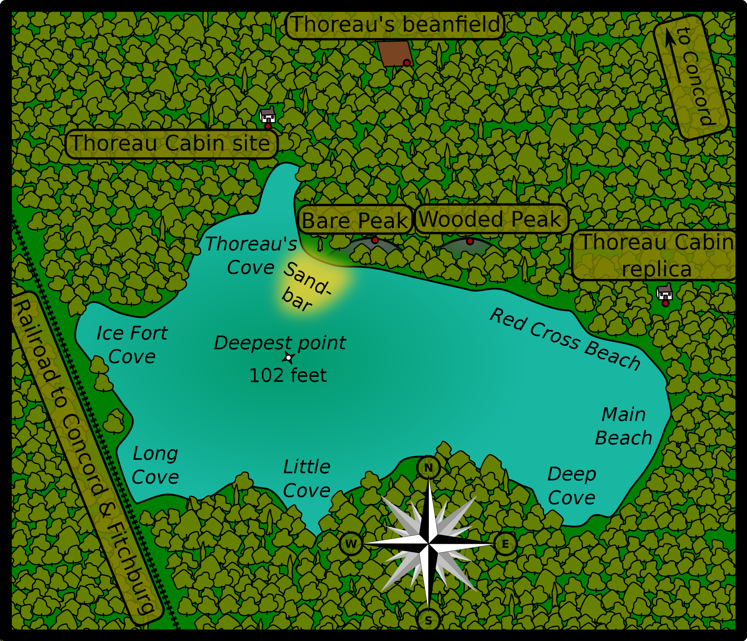
- 2010-12-18T18:45:41Z Prosopee 584x401 (17975 Bytes) {{Information |Description={{en|1=Walden Pond's map}} {{fr|1=Plan de Walden Pond.}} |Source={{own}} |Author=[[User:Prosopee|Prosopee]] |Date=2010-12-18 |Permission= |other_versions= }}
Uploaded with derivativeFX
File history
Click on a date/time to view the file as it appeared at that time.
| Date/Time | Thumbnail | Dimensions | User | Comment | |
|---|---|---|---|---|---|
| current | 19:13, 7 January 2011 | | 633 × 543 (1.9 MB) | Leovilok | idem |
| 15:46, 6 January 2011 |  | 633 × 543 (1.76 MB) | Leovilok | reupload because it didn't work | |
| 15:43, 6 January 2011 |  | 633 × 543 (1.76 MB) | Leovilok | {{Information |Description={{en|1=Thoreau sites in Walden Pond's map.}} {{fr|1=Plan de Walden Pond avec les sites relatifs à Henry David Thoreau.}} |Sour |
File usage
The following pages on the English Wikipedia use this file (pages on other projects are not listed):
Global file usage
The following other wikis use this file:
- Usage on ast.wikipedia.org
- Usage on ca.wikipedia.org
- Usage on es.wikipedia.org
- Usage on fr.wikipedia.org
- Usage on hi.wikipedia.org
- Usage on pl.wikipedia.org
- Usage on pnb.wikipedia.org
- Usage on ur.wikipedia.org