
File:Vermilion-ohio-river-marina.jpg
Size of this preview: 800 × 557 pixels. Other resolutions: 320 × 223 pixels | 640 × 445 pixels | 1,024 × 713 pixels | 1,280 × 891 pixels | 2,497 × 1,738 pixels.
Original file (2,497 × 1,738 pixels, file size: 1.24 MB, MIME type: image/jpeg)
| This is a file from the Wikimedia Commons. Information from its description page there is shown below. Commons is a freely licensed media file repository. You can help. |
Summary
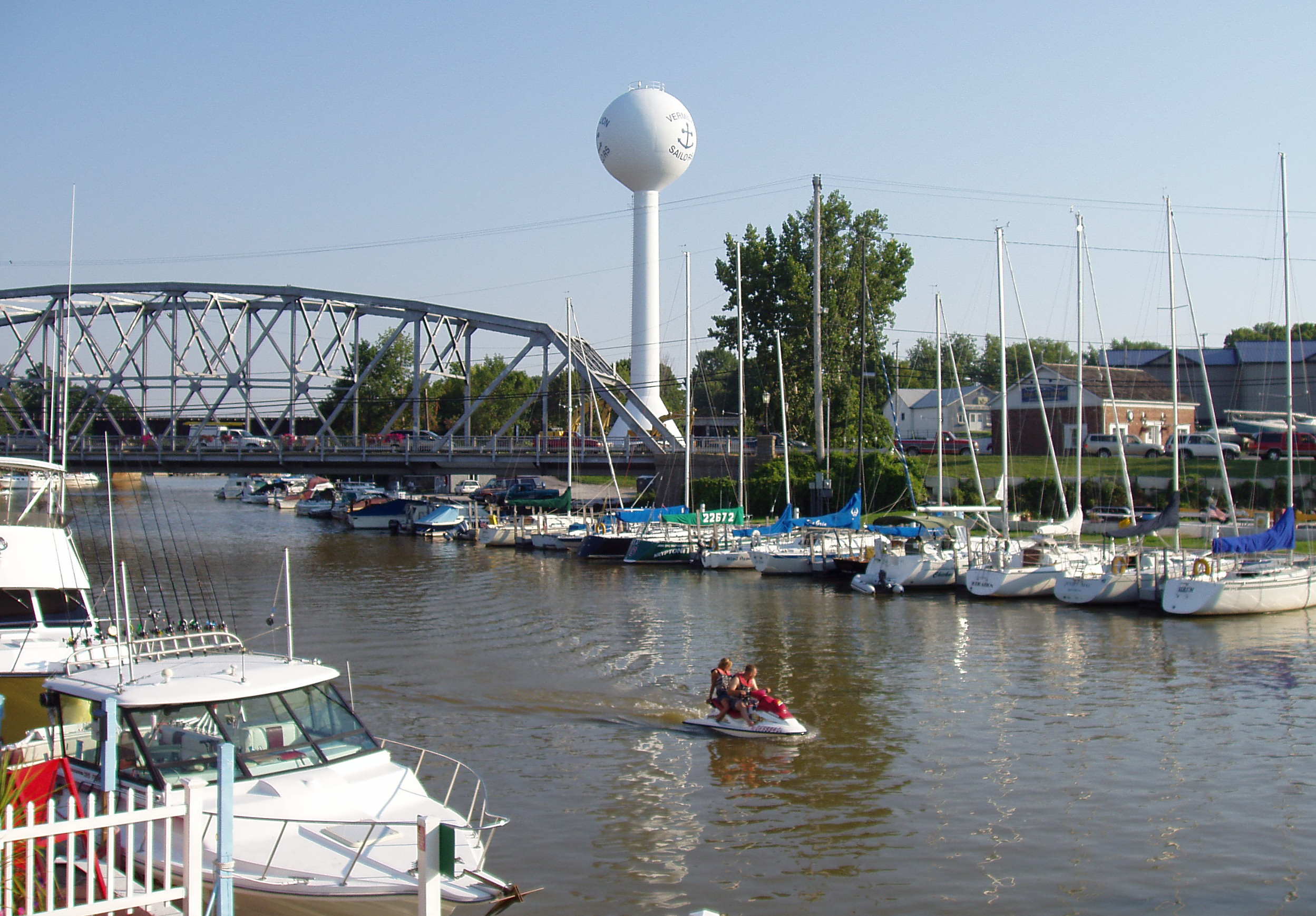
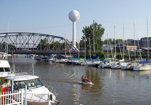
River marina on the Vermilion River in Vermilion, Ohio. Lake Erie is about a quarter mile down river, to the right. The bridge is part of US route 6. The water tower in the background is no longer in use but has been preserved by the efforts of private citizens due to its usefulness as a navigation aid, and its symbolism in the Vermilion community.
Photo shot by Derek Jensen (Tysto), 2005-September-12
| Camera location | | View this and other nearby images on: OpenStreetMap |
|---|
.jpg)
Licensing
This file is licensed under the Creative Commons Attribution 2.5 Generic license.
- You are free:
- to share – to copy, distribute and transmit the work
- to remix – to adapt the work
- Under the following conditions:
- attribution – You must give appropriate credit, provide a link to the license, and indicate if changes were made. You may do so in any reasonable manner, but not in any way that suggests the licensor endorses you or your use.
File history
Click on a date/time to view the file as it appeared at that time.
| Date/Time | Thumbnail | Dimensions | User | Comment | |
|---|---|---|---|---|---|
| current | 02:56, 13 September 2005 | | 2,497 × 1,738 (1.24 MB) | Tysto | Vermilion, Ohio river marina.<br> Photo shot by Derek Jensen (Tysto), 2005-September-12 Category:Vermilion, Ohio Category:Tysto-structures |
File usage
The following pages on the English Wikipedia use this file (pages on other projects are not listed):
Global file usage
The following other wikis use this file:
- Usage on hu.wikipedia.org
- Usage on it.wikipedia.org