
File:Virginia map 1606.jpg
Size of this preview: 775 × 600 pixels. Other resolutions: 310 × 240 pixels | 620 × 480 pixels | 992 × 768 pixels | 1,280 × 991 pixels | 2,560 × 1,981 pixels | 3,500 × 2,709 pixels.
Original file (3,500 × 2,709 pixels, file size: 6.05 MB, MIME type: image/jpeg)
| This is a file from the Wikimedia Commons. Information from its description page there is shown below. Commons is a freely licensed media file repository. You can help. |
| Description |
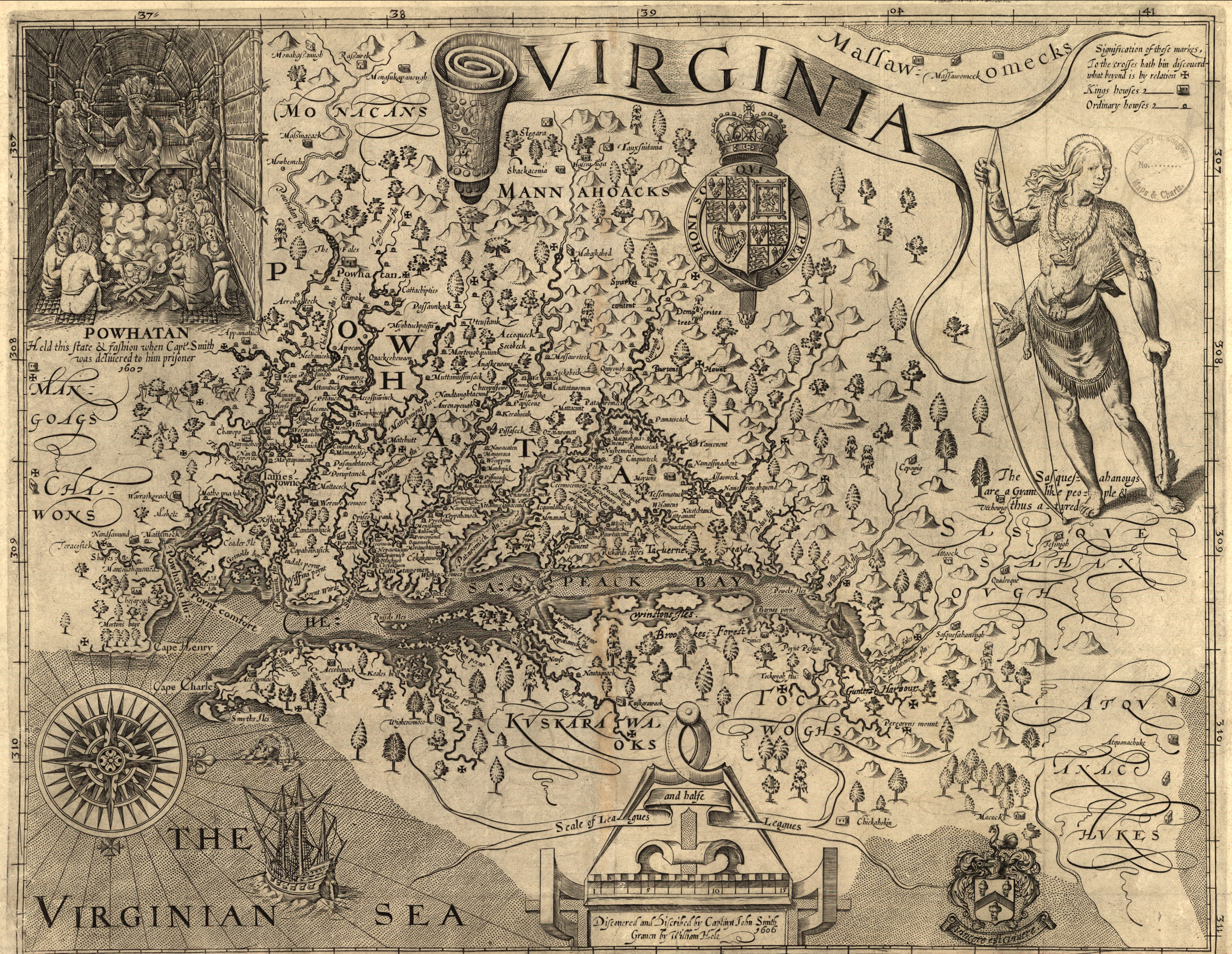
English: Map of Virginia, discovered and as described by Captain John Smith, 1606; engraved by William Hole. Map created in 1606. |
| Date | |
| Source | Library of Congress |
| Author | engraved by William Hole |
| Permission (Reusing this file) |
No known restrictions on publication. |
| Other versions |
|

Licensing
|
This work is in the public domain in its country of origin and other countries and areas where the copyright term is the author's life plus 100 years or fewer. | |
| This file has been identified as being free of known restrictions under copyright law, including all related and neighboring rights. | |
| Annotations | This image is annotated: View the annotations at Commons |
File history
Click on a date/time to view the file as it appeared at that time.
| Date/Time | Thumbnail | Dimensions | User | Comment | |
|---|---|---|---|---|---|
| current | 16:07, 17 March 2011 | | 3,500 × 2,709 (6.05 MB) | Patrickneil | Leveling and color correction |
| 19:06, 18 January 2007 |  | 3,500 × 2,709 (6 MB) | Aude | ||
| 19:04, 18 January 2007 |  | 4,970 × 3,847 (10.45 MB) | Aude | ||
| 19:01, 18 January 2007 |  | 5,733 × 3,854 (16.12 MB) | Aude | Map of Virginia, discovered and as described by Captain John Smith, 1606; engraven by William Hole. Map created in 1606. Source: Library of Congress |
File usage
The following pages on the English Wikipedia use this file (pages on other projects are not listed):
Global file usage
The following other wikis use this file:
- Usage on cs.wikipedia.org
- Usage on de.wikipedia.org
- Usage on eo.wikipedia.org
- Usage on es.wikipedia.org
- Usage on hr.wiktionary.org
- Usage on is.wikipedia.org
- Usage on ja.wikipedia.org
- Usage on ko.wikipedia.org