
File:WestCoastExpressMap.svg

Size of this PNG preview of this SVG file: 635 × 251 pixels. Other resolutions: 320 × 126 pixels | 640 × 253 pixels | 1,024 × 405 pixels | 1,280 × 506 pixels | 2,560 × 1,012 pixels.
Original file (SVG file, nominally 635 × 251 pixels, file size: 59 KB)
| This is a file from the Wikimedia Commons. Information from its description page there is shown below. Commons is a freely licensed media file repository. You can help. |
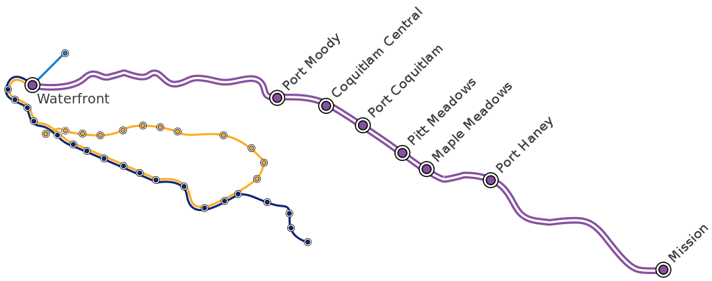
![]() A map of the West Coast Express commuter railway in Vancouver. By David Arthur.
A map of the West Coast Express commuter railway in Vancouver. By David Arthur.
![]() Un plan de trains de banlieue West Coast Express à Vancouver. Par David Arthur.
Un plan de trains de banlieue West Coast Express à Vancouver. Par David Arthur.
This file is licensed under the Creative Commons Attribution-Share Alike 2.0 Canada license.
- You are free:
- to share – to copy, distribute and transmit the work
- to remix – to adapt the work
- Under the following conditions:
- attribution – You must give appropriate credit, provide a link to the license, and indicate if changes were made. You may do so in any reasonable manner, but not in any way that suggests the licensor endorses you or your use.
- share alike – If you remix, transform, or build upon the material, you must distribute your contributions under the same or compatible license as the original.

File history
Click on a date/time to view the file as it appeared at that time.
| Date/Time | Thumbnail | Dimensions | User | Comment | |
|---|---|---|---|---|---|
| current | 21:02, 3 November 2007 | 635 × 251 (59 KB) | DavidArthur | Mark VCC-Clark station | |
| 23:00, 29 October 2005 | 635 × 251 (69 KB) | DavidArthur | 20px|English A map of the West Coast Express commuter railway in Vancouver. By David Arthur. 20px|Français Un plan de trains de banlieue '''West Coast Ex | ||
| 18:56, 2 October 2005 | 635 × 251 (64 KB) | DavidArthur | 20px|English A map of the en:West Coast Express commuter railway in en:Vancouver. By David Arthur. 20px|Français Un plan de trains de banlieue '''West Coast Express'' à [[:fr:Vancouver| |
File usage
The following pages on the English Wikipedia use this file (pages on other projects are not listed):
Global file usage
The following other wikis use this file:
- Usage on fr.wikipedia.org
- Usage on ko.wikipedia.org
- Usage on www.wikidata.org
- Usage on zh-yue.wikipedia.org