
File:WikiExpeditionMap2012 cropped.svg

Size of this PNG preview of this SVG file: 311 × 165 pixels. Other resolutions: 320 × 170 pixels | 640 × 340 pixels | 1,024 × 543 pixels | 1,280 × 679 pixels | 2,560 × 1,358 pixels.
Original file (SVG file, nominally 311 × 165 pixels, file size: 67 KB)
![]() ✓
The source code of this SVG is valid.
✓
The source code of this SVG is valid.
| Description |
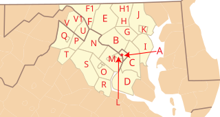
Cropped map of WikiExpedition hosted by Mitchazenia (talk · contribs) at WikiMania 2012 | |||||
|---|---|---|---|---|---|---|
| Source |
Own work based on File:USA Counties with names.svg as a base map | |||||
| Date |
22:35, 2 July 2012 (UTC) | |||||
| Author | ||||||
| Permission (Reusing this file) |
|
| This media file is either in the public domain or published under a free license, and contains no inbound file links. If this media file is useful, then it should be transferred to the Wikimedia Commons. If this media is not useful, then please propose it for deletion or list it at files for discussion. |
File history
Click on a date/time to view the file as it appeared at that time.
| Date/Time | Thumbnail | Dimensions | User | Comment | |
|---|---|---|---|---|---|
| current | 23:06, 2 July 2012 | | 311 × 165 (67 KB) | Imzadi1979 (talk | contribs) | {{Information |Description= Cropped map of WikiExpedition hosted by {{user|Mitchazenia}} at WikiMania 2012 |Source= Own work based on File:USA Counties with names.svg as a base map |Date= 22:35, 2 July 2012 (UTC... |
You cannot overwrite this file.
File usage
No pages on the English Wikipedia use this file (pages on other projects are not listed).